Map of Toronto, Ontario
Toronto Map – Ontario, Canada
Thinking about visiting Toronto (pronounced Tuh-ronno)? Not a bad choice! But before you visit, remember that Toronto is busy! Driving can be quite an adventure.
To help you get around Toronto, we’ve designed 3 printable maps so you don’t get lost. Each one gives you a unique perspective to learn more about the city.
Whether you’re a first-time visitor or a longtime Torontonian, print off our map collection of Toronto. It’s time to explore the cultural and economic hub of Canada.
Jump To: Interactive Map | Printable Road Map | 10 Things to Do | Reference Map
Toronto map collection
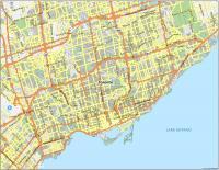
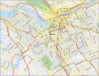
Interactive Map of Toronto
The interactive map below gives you a full 360° perspective of Toronto. In the map, you’ll see how Toronto is located on the north side of Lake Ontario. This is how you get that picturesque waterfront photo with a lake in the foreground. The downtown is located in the southern portion of the city and it’s filled with shopping, skyscrapers, and nightlife.
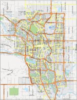
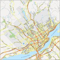
Toronto Road Map
This road map highlights some of the major highways and roads of Toronto. The most important freeway is Highway 401, which cuts through Toronto from west to east. Not only is it one of the busiest highways, but it’s also one of the widest in all of North America.
But Yonge Street is Toronto’s most famous, which includes sites like Toronto’s Eaton Center, the Hockey Hall of Fame, and the Yorkville shopping district.
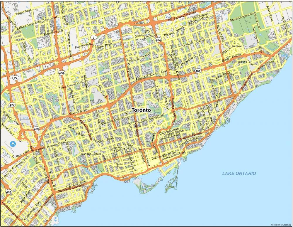
Highways: 27, 2A, 400, 401 Expressway, 404, 409, 427, Gardiner Expy, Hwy 2A
Major Roads: Kingston Road, Don Valley Pkwy, Lake Shore Blvd, Macdonald Cartier Fwy, Yonge Street, Mill Street, Wellington Street, King Street, Adelaide Street
Roads: Sheppard Avenue, Eglinton Avenue, Finch Avenue, Ellesmere Road, Dundas Street, Islington Avenue, Kipling Avenue, Don Mills Road, St. Clair Avenue, Bayview Avenue, Victoria Park Avenue, Bathurst Street, Markham Road, Lawrence Avenue, Wilson Avenue, The Queensway, Warden Avenue, Kennedy Road, Dufferin Street, Midland Avenue, Morningside Avenue
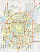
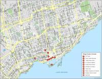
10 Things To Do in Toronto
Looking for the best sights to check out in Toronto? This map of Toronto gives you a list of the top attractions in Toronto. Located in the heart of downtown, your first stop should be the CN Tower. This is the perfect place to dine in its 360° restaurant or straddle the edge of one of the world’s tallest towers. You also shouldn’t miss the Hockey Hall of Fame which has some of the world’s rarest hockey artifacts.
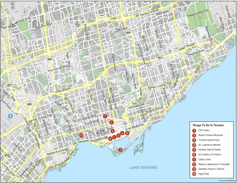
Toronto is the capital of the province of Ontario and is the largest city in Canada. There are plenty of activities for all ages. Here are the 10 attractions that we recommend.
- CN Tower
- Royal Ontario Museum
- Toronto Island Park
- St. Lawrence Market
- Hockey Hall of Fame
- Art Gallery of Ontario
- Casa Loma
- Ripley’s Aquarium of Canada
- Distillery Historic District
- High Park
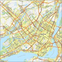
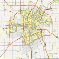
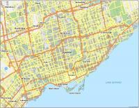
Toronto Reference Map
The UN recognizes Toronto as one of the most multicultural cities in the world. That’s why it’s often called a melting pot of cultures and you can notice this in its wide range of ethnic restaurants.
Although you can’t see the diversity on this map, it’s there for you to enjoy in any of its main communities including East York, Etobicoke, North York, Scarborough, Toronto, and York.
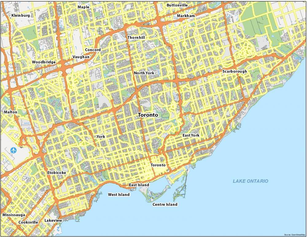
Airports: Toronto Pearson International Airport
Lakes: Lake Ontario
Communities: North York, Scarborough, East York, York, Etobicoke, Toronto, East Island, West Island, Centre Island