Vancouver Map, Canada
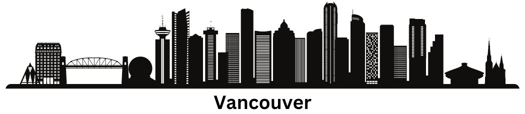
Map of Vancouver, BC
Ready to grab a high-quality map of Vancouver, BC? Explore Canada’s third-largest city because they don’t call it “Beautiful” British Columbia for nothing.
Our Vancouver map collection includes a road map, an interactive map, and a list of things to do. We also include major highways, neighborhoods, and airports.
Whether you want to check out the scenic Stanley Park, ride the SkyTrain, or get lost in Vancouver’s downtown area, print it out and enjoy the scenery.
Jump To: Interactive Map | Printable Road Map | 10 Things to Do | Reference Map
Vancouver map collection
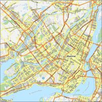
Interactive Map of Vancouver
This interactive map of Vancouver can help you organize your travels and keep track of your surroundings. You can see everything from points of interest to traffic updates and transportation.
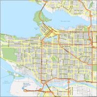
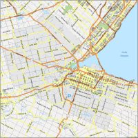
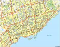
Vancouver Road Map
Vancouver is a massive city with a lot to see. To help you get around, we’ve built this downloadable road map of the city. Some of the most popular roads are Granville Street, Kingsway, and Robson Street in the northwest.
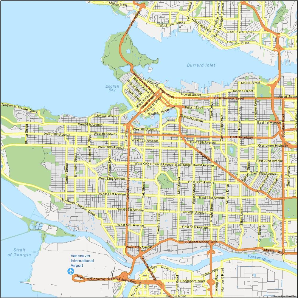
Highways: 1, 7, 99, 401, 404, Trans-Canada Highway, Lougheed Highway, Grandview Highway
Major Roads: Arthur Laing Bridge, Boundary Road, Dunsmuir Street, Dunsmuir Viaduct, East Broadway, East Hastings Street, Georgia Viaduct, Granville Street, Hastings Street, Howe Street, Kingsway, Knight Street, Main Street, Marine Drive, Oak Street, Oak Street Bridge, Prior Street, Seymour Street, Marine Drive, West Broadway, Hastings Street
Roads: Grant McConachie Way, Robson Street, Commercial Drive, Davie Street, Denman Street, Georgia Street, Lonsdale Avenue, Clark Drive, Pender Street, Water Street, West 4th Avenue, West 41st Avenue, West 49th Avenue, West 57th Avenue
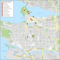
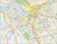
10 Things To Do in Vancouver
Get directions, find tourist attractions, and learn about Vancouver’s surroundings. Our map is perfect for visitors and residents of Vancouver who want to know. From Stanley Park to the Vancouver Aquarium, we show you the best places to go and how to get there.
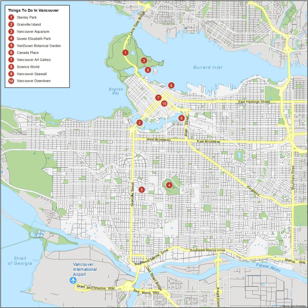
Vancouver is located in the province of British Columbia and is the largest city in that province. If you’re looking for fun activities for the family, here are the 10 attractions that we recommend.
- Stanley Park
- Granville Island
- Vancouver Aquarium
- Queen Elizabeth Park
- VanDusen Botanical Garden
- Canada Place
- Vancouver Art Gallery
- Science World
- Vancouver Seawall
- Downtown Vancouver
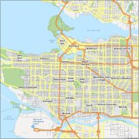
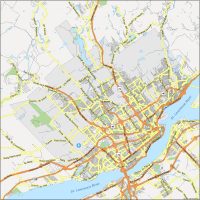
Vancouver Reference Map
Find roads, attractions, and other points of interest. We’ve mapped each layer out so you can easily see what’s close by and where to go. Print out our Vancouver map to explore this coastal city.

Airports: Vancouver International Airport (YVR)
Lakes: Fraser River, Strait of Georgia, English Bay, Burrard Inlet
Communities: West End, Downtown, Strathcona, Hastings-Sunrise, West Point Grey, Kitsilano, Fairview, Mount Pleasant, Dunbar-Southlands, Shaughnessy, South Cambie, Riley Park, Renfrew-Collingwood, Kerrisdale, Oakridge, Sunset, Marpole, Victoria-Fraserview, Killarney
Edmonton map download is incorrect it downloads the Vancouver map
Thanks for letting me know. I fixed the Edmonton page – https://gisgeography.com/edmonton-map-canada/