Map of Winnipeg, Manitoba
Winnipeg Map – Manitoba, Canada
Thinking about visiting Winnipeg (aka The Peg)? Download our Winnipeg map before you go so you know exactly where to go!
Winnipeg is the capital of Manitoba and is located smack dab in the middle of Canada. Although it’s known for its cold winter weather, spring, and summer are rather pleasant.
Winnipegers have a welcoming spirit. This ties in well with its license plates with the motto “Friendly Manitoba“. But drivers can be a bit unfriendly at times.
Jump To: Interactive Map | Printable Road Map | 10 Things to Do | Reference Map
Winnipeg map collection
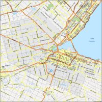
Interactive Map of Winnipeg
We start with an interactive map of Winnipeg so you can see what the city’s all about. The intersection of Portage Avenue and Main Street is the core of the city (but mostly underground). Not only is it one of the busiest, but it’s also said to be one of the windiest intersections in the world. From this intersection, it’s just a short distance to the Forks or to its largest sports arena.
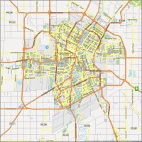
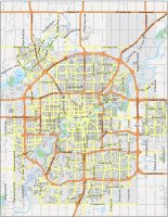
Winnipeg Road Map
This Winnipeg road map gives you all the important highways and roads of the Peg. For locals, it’s said that roads are always “under construction” due to the cold winter weather that tears apart the streets. It’s true that potholes are so deep that they can actually damage vehicles. If they’re not talking about potholes, they’re talking about the slippery icy conditions for winter driving. So regardless of the season, be careful driving here.
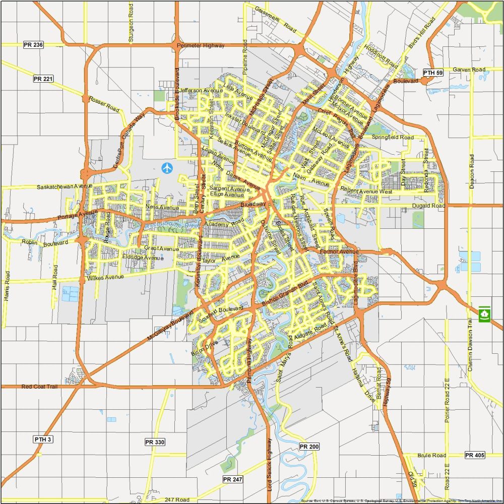
Highways: Trans-Canada Highway, 100, 1, 59, 90, Henderson Highway, Pembina Highway, Perimeter Highway, Oak Point Highway
Major Roads: Academy Road, Bishop Grandin Blvd, Broadway, Brookside Boulevard, Carlton Street, CentrePort Canada Way, Century Street, Chief Peguis Trail, Corydon Avenue, Cumberland Avenue, Disraeli Freeway, Donald Street, Dugald Road, Kenaston Boulevard, King Edward Street, Lagimodiere Blvd, Main Street, McGillivray Boulevard, McMillan Avenue, McPhillips Street, Moray Street, Notre Dame Avenue, Portage Avenue, St. Mary’s Road, St. Anne’s Road, Smith Street
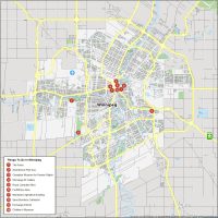
10 Things To Do in Winnipeg
A lot of people don’t know that Winnipeg has a world-class art and culture scene. Whether it’s the Canadian Human Rights Museum or if you just want to hang out at the Forks, there is a long history of Winnipeg. This includes the Winnipeg Jets, its NHL team which the city is extremely passionate about.
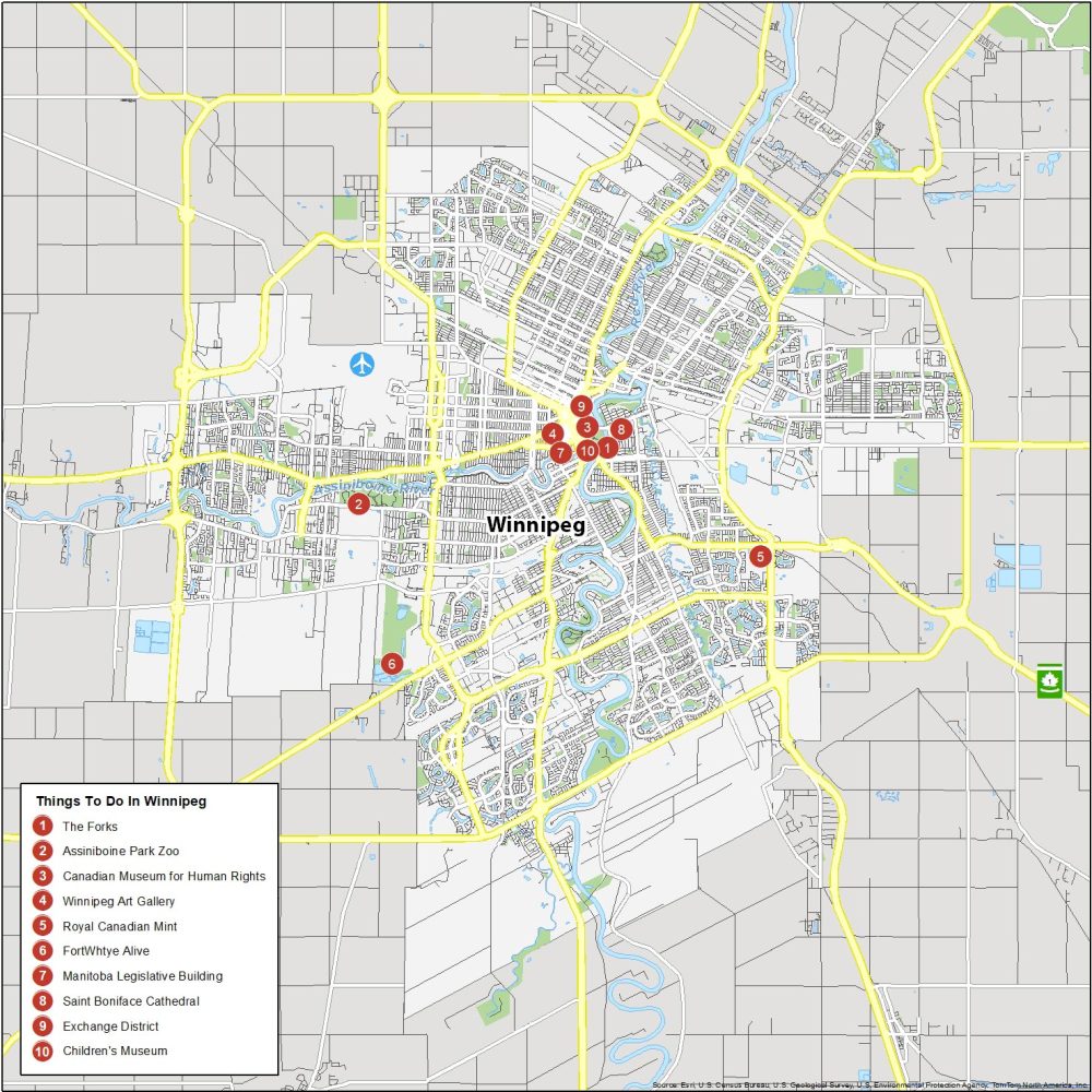
Winnipeg is the largest city and capital of the Province of Manitoba. Here are the top 10 attractions that we recommend checking out in Winnipeg.
- The Forks
- Assiniboine Park Zoo
- Canadian Museum for Human Rights
- Winnipeg Art Gallery
- Royal Canadian Mint
- FortWhtye Alive
- Manitoba Legislative Building
- Saint Boniface Cathedral
- Exchange District
- Children’s Museum
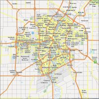
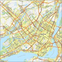
Winnipeg Reference Map
The majority of Winnipeg is contained within the Perimeter Highway (100), which circles around the city. Some of the key neighborhoods in Winnipeg include St. Boniface (French district), Osborne Village, and Downtown Winnipeg. Whether you want to explore the historical sites of the Exchange District or enjoy the modern shopping area of Seasons of Tuxedo (with IKEA), there is something for everyone in Winnipeg.
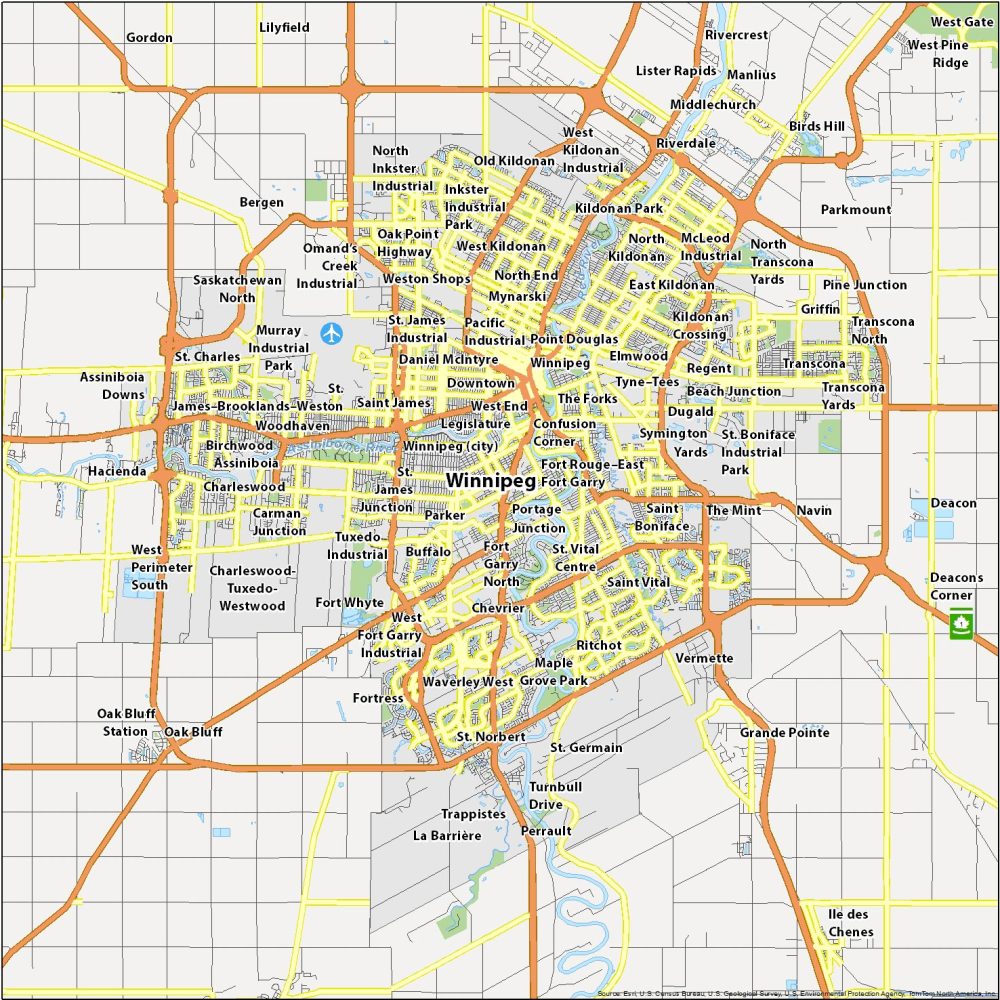
Airports: Winnipeg Richardson International Airport (YWG)
Rivers: Red River, Assiniboine River, LaSalle River, Seine River
Communities: Assiniboia, Charleswood, Confusion Corner, Downtown, Dugald, East Kildonan, Elmwood, Fort Garry, Fort Rouge, North End, North Kildonan, Point Douglas, River Heights, Saint Boniface, Saint James, Saint Vital, St. Charles, St. James, St. Norbert, Transcona, Tuxedo, Waverley West, West End, West Kildonan
I’m looking for a foldable paper map of all the streets in Winnipeg, I think it is called a pocket map
Please go ahead and print this one off, if it’s helpful
No map of Regina, dag nabbit!
Regina’s in the Province of Saskatchewan