What is Geodata? A Guide to Geospatial Data
Geodata is location data stored in a Geographic Information System (GIS). By using geographic data, we better tackle problems that require spatial thinking.

Geodata is location data stored in a Geographic Information System (GIS). By using geographic data, we better tackle problems that require spatial thinking.

When you want historical imagery, the best web viewers are Google Earth, Esri’s Wayback Living Atlas, USGS LandLook, NASA Worldview and Planet’s Stories.
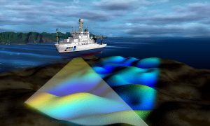
Have you ever wanted to look deep into the ocean and see its topography? Turns out, you actually can with this list of ocean bathymetry data.
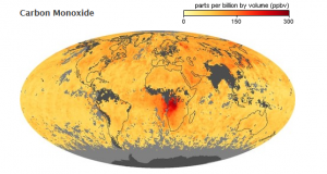
Since 1999, NASA Earth Observatory has kept a close eye on the environment (fires, atmospheric gases, land use) and global climate change.
OpenStreetMap is like the Wikipedia of maps. As “open” is its key philosophy, this is true for OSM data. Learn to download OpenStreetMap data.

Planet Labs (or simply Planet) started with one main idea: To capture our dynamic Earth… Every day. using an ultra-compact, inexpensive CubeSAT satellite.
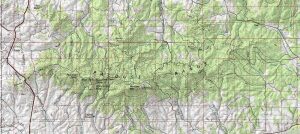
If you’re looking for topographic maps (contours, place names & hydrography) for the United States, the first place to look is the USGS topo maps series.

Esri’s tapestry segmentation data provides insights on lifestyle choices made by customers helping you make more informative business decisions.
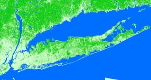
Over the span of your life, how much has the Earth changed? Quite a bit, but you probably just can’t put a number to it. You actually CAN with land cover.
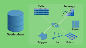
If you’re a bit confused whether or not to use a file geodatabase (*.gdb) or a personal geodatabase (*.mdb)… Here’s everything you need to know.