Earth at Night – Black Marble (NASA)
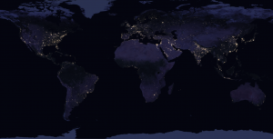
By stitching 400+ images from space, NASA’s Black Marble (Earth at Night) map the most comprehensive night view using Suomi NPP imagery.
By stitching 400+ images from space, NASA’s Black Marble (Earth at Night) map the most comprehensive night view using Suomi NPP imagery.

A web mapping service (WMS) consists of geospatial data hosted on a GIS server with standards set by the Open Geospatial Consortium (OGC).
Esri’s Living Atlas of the World is the largest curation of maps, apps, and data layers from authoritative providers around the world.
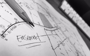
COGO (Coordinate Geometry) is a tool that maps the geometry from survey plans for land parcels, road allowances, and property easements.
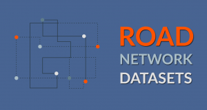
We list the top geometric networks as GIS data sources that you can use for routing, geocoding, map display or any type of network analysis.

This post is dedicated to Antarctica data. If you’re trying to find data for the South Pole, then we have research stations, satellite imagery and much more.

These are the top 25 satellite maps in the world. The best part? You’ll get to explore Earth in new ways that you’ve never thought possible.
The expression goes: “You can’t manage what you can’t measure”. And for measuring climate, it’s world climate data that benchmarks the health of our planet.

How well do you know GIS formats? This list lets you know all the geospatial data formats that GIS technicians manage, and share data.
Topography lays the underlying foundation of the Earth’s surface. In this comprehensive guide, you’ll learn everything about topography and topographic maps.