Indiana Lakes and Rivers Map
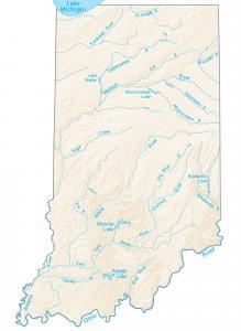
This map shows major rivers and lakes of Indiana like Monroe, Patoka and Brookville Lake. Rivers in Indiana flow westward into the Ohio River
This map shows major rivers and lakes of Indiana like Monroe, Patoka and Brookville Lake. Rivers in Indiana flow westward into the Ohio River
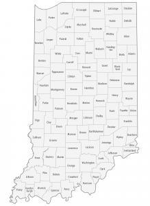
This Indiana county map displays its 92 counties. Marion, Lake and Allen are some of the largest counties in Indiana for highest population.
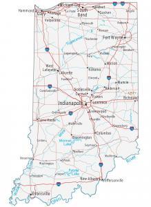
This Indiana map contains cities, roads, rivers and lakes. Indianapolis, Fort Wayne and Evansville are major cities shown in this map of Indiana.
An Illinois State Map that shows major landmarks and places such as national forests, military bases, wildlife refuges and other federal lands in Illinois.
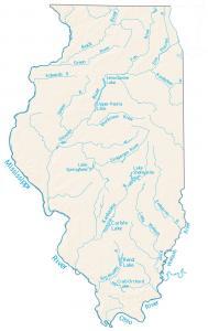
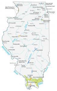
A map displaying major rivers, reservoirs and lakes in Illinois including Lake Shelbyville, Lake Springfield and the Illinois River.
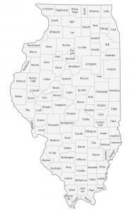
An Illinois county map that displays its 102 counties. For instance, Cook, DuPage and Lake county are the most populated counties in Illinois.
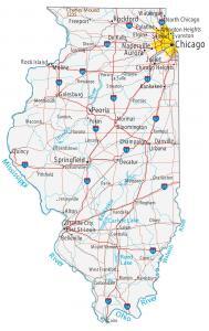
A city and road map of Illinois that has major rivers, lakes and landmarks. Chicago, Springfield and Aurora are major cities shown in this Illinois map.
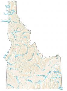
This map shows the major rivers and lakes of Idaho like the Snake, Salmon and Boise River. Rivers in Idaho flow into the Pacific Ocean and Great Basin.
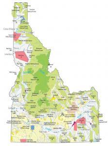
This Idaho State Map includes national parks & forests, military stations, national monuments, wildlife refuges and other federal lands.
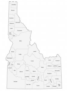
This Idaho county map displays its 44 counties. Ada, Canton and Kootenai are some of the largest counties in Idaho in terms of population.