Eritrea Map and Satellite Image
An Eritrea map – Eritrea is located in northeast Africa sharing borders with Ethiopia, Sudan, and Djibouti on the Horn of Africa.
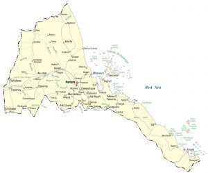
An Eritrea map – Eritrea is located in northeast Africa sharing borders with Ethiopia, Sudan, and Djibouti on the Horn of Africa.
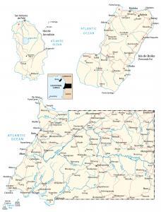
An Equatorial Guinea map – Equatorial Guinea is located in Central Africa along the west coast between Cameroon, Gabon, and the Gulf of Guinea.
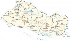
This El Salvador map contains major cities, roads, and imagery – El Salvador is located in Central America bordering Honduras and Guatemala.
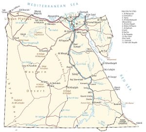
An Egypt map with cities, roads, and imagery – Egypt is a country located in northeastern Africa along the Mediterranean and the Red Sea.
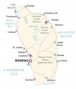
This map of Dominica displays populated places, parishes, and airports – Dominica is a small island located in the Caribbean.
A Djibouti map collection – Djibouti is located in eastern Africa on the Horn of Africa along the Gulf of Aden and Bab al-Mandab Strait.
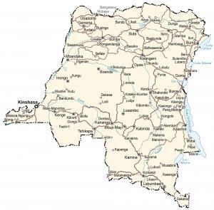
This Democratic Republic of Congo map (DR Congo and formerly Zaire) contains major cities, towns, roads, imagery, and topography.
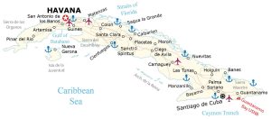
A Cuba map (Republic of Cuba) that shows major cities, towns, roads, elevation, and satellite imagery with its various smaller archipelagos.
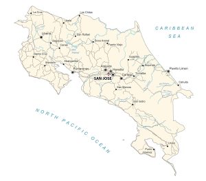
A Costa Rica map with major cities, towns, roads, elevation, and satellite imagery. Costa Rica is a small country located in Central America.
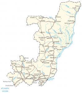
This Congo map displays cities, towns, roads, elevation, and imagery -The Republic of Congo (or simply Congo) is located in central Africa.