Map of Nunavut
This Nunavut map displays populated places, lakes, and rivers – Nunavut is the newest and largest territory in Canada, occupying the Arctic.
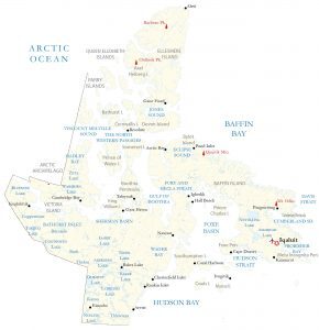
This Nunavut map displays populated places, lakes, and rivers – Nunavut is the newest and largest territory in Canada, occupying the Arctic.
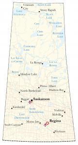
This Saskatchewan map shows cities, roads, rivers, and lakes – Regina, Saskatoon, and Prince Albert are shown in this map of Saskatchewan.
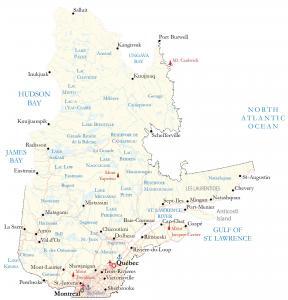
A Quebec map showing major highways, lakes, rivers, satellite imagery, and elevation including major cities like Montreal and Quebec City.
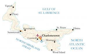
A Prince Edward Island map for the Canadian province located on the east coast – it shows major highways, roads, cities, and populated places.
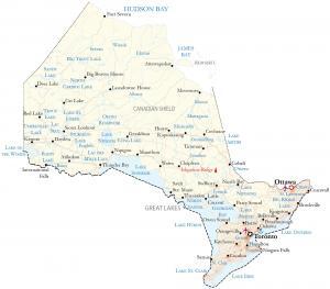
An Ontario map showing major highways, lakes, rivers, satellite imagery, and elevation – with major cities like Toronto, Ottawa, and Hamilton.
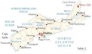
This Nova Scotia map contains major highways, roads, and cities. It includes the capital city of Halifax, as well as other populated places.
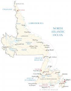
A map of Newfoundland and Labrador displays highways, cities, and populated places for the province in the Atlantic region of Canada.
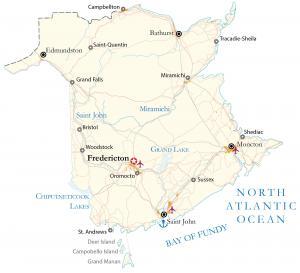
This New Brunswick map shows highways, roads, and cities. It includes the capital city of Fredericton and the most populous city of Moncton.
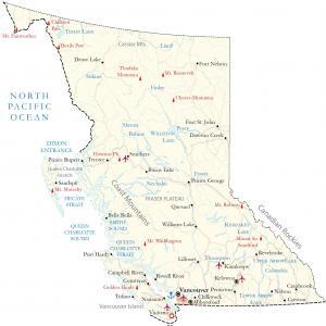
This British Columbia map (BC map) displays major cities, highways, lakes, and rivers – including satellite imagery, elevation, and peaks.
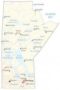
A map of Manitoba contains roads, rivers and lakes, and cities. For example, it displays the capital city of Winnipeg, Brandon, and Thompson.