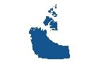
Map of Nunavut
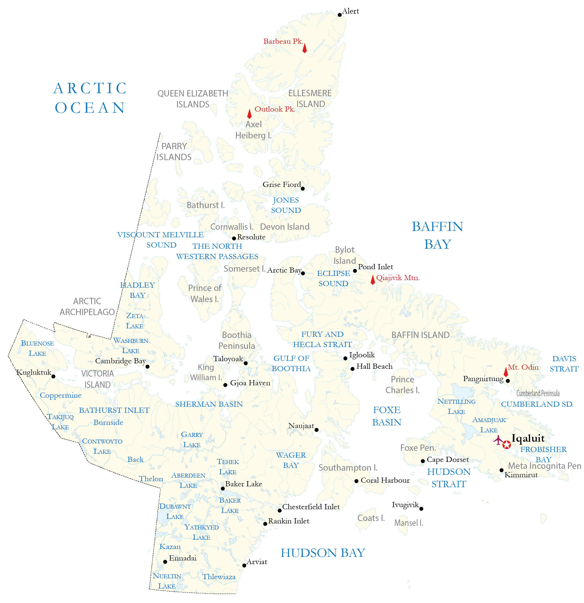
Our map of Nunavut map displays populated places, islands, mountain peaks, lakes, and rivers. Also, it includes satellite imagery and an elevation map of Nunavut to display the topography and the Arctic mainland and archipelago.
You are free to use our Nunavut map for educational and commercial uses. Attribution is required. How to attribute?
About the map
Nunavut is the newest territory in Canada and gained legal status as early as 1999. It’s the largest Canadian territory (over 2 million square kilometers) or province occupying most of the Canadian Arctic.
The population is sparsely scattered throughout the territory with Iqaluit (Frobisher Bay), Rankin Inlet, and Arviat as the most populous. But it’s the least populous of all provinces and territories. It’s home to the world’s northernmost permanently inhabited place, Alert.
The territory is known for its Aurora Borealis, polar bears, and natural resources. If you go as far north as Grise Fiord, you get 24 hours of darkness in December. Iqaluit is the capital and largest city in Nunavut. Nunavut borders the Northwest Territories to the west, Manitoba to the south, and the Hudson Bay or Northwestern Passage to the east.
IMAGERY
Nunavut Satellite Map
Nunavut is enormous in size at 2,038,722 square kilometers (787,155 sq mi). If Nunavut was a country on its own, it would be the thirteenth-largest in the world. The territory of Nunavut has two main regions.
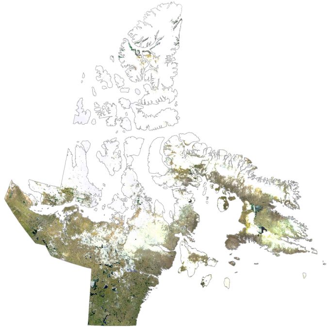
First, it lies within the Canadian Shield to the east along Hudson Bay. Secondly, it’s part of the Arctic Archipelago to the north known for its frigid temperatures and barren icy ground. It consists of several large islands including its two largest, Ellesmere Island and Baffin Island.
Otherwise, there is also the Queen Elizabeth Islands, Somerset Island, Prince of Wales Island, and the east section of Victoria Island. The climate is polar in the higher latitudes with winter temperatures around -30°C.
HILLSHADE
Nunavut Elevation Map
Nunavut is mostly treeless, barren, and frozen tundra covered with rocky and icy ground. The Canadian Shield region is poorly drained with lakes, swamps, and a dense river system. But the largest lake in Nunavut is Nettilling Lake at the south end of Baffin Island.
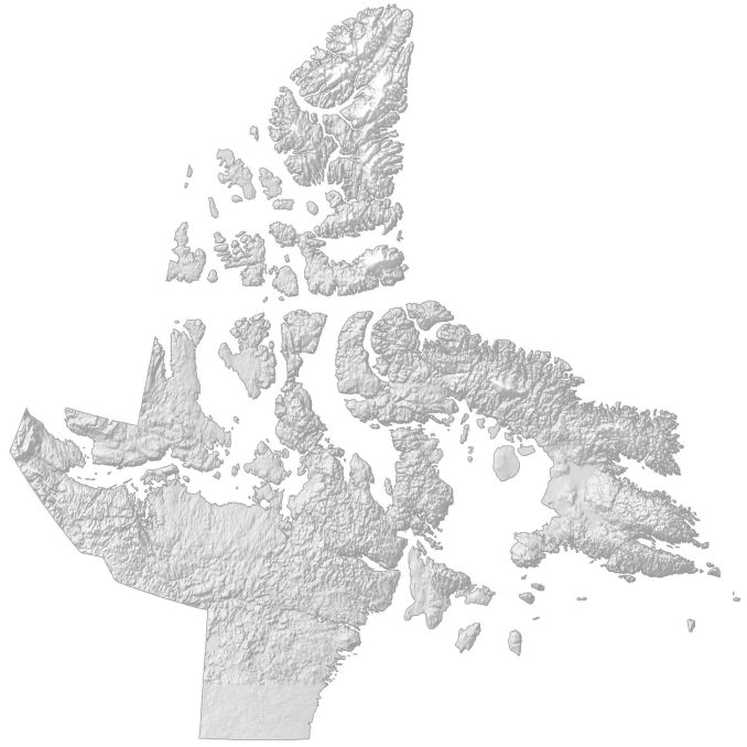
Its most rugged area is the Arctic Cordillera, which extends from Ellesmere Island to Labrador. Within this region, it contains several mountain peaks such as Mount Odin, Ellesmere Peak, and Angilaaq Peak. At 8,583 feet (2,616 meters) in height, Barbeau Peak is the highest peak in Nunavut.


just as a request, you should add towns like Dunnville, Smithville, and Grimsby