Line of Sight vs Viewshed: Visibility Analysis
“Line of sight” determines the visibility between a specific observer point and target locations, whereas “viewshed” calculates the areas visible from an observer point based on elevation and obstruction data.
The line of sight tool and viewsheds are useful for any type of visibility analysis. But what’s the difference between them? In this article, we’ll explore the differences between these two tools. Plus, we’ll also look into some of their potential applications.
Line of sight shows obstructed parts along a line
The line of sight analysis is part of the 3D analysis tools that use a polyline as input. From an observer’s point of view, it determines where they have a clear view. The tool cuts the line up into obstructed and non-obstructed sections.
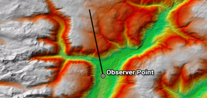
Because the “line of sight” tool determines what is visible and hidden along a line, the input is a polyline. Also, it’s important how you draw the line. For example, the order you draw vertices determines the start and endpoint of the visibility analysis.
Lastly, you will need an elevation surface. Line of sight uses elevation to determine what is visible or not.
As shown below, the line of sight tool breaks the line up into obstructed and unobstructed sections.
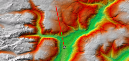
From the start to the end of the line, you can begin to understand visibility. For example, visible is in green. However, the non-visible sections are in red.
So from the observer’s point, the line of sight shows visibility along that path of vision. And it does this by dividing the line into obstructed and unobstructed pieces.
A viewshed displays what’s visible from an observer
On the other hand, a viewshed analysis determines locations visible to an observer in all directions. This type of analysis shows visible and non-visible in all of the surrounding areas.
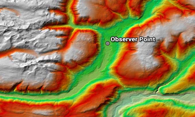
Instead of using a straight line as an input, viewshed analysis uses a single point.
Likewise, we try to understand visibility from an observer’s point of view. But instead, it’s a raster output indicating visibility. For example, you simply place an observer point on the map.
In the result below, we see the viewshed in green from a point.
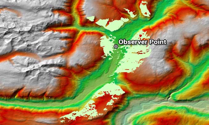
This extent is how far the observer can see, usually in a raster format. In other words, if you look at 360 degrees, this is what is visible to the observer.
This video demonstrates how to create a viewshed in ArcGIS Pro using a digital elevation model and an observer point.
What are visibility applications?
Although the line of sight and viewshed tools are both visibility analyses, they produce different results.
Whether it’s a line of sight or a viewshed, both enable you to understand distance with sight. While the “line of sight” tool carves out a straight line as obstructed and non-obstructed, a viewshed dictates all visible areas from an observer’s point of view.
Amongst other GIS applications, we often use visibility analysis in real estate, construction, and military applications.
Imagine using these types of analyses in a game of hide-and-seek. You’d be unstoppable. Where else do you see viewshed and line of sight in the world today?


In a project which our class did , the view shed doesn’t show the extent of view as line of sight . Line of sight passes through the area of viewshed but part visible and part not visible. the part in not visible is still in view shed area. It doesn’t make sense.
I assume line of sight should be all visible in viewshed area.
Please advise.
Thank you