20 Non-Geospatial Tools for GIS Users
A List of Non-Geospatial Tools for GIS Users
The capabilities of any geospatial software have been expanding rapidly. But when geospatial software just can’t do it, who ya gonna call?
Here’s a list of non-geospatial tools we’ve all got secretly in our back pockets.
So without further ado, here’s a list of complimentary non-geospatial tools for GIS users.
READ MORE: 30 Best GIS Software Applications
1. ColorBrewer
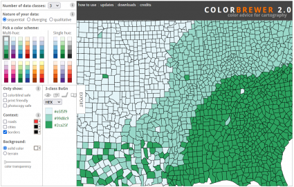
Brilliant cartographers aren’t born. Sometimes, they just need a bit of help choosing the right colors.
ColorBrewer is a freebie web-based tool that helps you select the perfect color palette for your thematic maps.
PRO TIP: Pick color scheme options for color blindness, print-friendly, and photocopy-safe.
2. GIMP
If you don’t want to pay for Adobe Illustrator or Photoshop, GIMP isn’t a true replacement for these graphic editing products. Instead, it’s ideal for quick touch-ups and enhancements.
For example, it can be useful to fix contrast, add grayscale, and clean up historical images before consuming them in GIS software. But remember that once you bring spatial data into GIMP, you lose all georeferenced information.
3. Google Earth Pro
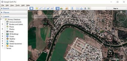
I am not here to debate whether Google Earth Pro is considered GIS software or not. Instead, I just want to say how it’s such a nifty tool.
It’s not only for KML/KMZ creation, it has TONS of historical imagery, Google Streetview, and 3D viewing as well. Don’t forget about Mapillary as an alternative for street-level images.
4. Bulk Rename Utility
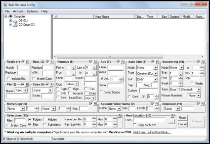
Have you ever had hundreds of files that you wanted to rename, but don’t want to update each one by one? Then, the Bulk Rename Utility is the flexible renaming tool that you might be looking for.
If you want to add, replace, insert text and date stamps into file names, it has an intuitive interface to enable this functionality. It even includes regular expressions (RegEx) for matching search patterns to find and replace specific text.
5. Notepad++
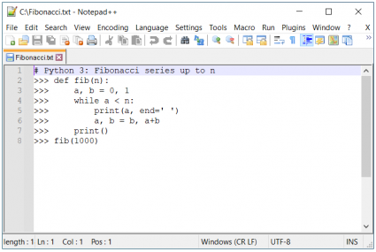
It’s not the best tool for writing code snippets or editing XMLs. But Notepad++ is easy to use and neatly separates your markup in different text colors.
Although it’s not feature-rich like other IDEs, it supports tabbed editing for multiple files open at the same time and line numbering.
6. FileZilla
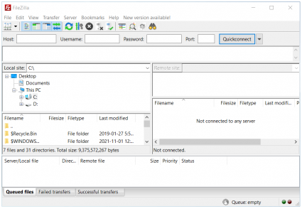
When you need to transfer data through FTP, SFTP, and FTPS, FileZilla is one of the most stable clients available today with lightning-fast transfers.
It not only supports Windows, Mac OS X, and Linux but also cloud-based providers like Google Drive, OneDrive, Amazon S3, and DropBox.
7. Spyder
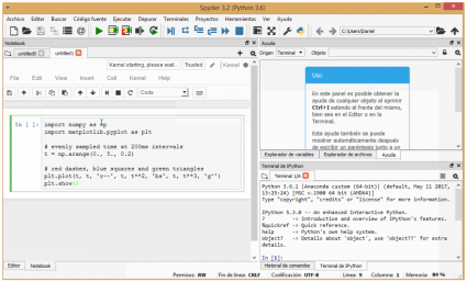
Spyder is another IDE for Python but with more venom. Some of its key features include syntax highlighting, code completion, and support for multiple consoles for IPython.
The interface is one of the easiest IDEs to install for Python 3 development. Not only that, but you can also install it and add it as a package from ArcGIS Pro.
8. SketchUp

SketchUp is a powerful 3D design software built by Google, then acquired by Trimble. Its standout feature is how it enables you to build 3D models to consume for GIS.
This has applications in a variety of areas such as landscape architecture, civil engineering, and indoor mapping. It’s through COLLADA models that you can import and export back and forth into a GIS.
9. 7-Zip
When you want to email a file, 7-Zip is one of the top options. Because of its high compression ratio, it shrinks the file size a bit better than other compression utilities.
Not only can you extract compressed files and create your own, but you can also encrypt ZIP files and password-protect them for more secure transfers.
10. Plas.io
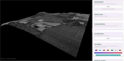
Plas.io is a one-of-a-kind LiDAR viewer, entirely in a web browser. If you want to quickly examine point cloud files, just upload your LAS file in Plas.io, and choose an attribute to display such as height, classification, or RGB.
But it also has other useful features such as altering the camera from perspective, orthographic, and top-view. In addition, you can turn up water levels in the slider to show where inundation occurs.
11. PyCharm
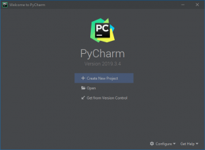
Pycharm is a free, lightweight Python IDE packed with features like smart code completion, debugging, and on-the-fly code highlighting.
Similar to Spyder, its functionality is rich. But the focus is on scientists, data engineers, and analysts for scientific programming in Python.
12. JS Fiddler
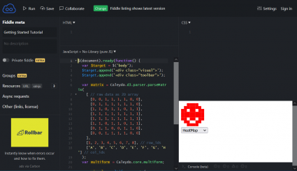
If you want to test HTML, CSS, and JavaScript markup on the web, Fiddler allows you to write code and debug in real time. This is one of the most interactive ways to code for web development of any sort.
For instance, web developers can collaborate, showcase and share snippets of code (fiddles) and simulate it in this web-based application.
13. Adobe Reader

Unfortunately, you can’t edit PDFs with Adobe Reader. This is because you have to pay for Adobe Acrobat Pro for those features.
Although the functionality is bare, you still can view, sign, collaborate, and annotate PDF files with it. Overall, it serves as a reliable PDF viewer for maps and reports.
14. Firebug / Chrome Developer
Firebug (for Firefox) and the built-in Chrome Developer tools are the easiest way to modify existing webpage HTML/CSS and layouts in real time.
Both browser-based tools can also help inspect the JavaScript waterfall chart for any webpage. This can help you pinpoint what’s slowing a webpage down and accurately analyze network usage and performance.
15. Paint.NET
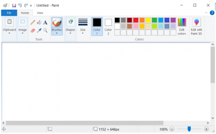
Paint.NET is not really one of my favorite graphic editing tools. First, it looks like it was built in the 1980s. Secondly, the tools are sparse and not as good as GIMP. Lastly, the software support is terrible.
But it’s worth mentioning for its intuitive interface and capabilities to capture screen snapshots… Albeit, it’s still no replacement for Snagit either.
16. Git
GitHub is like Facebook for developers. Any developer can see what their peers are working on and inspect the entire history of a project.
It has version control so you can also study a project’s code and modify it on your own. Whereas Git is just for local version control systems so developers can save snapshots of their projects over time locally.
17. VLC Media Player
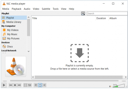
VLC Media Player is an exceptional application for desktop video recording and video playback. It also has a well-maintained app for Apple and Android.
It’s the most flexible video player today. But the best part is how it can recognize practically any file format and even incomplete files and play whatever is available.
18. Visual Studio Express
Visual Studio Express is Microsoft’s IDE for development in C++, .NET, and other programming languages. As freeware, it facilitates source-code control, project management, and team collaboration.
It’s flexible because you can build applications for Android, iOS, Windows, web applications, and cloud services. In addition, it’s feature-rich with debugging tools and UI analysis.
19. IDLE
IDLE is part of the default Python installation. You can use it to execute a single statement just like Python Shell. If you have a Python script (.py), you can also use it to modify, maintain and run these file types.
But once you know about PyCharm or Spyder, mostly coders abandon IDLE for greener pastures. It’s because you don’t get code completion, linting, and handling of virtual environments in IDLE.
20. Fugro Viewer
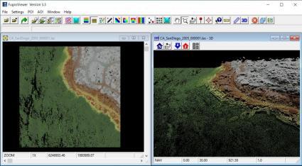
This LiDAR freeware package is something you can just pick up and go with. It’s the type of software that you point and click to make things happen for any LAS file.
If you want to display contours, build elevation profiles, or view side-by-side viewports, the Fugro Viewer helps you achieve this. But because it’s freeware, you can only use it for a limited time.
Conclusion
Well, there you have our top 20 non-geospatial tools for GIS users. It’s the complimentary software tools that we use in our daily work and workflow.
But what did we miss? I know there are a lot of tools out there. So please let us know the one essential tool that you use to complement any GIS software.
Write it down in the comment section below.


Your screenshot of Paint.NET is actually MS Paint. MSPaint is made by Microsoft. Paint.NET is made by dotPDN LLC.