Planet Labs Imagery: The Entire Earth, Everyday
Planet Labs (or simply Planet) started with one main idea: To capture our dynamic Earth… Every day. using an ultra-compact, inexpensive CubeSAT satellite.
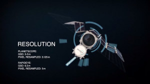
Planet Labs (or simply Planet) started with one main idea: To capture our dynamic Earth… Every day. using an ultra-compact, inexpensive CubeSAT satellite.
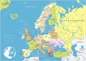
A Europe Map featuring countries and labels. It includes western, northern, southern, and eastern Europe with outlines for each country.
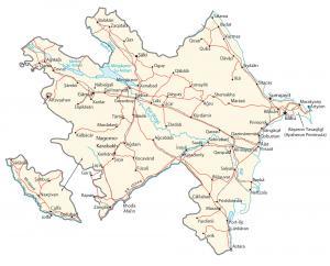
A map of Azerbaijan (physical and reference) located in the Middle East. Azerbaijan is between Iran and Russia, and borders the Caspian Sea.
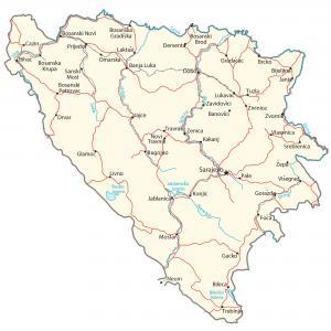
A Bosnia and Herzegovina Map with cities, roads and hydrography – B&H is located in southeast Europe and borders the Adriatic Sea and Croatia.
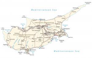
A Cyprus map showing major cities, roads and water – Cyprus is an island in the Middle East. It’s located in the Mediterranean Sea near Turkey
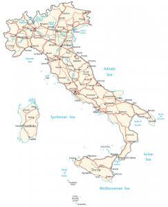
A map of Italy containing major cities, transportation and water features – Italy is located in southern Europe next to the Mediterranean Sea.
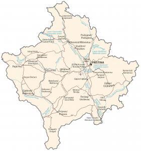
A Kosovo map highlighting major cities, transportation and hydrography – Kosovo is in southeastern Europe, between Serbia and Macedonia.
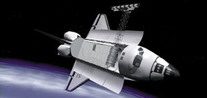
During an 11-day mission, Space Shuttle Radar Topography (SRTM) mission captured Earth’s elevation at 1 arc-second (30 meters) for over 80% of the Earth.
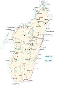
A Madagascar map with cities, transportation and water – Madgascar is an island in Southern Africa, in the Indian Ocean, east of Mozambique.
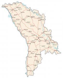
A Moldova map containing major cities, transportation and hydrography – Moldova is in eastern Europe, northeast of Romania, west of Ukraine.