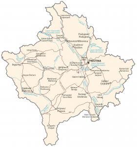
Kosovo Map – Cities and Roads
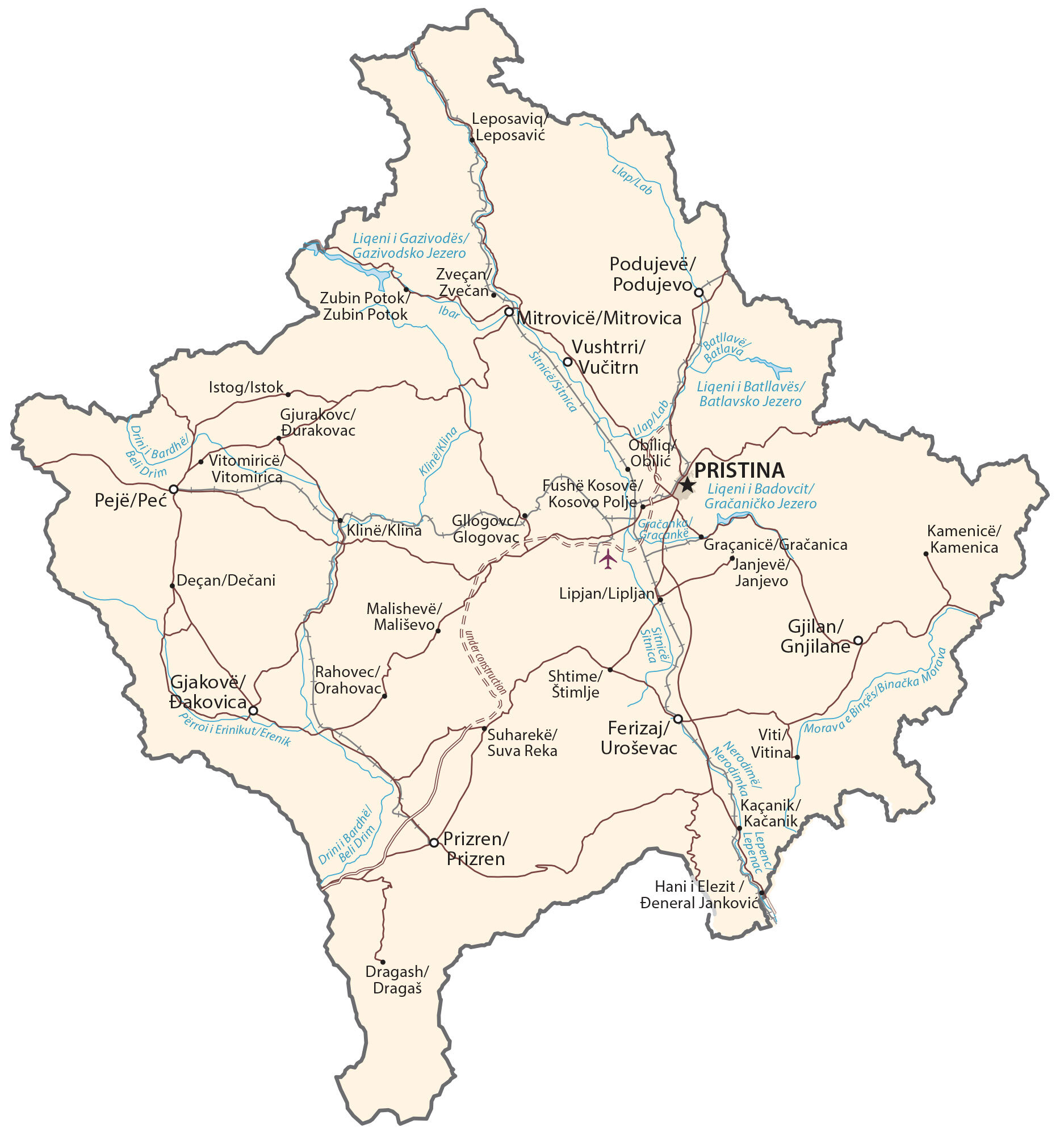
This map of Kosovo contains major cities, towns, roads, lakes, and rivers. Satellite imagery and a terrain map show its topography like its plains and mountainous areas.
Kosovo map collection
You are free to use our Kosovo map for educational and commercial uses. Attribution is required. How to attribute?
About the map
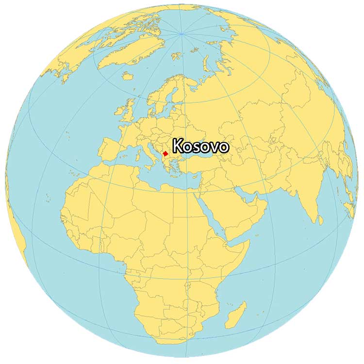
Kosovo is a landlocked country in Southeastern Europe, located at the center of the Balkans. The majority of the population is Albanian, with a significant minority of Serbs. The official languages are Albanian and Serbian.
It borders 4 other countries including Serbia to the north, Montenegro to the west, Albania to the southwest, and North Macedonia to the southeast.
It’s been recognized as a nation since 2008 when it declared its independence from Serbia. Pristina is the capital and largest city of Kosovo. Other major cities are Prizren, Gjilan, and Peja.
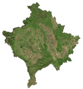
SATELLITE IMAGERY
Kosovo Satellite Map
Kosovo occupies an area of 10,887 square kilometers (4,203 sq mi). This makes it similar in size to Lebanon, but slightly larger. It is a mix of high plains, rolling plains, and mountainous areas. Metohija is a large basin in the west of Kosovo that covers 35% of the area.

The country is positioned between 42° and 43° N latitudes. Because of its continental climate, Kosovo mostly has warm summers and cold winters. Forests cover almost half of the landmass in Kosovo.
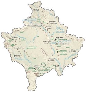
PHYSICAL MAP
Kosovo Physical Map
The interior is mostly flat. Whereas the outer boundaries are mountainous. For example, the Kopaonik Range spans the northern border between Serbia. While the Šar Mountains divide North Macedonia, the Accursed Mountains bound Kosovo with Montenegro.
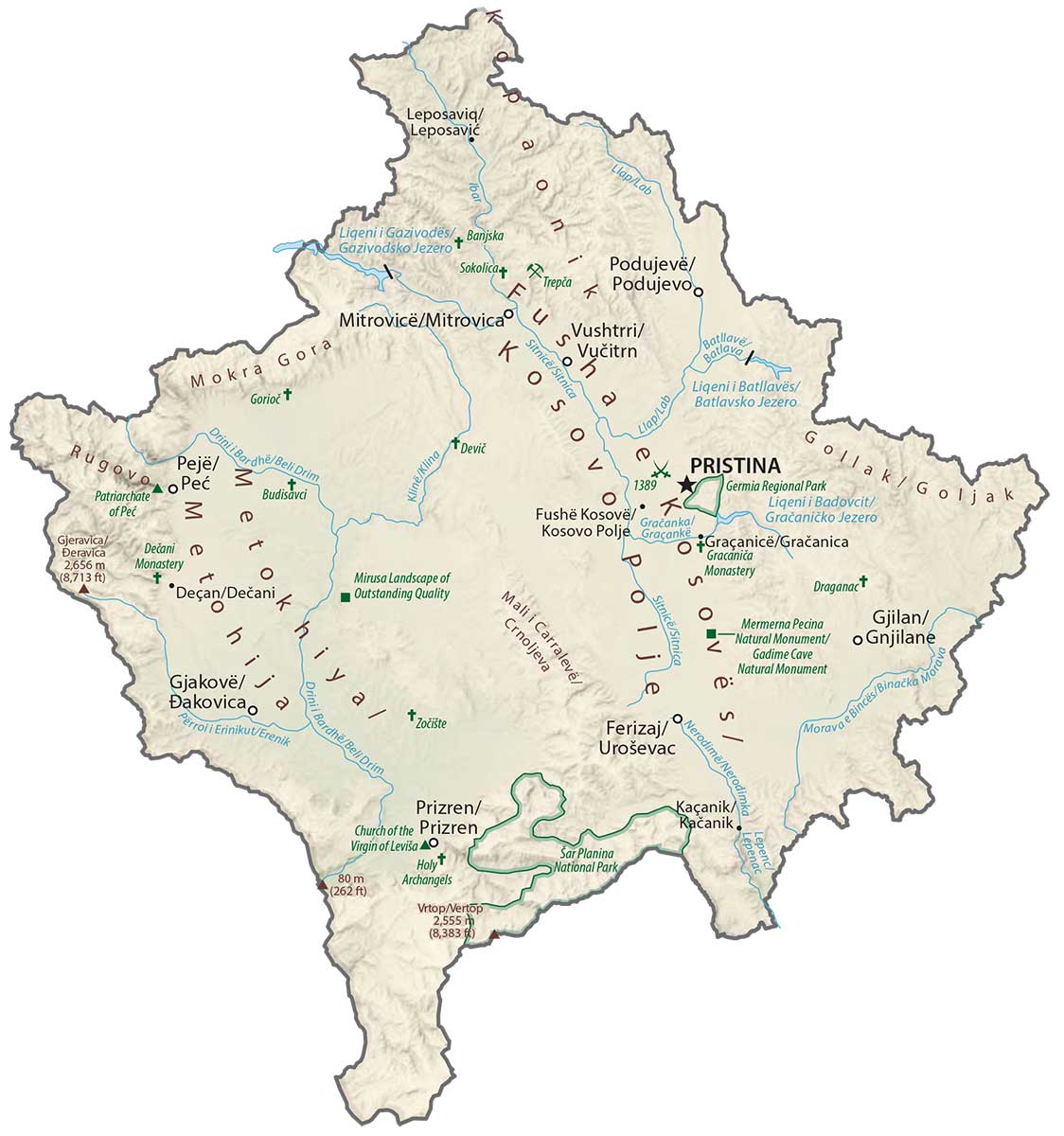
At 2,658 meters (8,720 ft) in height, Kosovo’s highest peak is Velika Rudoka within the Šar Mountains. White Drim situated in the southwest is Kosovo’s lowest point at 297 meters above sea level.
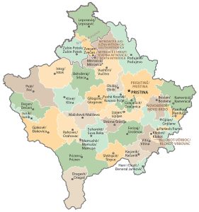
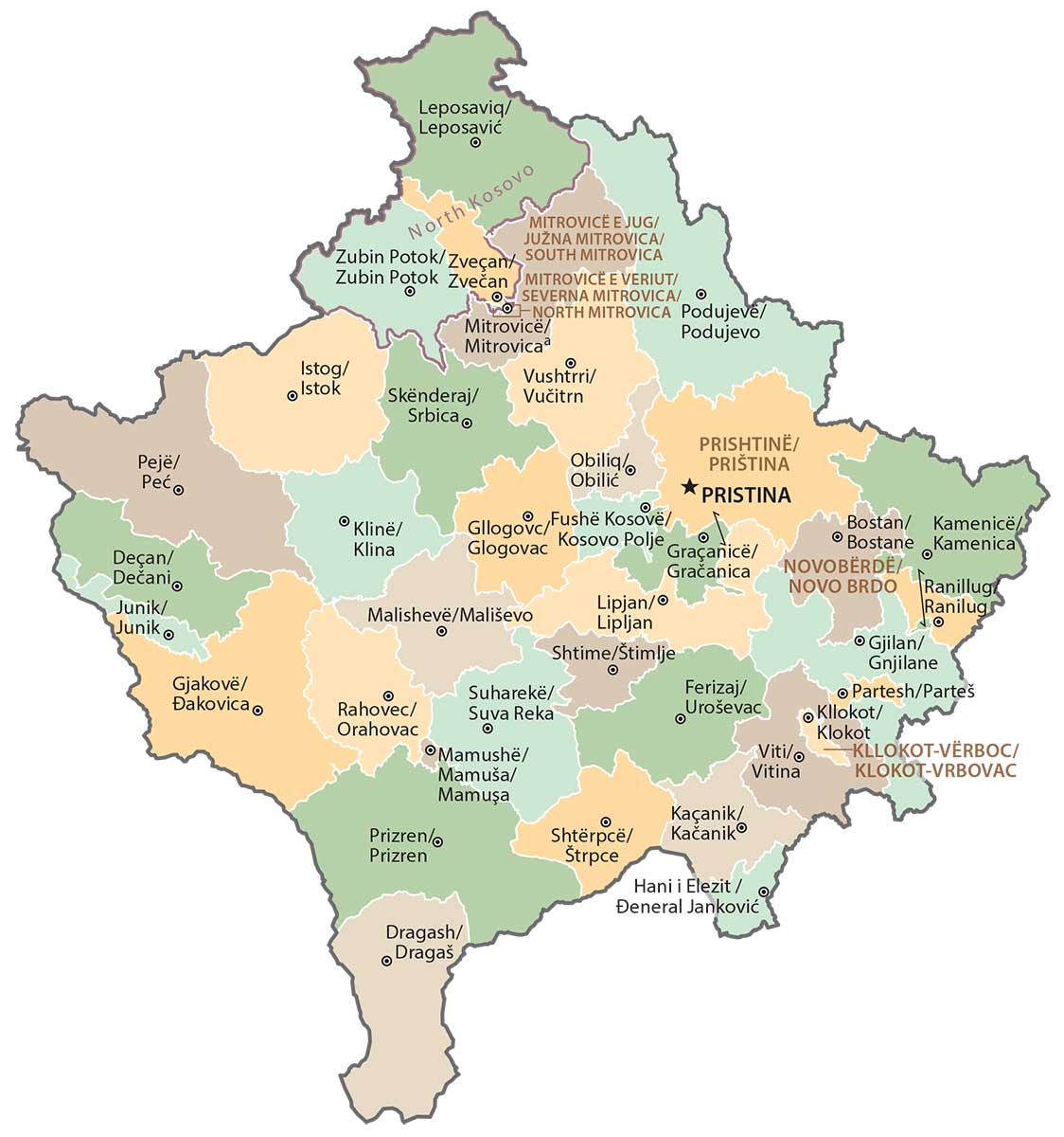
POLITICAL MAP
Kosovo Municipal Map
Districts are the first level of administrative divisions of Kosovo. Altogether, there are 7 districts in Kosovo divided administratively and geographically. Next, this is followed by municipalities, in which there are 38 administrative units in Kosovo.
Capital City
Pristina
Major cities and towns
Ferizaj (Uroševac)
Gjakove (Dakovica)
Gjilan (Gnjilane)
Mitrovicë (Mitrovica)
Pejë (Peć)
Prizren (Prizren)
Cities, towns and villages
Deçan (Dečani)
Dragash (Dragaš)
Gjurakovc (Durakovac)
Gllogovc (Glogovac)
Graçanicë (Gračanica)
Hani i Elezit (Deneral Janković)
Istog (Istok)
Janjevë (Janjevo)
Kaçanik (Kačanik)
Kamenicë (Kamenica)
Klinë (Klina)
Leposaviq (Leposavić)
Lipjan (Lipljan)
Llap (Lab)
Malishevë (Mališevo)
Obiliq (Obilić)
Podujevë (Podujevo)
Rahovec (Orahovac)
Sitnice (Sitnica)
Shtime (Štimlje)
Suharekë (Suva Reka)
Vitomiricë (Vitomirica)
Viti (Vitina)
Vučitrn (Vushtrri)
Zubin Potok (Zubin Potok)
Zveçan (Zveçan)
Lakes, rivers and creeks
Batlavsko Jezero
Beli Drim River
Binca Morava River
Drini Bardhël River
Erenik River
Ibar River
Gračaničko Jezero
Gazivodsko Jezero
Sitnice River