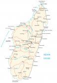
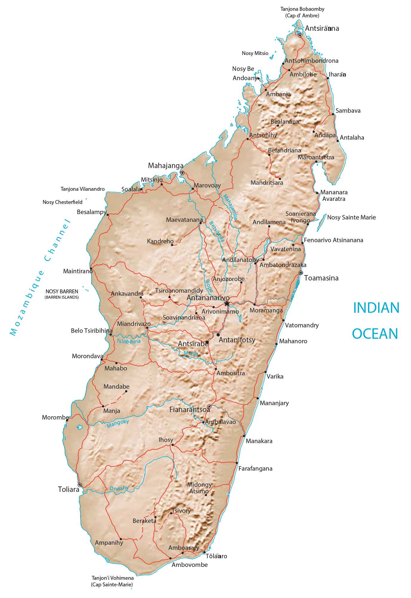
Madagascar Map

This map of Madagascar displays major cities and roads for the island in the southwest of Africa. Satellite imagery and a terrain map reveal everything from its coastal lowlands to its interior high plateau.
Madagascar map collection

You are free to use our Madagascar map for educational and commercial uses. Attribution is required. How to attribute?
About the map
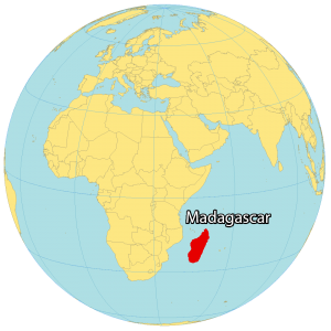
Madagascar is an island in Southern Africa in the Indian Ocean. It’s 430 km (267 mi) in distance from Madagascar to Mozambique on mainland Africa. Its coastline is 2,470 km (1,535 mi) with an area of 801,590 square kilometers (309,500 sq mi). Altogether, this makes it the fourth largest island in the world. Antananarivo is the capital and largest city. But other major cities are Toamasina, Antsirabe, and Mahajanga.
The geography of Madagascar is varied and unique. The island is home to a wide variety of landscapes, from rainforests and mountains to beaches and coral reefs. Madagascar is also home to a number of endemic species, meaning that they are found nowhere else in the world. This makes the island a hotspot for biodiversity.
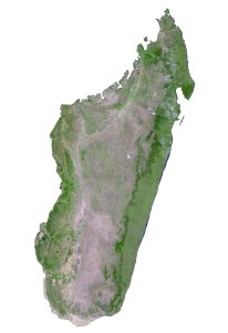
SATELLITE IMAGERY
Madagascar Satellite Map
Madagascar lies south of the equator between 26°S to 12°S latitudes. Because of its position in the Indian Ocean, it mostly has a tropical climate. While its wet season is from October to March, it’s mostly dry between April and September.

The longest river in Madagascar is the Mangoky River with a length of 564 kilometers (350 mi). Lake Alaotra is Madagascar’s largest lake with a surface area of 900 square kilometers (350 sq mi). The island is rimmed with sandy beaches with plateaus and rainforests covering the interior.
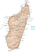
PHYSICAL MAP
Madagascar Physical Map
Madagascar consists mostly of coastal lowlands along its perimeter. Whereas the central region is upland and high plateaus in the northwest. Some of its highlands and mountains include the Ankaratra, Tsaratanana, and Ivakoany Massif.
At 2,876 meters (9,436 ft) in height, Mount Maromokotro is Madagascar’s highest peak to the north. Whereas its lowest point is the Indian Ocean.
Capital City
Antananarivo
Major cities and towns
Antanifotsy
Antsirabe
Antsiranana
Fianarantsoa
Mahajanga
Toamasina
Toliara
Cities, towns and villages
Ambalavao
Ambanja
Ambato Boeny
Ambatondrazaka
Ambilobe
Ambositra
Andapa
Andilanatoby
Andilamena Ivongo
Andoany
Anjozorobe
Ankavandra
Antalaha
Antsohihy
Antsohimbondrona
Arivonimamo
Bealanana
Befandriana
Belo Tsiribihina
Beraketa
Besalampy
Fenoarivo
Farafangana
Ihosy
Kandreho
Mahabo
Mahanoro
Maevatanana
Maintirano
Manakara
Mananara Avaratra
Mananjary
Mandabe
Mandritsara
Manja
Marovoay
Maroantsetra
Midongy Atsimo
Miandrivazo
Moramanga
Morombe
Morondava
Soalala
Soanierana
Soavinandriana
Tsiroanomandidy
Tsivory
Vatomandry
Vavatenina
Varika
Lakes, channels and water
Betsiboka River
Ikopa River
Indian Ocean
Mahajamba River
Mangoky River
Mania River
Mozambique Channel
Onilahy River
Tsiribihina River
Capes and islands
Barren Islands
Cap Sainte-Marie
Cap d’Ambre
Nosy Be
Nosy Mitsio
Nosy Sainte Marie