Which Programming Language Should You Learn in GIS?
Programming in GIS: A Step-by-Step Guide
Learning to code pays off big in the geospatial industry. In fact, GIS developers are some of the highest earners in the geospatial industry.
Change my mind. Mastering coding skills in the geospatial field is a high-yield investment for yourself.
But which coding language should you learn?
Today, we’ll give you a list of the top programming languages in GIS. Let’s get started with a quick overview table.
| Coding Language | Details |
|---|---|
| Python | Python is versatile with lots of libraries. It serves as the top option for automation, scripting, and integration with various GIS libraries. |
| R | R is well-suited for conducting statistical analyses and creating visualizations of spatial data. |
| SQL | Spatial databases rely heavily on SQL for essential operations. This makes it an indispensable tool in querying geographic data. |
| JavaScript | JavaScript is essential for web-based GIS applications and interactive mapping. Check out these Esri JavaScript API examples for its webmaps and scenes. |
| Java | We mostly use Java for desktop GIS application development. This includes GIS libraries and APIs like GeoTools. |
| C++ | C++ is a prominent choice for desktop GIS software and high-performance applications. It’s actually the secret sauce behind the scenes in QGIS 3. |
1. Python

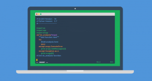
Python allows you to extend GIS with more than 100,000 libraries. It’s also fast, versatile, and easy to learn so it’s perfect for beginners who want to learn to program.
We use Python in a wide range of industries for data science and automation. Want to do data visualization? Try out Bokeh or Seaborn. How about spatial analysis? Shapely and Fiona are perfect for geometric operations and reading/writing spatial data formats.
Python is like the Swiss Army knife of programming languages. It’s not just for GIS; you can use it for tons of things… Automation magic! Python can do the heavy lifting to repeat repetitive tasks… And you’re not alone. The Python community is booming.
2. R Language

R is the most widely used language for statistical analysis in terms of the number of users. Some of its most popular libraries include dplyr, ggplot2, and tidyverse.
We use R programming in GIS for data visualization, table operations, and geostatistics, amongst other applications. Similar to Python, it’s also ideal for automation as well.
To use R in GIS, you typically install R on your computer, along with relevant GIS packages. You can then write scripts or use R Markdown to perform analyses, create visualizations, and generate reports.
3. SQL
SQL (structured query language) is the most common way of communicating with databases. This language allows you to retrieve, manipulate, and store information from a database as the standard language used in relational database management systems (RDBMS).
As a database administrator, you need to know how to manage information and data in the database through SQL commands. Because in the end, using SQL involves leveraging its capabilities to interact with spatial databases, manage geospatial data, and perform spatial queries.
4. JavaScript

JavaScript is a dynamic, object-oriented programming language that is interpreted by a web browser. It has become widely and commonly used by developers across the web.
Plus, it’s fast, widely available, and works on all major browsers. There are hundreds of libraries available to expand its capabilities. Because of its wide use, JavaScript has become a perfect language for beginners with little programming experience to start their coding journey.
There are many reasons why you would want to learn how to code in JavaScript. For instance, you’ll be able to create interactive websites, app experiences, and mobile applications that are engaging and attractive.
5. Java
How do we use Java in GIS? Very sparsely, actually! I don’t suggest learning this language unless you are doing software development type of programming.
Java is a general-purpose, concurrent, class-based, object-oriented programming language. It is easy for beginners to get the hang of but still has all the features programmers need.
But even though it is Java’s simplicity that makes it popular among beginners, its flexibility has not gone unnoticed by experienced developers either. If you are looking for a way to start programming or want to try something new, Java may be exactly what you need.
6. C++
C++ is a programming language that is regarded as standard in the field of computer programming. In recent years, C++ has been used by many programmers to create games and programs with more intricate features and functions.
The C++ language is known for its flexibility, performance, and power because you have direct access to memory for running heavy tasks with fewer computer resources.
The goal is to help individuals familiarize themselves with the foundational skills of C++ like OOP, memory management, and concurrency. It’s also a great way for individuals who want to get into the software development world, but don’t have any experience yet.
Which Programming Language Should You Learn in GIS?
Python stands out as a versatile and widely embraced language. It serves as a robust option for automation, scripting, and integration with various GIS libraries.
JavaScript is essential for web-based GIS applications and interactive mapping. Whereas R finds its place in statistical analysis and visualization of GIS data.
Java and C++ are prominent choices for desktop GIS software and high-performance applications. While ArcObjects is obsolete, SQL is indispensable for working with spatial databases.

