QGIS Geocoding: Addresses to Points
QGIS Geocoding: Transforming Addresses into Points
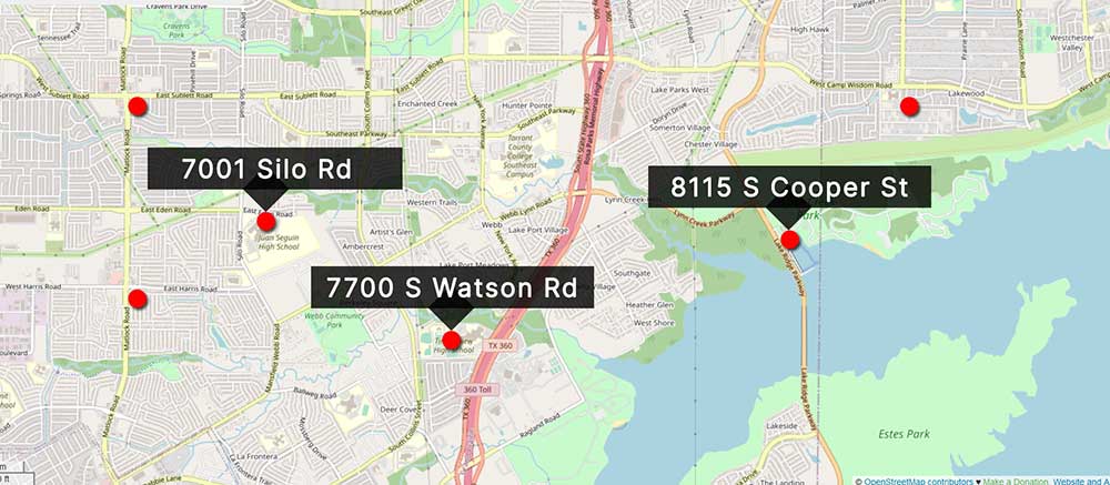
QGIS geocoding converts an address into geographic coordinates within the open-source GIS desktop application of QGIS. These coordinates can then be used to plot points on the map and do anything from building simple maps to calculating directions and distances between them.
The idea behind geocoding is that it provides a way for people to locate their homes, businesses, airports, schools, and churches with relative ease on a map.
If you’re looking for a QGIS geocoding plugin, then the MMQGIS geocoding plugin is like the Swiss-army knife for geoprocessing in QGIS.
One of its tools is a geocoder, which you can use to translate addresses into points on a map. Let’s take a look at how you can start geocoding with single addresses or by bulk in QGIS.
READ MORE: Geocoding: Longitude and Latitude by Address
Install and Activate MMQGIS
A QGIS plugin is an extension that adds new functionality to QGIS, the Geographic Information System (GIS) software. One of the best ways to geocode is by using the MMQGIS plugin.
In order to install this plugin, you will have to open QGIS and click on the top menu for “Plugins”.
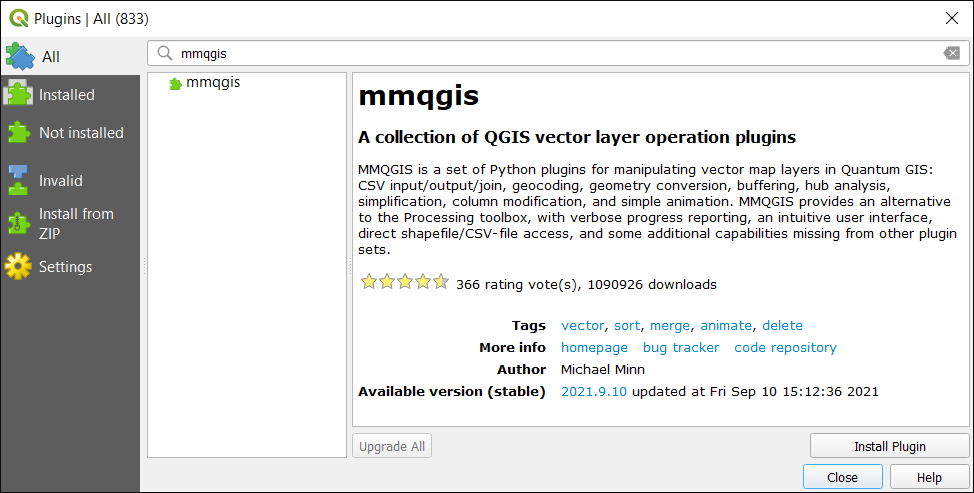
Plugins > Manage and Install Plugins.
Next, search for MMQGIS. After it appears in the search results, click on “Install” and activate the plugin.
MMQGIS Geocoding Plugin
MMQGIS is a multipurpose plugin that can do a variety of GIS processing. But in this case, we are going to use its geocoding tools, which can turn your addresses into coordinates on a map.
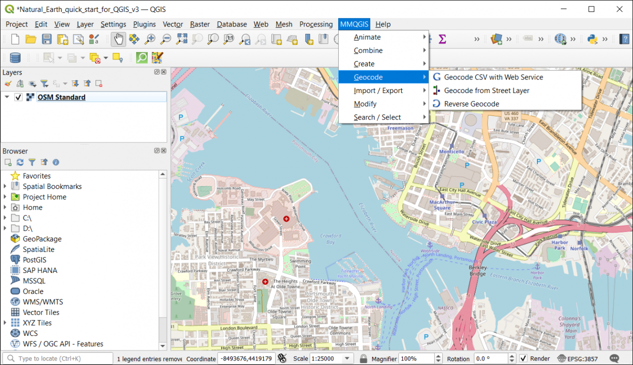
To access the MMQGIS plugin, you can find a dedicated menu to “MMQGIS” at the top of QGIS Desktop. There are two ways that you can geocode with MMQGIS:
- Bulk Geocoding – Input is a CSV with address, city, and state. Creates points based on each record address.
- Geocode from Street Layer – Capabilities to geocode from a street layer.
- Reverse Geocoding – Use an existing set of points and find addresses.
Here is an example of where you can find the MMQGIS Geocoding menu in QGIS Desktop.
Geocoding Use Case and Example
You will need a CSV with addresses, city, and country at the very least. For example, here is the format that the spreadsheet has to be:
| Name | Address | City | State |
|---|---|---|---|
| Chrysler Museum | 1 Memorial Pl | Norfolk | VA |
| Town Point Park | 113 Waterside Dr | Norfolk | VA |
| Portsmouth Olde Town Historic District | 321 Court Street | Portsmouth | VA |
| Portsmouth Naval Shipyard Museum | 2 High St | Portsmouth | VA |
| Sheraton Norfolk Waterside Hotel | 777 Waterside Dr | Norfolk | VA |
Next, you’ll have to map your fields to the correct ones in the MMQGIS geocoding dialog box. You have the option to use OSM for addressing. Alternatively, if you have a Google Maps API key, you can use that as well.
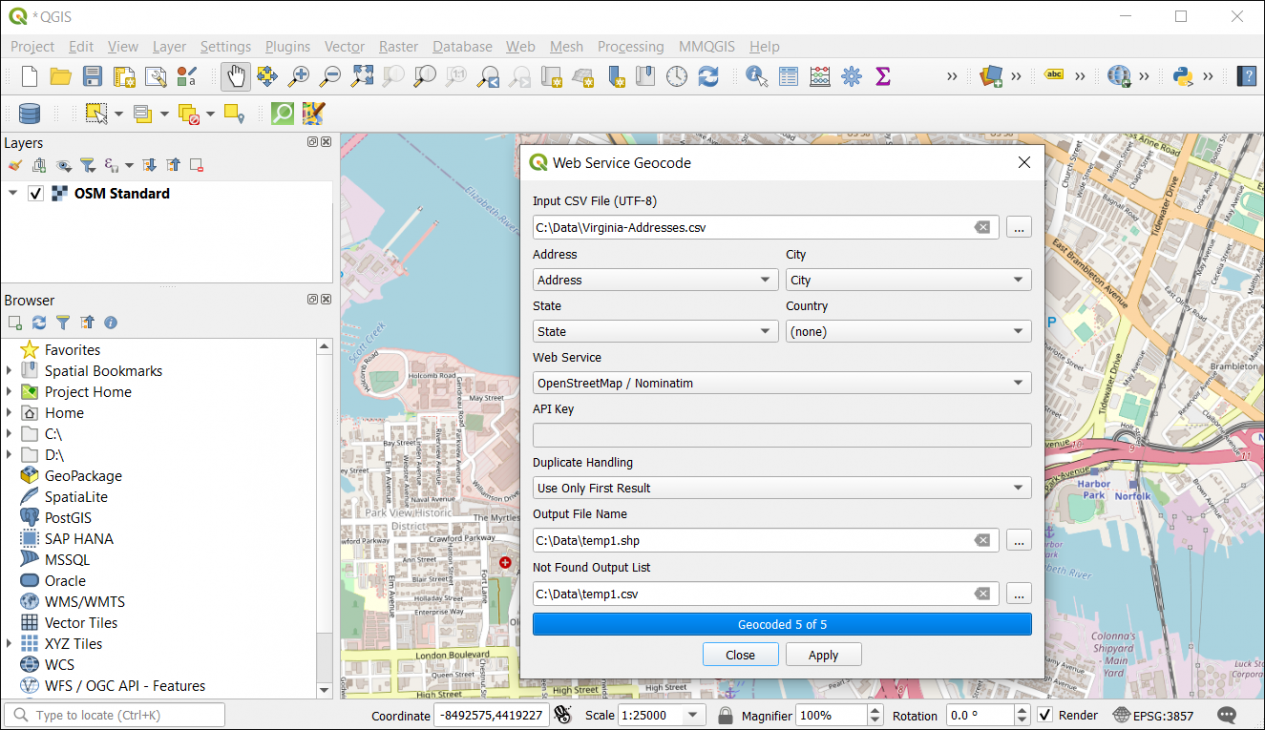
Once you click the “Apply” button, MMQGIS will use the web service as specified to search and geocode the addresses from your CSV.
Finally, the addresses will pop up in your table of contents and map canvas as a temporary layer. If you want to make it a permanent layer, you will have to right-click the layer and export it to a directory on your file system.
Summary: QGIS Geocoding with MMQGIS
In this tutorial, you learned how to geocode addresses using QGIS Desktop with the MMQGIS plugin.
No matter the size of your CSV, the MMQGIS plugin is extremely flexible with a wide set of tools.
Although OpenStreetMaps geocoding tool works fairly well, the addressing accuracy improves with a Google Maps API key. That’s why we have Google Maps ranked as our top geocoder because of its highly accurate and up-to-date addressing system.
Do you use QGIS for geocoding? What do you like to use as your geocoder? Please let us know with your comments below.


Hi, thanks for the post. I have an issue with the connection. The error is the following:
Failure connecting to API:
If someone knows what it could be, I’d be happy.
my MMQGIS version is 2021.9.10 and my QGIS version is 3.16.11-Hannover