5 Maps with Street View To See Your House
Maps with Street View
Last year, I planned a trip to San Francisco but couldn’t decide which hotel to book. Using maps with street view, I could walk the streets of San Francisco from my living room. I just wanted to make sure it was safe.
Today, we’ll explore 4 maps with street view (street view alternatives) so you can get the lay of the land. But just imagine all the possibilities. And for those of you who want to see your house, of course, you can do that too.
1. Google Street View
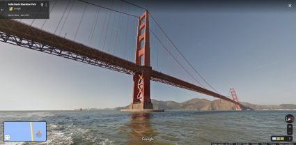
At the top of the list is Google Street View. Google has traveled more than 10 million miles worldwide with a 360-degree camera. It’s not only by car. Google has used boats, scuba, snowmobiles, and even camels to collect Street View imagery.
How much has Google collected? Google has collected over 220 billion Street View images from over 100 countries and territories. This massive archive is the largest in existence today.
Keep in mind that Google also uses contributor photos. This is a nice feature for areas that are harder to reach. Plus, it gives you a bit of a different perspective at times of the day.
2. Mapillary

Think of Mapillary as an evolving global scrapbook of photos. But it’s not just any scrapbook. Mapillary is an active community. It’s mapped by people like you and me. That’s the essence of crowd-sourced mapping.
Mapillary contains more than 2 billion images. All images are shared under a CC-BY-SA license. This means you can use and modify these images, as long as you provide attribution.
Have you ever thought, your snapshots could help map the world? Check out Mapillary for its fresh, user-contributed photos. This is a true community-driven effort for street-level photos.
3. Apple Maps Street-Level View
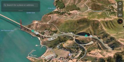
Apple Maps is building up its street-level view imagery through its “Look Around” technology. It’s improved incredibly over the years with more photos uploaded every day.
How do you access streel-level imagery? Click on the binocular icon in Apple Maps. This allows you to view a 360-degree panoramic scene. By clicking this button, you can take a virtual walk-through of an area
Interestingly enough, every picture tells a story. This is especially true when its a street-level image. This is where Apple Maps exploration meets innovation.
4. KartaView
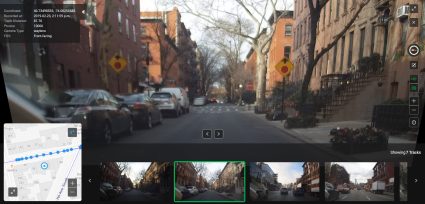
KartaView, formerly known as OpenStreetCam, is an open-source database of street-level imagery. This collaborative project aims to create a free of street-level images. Similar to Mapillary, it operates on the principle of crowdsourcing.
First, users upload photos of streets using smartphones, cameras, or dedicated dashcams. Then, KartaView stitches together images as continuous panoramic views. Because privacy is a concern, it automatically blurs faces and license plates for privacy.
These images are then made available to contributors of OpenStreetMap (OSM). By using these images, KartaView can add, verify, and improve the OSM map with real-world visuals.
5. Oriented Imagery

Looking for an in-house street view? Esri introduces the oriented imagery capability in ArcGIS. This feature allows users to incorporate a wide range of imagery sources for situational awareness.
This feature is available in ArcGIS Online, ArcGIS Pro, and ArcGIS Enterprise. All of which allows you to incorporate drone images and street-level photos, within a map context.
The capability leverages camera location, orientation, and digital elevation models to map each pixel to a ground location. Future versions might include additional imagery formats, like 360° images, videos, and panoramas.
Maps with Streetview
Ever found yourself lost in another country? Maps with street view change that. They give you a real-life glimpse of your destination before you arrive.
In this article, we’ve provided you with 4 maps with street view. Check out your house. Check out your next travel destination. Or check out almost anywhere in the world with these street view map platforms.


