Map of Michigan – Cities and Roads
This Michigan map contains cities, roads, islands, mountains, rivers and lakes. Detroit, Grand Rapids and Warren are major cities in this map of Michigan.
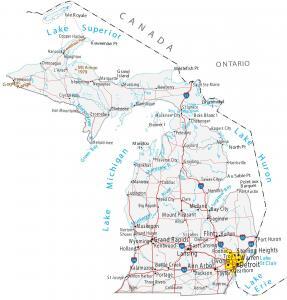
This Michigan map contains cities, roads, islands, mountains, rivers and lakes. Detroit, Grand Rapids and Warren are major cities in this map of Michigan.
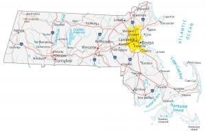
This Massachusetts map contains cities, roads, rivers and lakes. Boston, Springfield and Worcester are major cities shown in this map of Massachusetts.
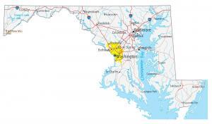
This map of Maryland contains cities, roads, rivers and lakes. Baltimore, Columbia and Annapolis major cities shown in this map of Maryland.
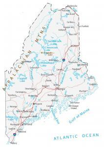
This Maine map displays cities, interstate highways, rivers and lakes. Portland, Lewiston and Bangor are major cities shown in this map of Maine.
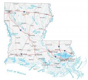
This Louisiana map displays cities, roads, rivers and lakes. New Orleans, Baton Rouge and Shreveport are major cities shown in this map of Louisiana.
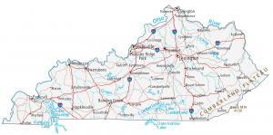
This Kentucky map shows cities, roads, rivers and lakes. Louisville, Lexington and Frankfort are major cities shown in this map of Kentucky.
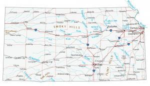
This Kansas map displays cities, roads, rivers and lakes. Kansas City, Wichita and Topeka are some of the major cities shown in this map of Kansas.
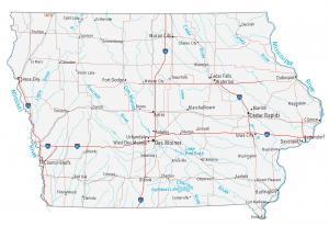
This Iowa map displays cities, roads, rivers and lakes. Des Moines, Cedar Rapids and Davenport are some of the major cities shown in this map of of Iowa.
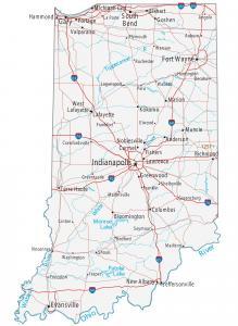
This Indiana map contains cities, roads, rivers and lakes. Indianapolis, Fort Wayne and Evansville are major cities shown in this map of Indiana.
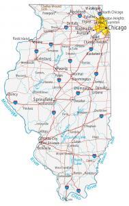
A city and road map of Illinois that has major rivers, lakes and landmarks. Chicago, Springfield and Aurora are major cities shown in this Illinois map.