UAV Mapping for Aerial Surveying

Drone Surveying
Once upon a time, surveyors spent months traversing rugged terrains. The art of mapping faced many challenges. Surveyors used their own two feet to chart unknown lands.
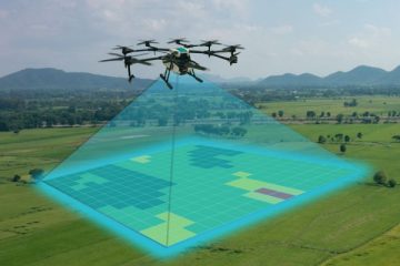
Fast forward to the present day. And the landscape of surveying has undergone a massive shift because of UAV surveying. Drones can reach places people can’t easily go to.
So, from walking miles to flying drones, UAV data and aerial mapping have changed it all. The process was slow. But accuracy is still key. Now, drones can build maps quickly and with accuracy.
Types of Drone Surveys
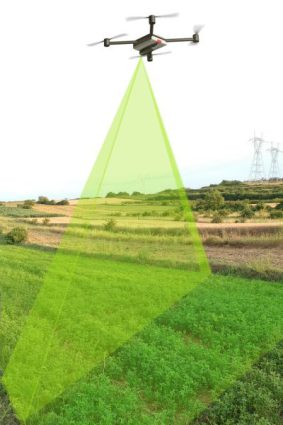
Drone surveys come in many types. Each has its own way of looking at the earth. Some drones measure elevation, while others use special cameras to see what our eyes can’t.
Let’s take a look at some of the types of drone surveys that are available today.
1. Drones for Photogrammetry

Photogrammetry surveys use drone-captured images to make 3D models. Drones fly over an area, taking overlapping photos at different angles.
By stitching these photos together, the photogrammetry uses parallax to see details in land features. This is great for landscapes, buildings, and large objects.
2. LiDAR Mapping Drones
LiDAR (Light Detection and Ranging) drones send out laser pulses to measure distances. This method creates accurate 3D models of the ground, even through vegetation.
Using LiDAR, the laser scans the ground and objects, capturing millions of points. These points create a detailed 3D point cloud. Although both LiDAR and photogrammetry measure elevation, they are different survey types.
3. Thermal Imaging

Drones with thermal cameras can detect heat, not light. This means they can see in the dark or through smoke. Perfect for locating hotspots, thermal imaging is a growing technology.
One common use case for thermal imaging is in search and rescue. Thermal drones can find people lost in forests or mountains. They spot human heat against the cooler background, even at night.
4. Multispectral and Hyperspectral Imaging
These drones capture data across different light spectrums. Multispectral imaging acts like an advanced camera. It can capture images in various light spectrums, including some that are invisible to the human eye.
Meanwhile, hyperspectral imaging takes this concept to a whole new level. By capturing a much broader spectrum of light, it can distinguish subtle differences in materials. But hyperspectral imaging requires more sophisticated processing and analysis.
5. UAV 3D Mapping

The beauty of 3D drone mapping lies in its ability to capture data quickly and safely. It does so without disturbing the site. This makes it a go-to method for projects requiring up-to-date, detailed visual information.
So, it’s clear that 3D mapping with drones is not just about creating models. Using LiDAR or photogrammetry, it turns photos or laser scans into three-dimensional models.
Use Cases for UAV Mapping
UAV mapping changes how we collect data from the sky. Here’s a closer look at 10 ways drones are helping us:
- Farming: Drones check on crops from above. This is perfect for maintaining crop health and maximizing yield.
- Construction: They give a top view of building sites. Drones help keep projects on schedule by showing what’s happening.
- Environment: Because drones map out animal habitat, it helps keep an eye on protecting the environment.
- Disaster Response: Drones quickly look over areas hit by disasters. As such, we can prioritize where help is needed most.
- Mining: Drones measure how much material is in mines. It also checks environmental safety, making mining safer.
- Forestry: They count trees and check their health, which is important for keeping forests healthy.
- Managing Water: Drones map lakes and rivers. By using drone imagery, we can take care of our water resources.
- Infrastructure: Inspecting bridges and power lines with drones makes sure they are safe and working properly.
- Real Estate: Aerial photos and 3D models from drones make real estate listings more attractive to buyers.
- Insurance: After storms, drones check buildings for damage. This makes insurance claims faster and more accurate.
This is just the tip of the iceberg. As drones continue to improve, they’ll keep finding new ways to manage the world around us.
The Future of UAV Surveying
As drone technology improves, we can expect drones to become more autonomous with minimal human oversight. They’ll use smart tech to look at the data right away. For example, augmented reality (AR), will allow for more immersive mapping experiences.

Secondly, battery technology improvements will extend flight times. This will allow drones to cover larger areas or focus without frequent recharging. Regulatory developments will also play a key role. It may open up new airspace or eliminate the line of sight requirement in some countries.
Finally, artificial intelligence (AI) and machine learning will power the leap forward. It will not only enable drones to collect data in real-time, but it will provide instant insights. With all these changes, drones will help us in many ways. From building cities to protecting the environment, technology will continue to grow.
UAV Surveying and You
Today, you learned about the different types of UAV surveys. Each type serves different needs. For example, photogrammetry is good for mapping, while LiDAR is better for detailed terrain models.
We also explained the use cases for drones and future trends. Now, we want to turn things over to you. Are you using UAV mapping? Let us know how in the comment section below.


I’m not using it right now. However, I have a buddy in real estate/house inspections who could benefit from UAV Surveying. Thanks for the tip.