Map of Ukraine
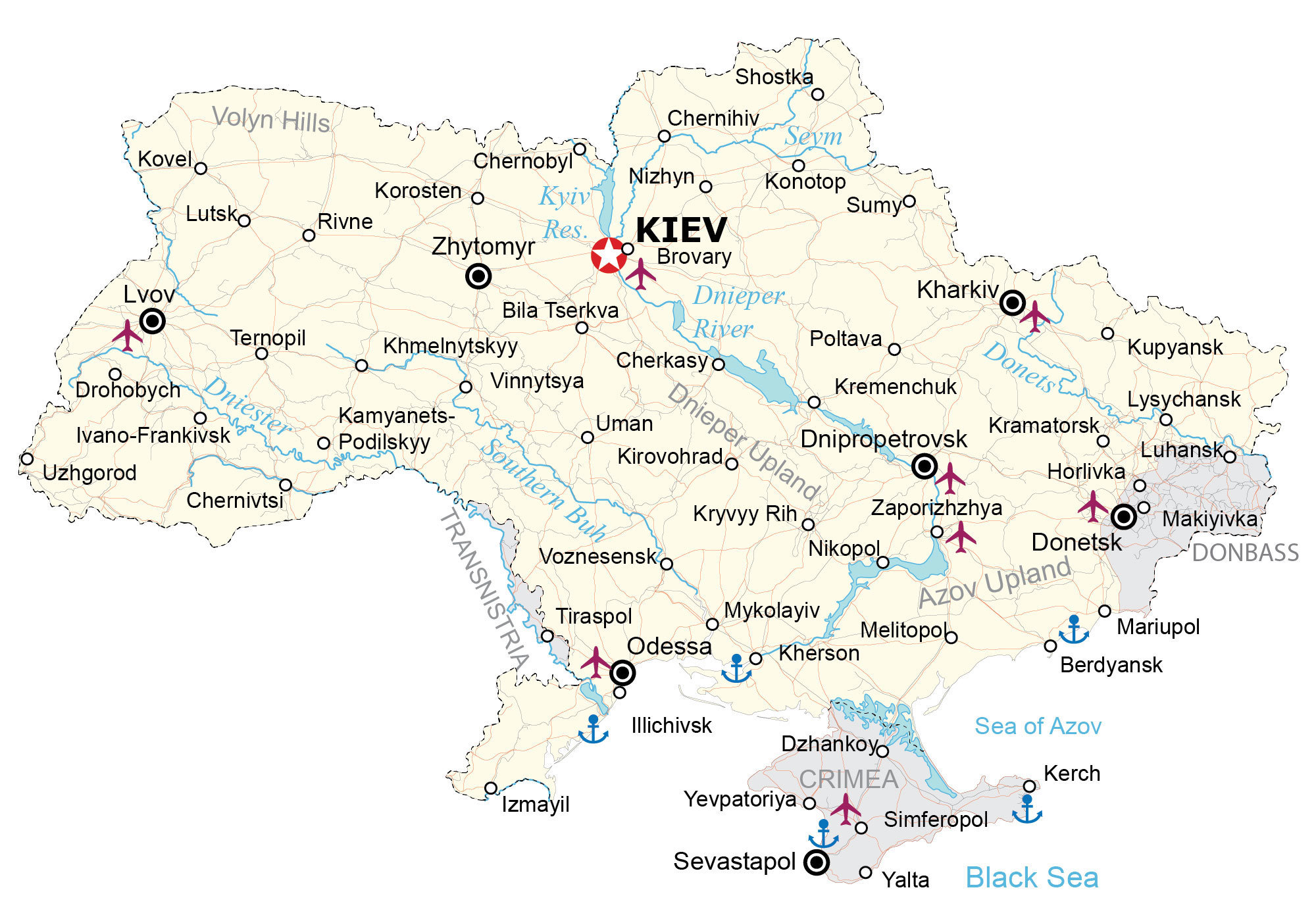
This map of Ukraine contains major cities, rivers, highways, and disputed areas. It also features a satellite and elevation map to see features like the Dnieper River, vast plains, and hilly terrain.
Ukraine map collection
You are free to use our Ukraine map for educational and commercial uses. Attribution is required. How to attribute?
About the map
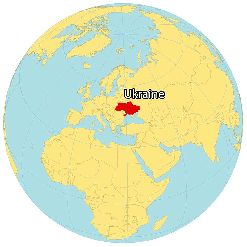
Ukraine is an eastern European country, along the coast of the Black Sea. It borders several countries in Europe including Russia to the northeast, Moldova and Romania to the south, Hungary and Slovakia to the southwest, Poland to the west, and Belarus to the north.
But it also shares disputed borders in the Crimea, Donbas, and Transnistria regions with Russia and Moldova. Ukraine is the second-largest country in Europe, after Russia, at 603,628 square kilometers (233,062 sq mi).
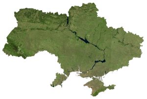
SATELLITE IMAGERY
Ukraine Satellite Map
One of the most notable features in Ukraine is how the Dnieper River cuts through it in a north-south direction. Not only is it the longest river in Ukraine, but it’s the fourth-longest in all of Europe.
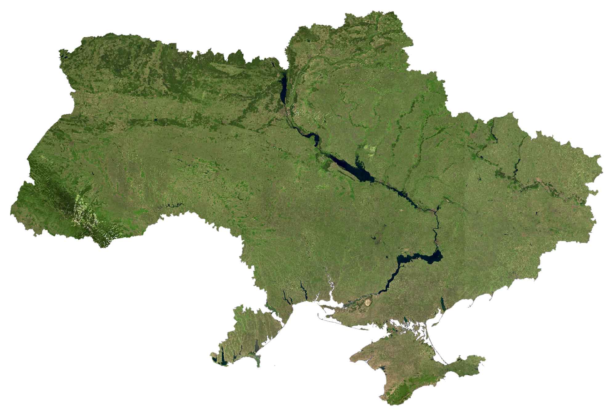
It holds several large reservoirs within this river system such as the Kyiv, Kakhovka, and Dnieper Reservoirs. Only about 17% of Ukraine is covered in Europe which makes it one of the lowest of all countries in Europe. Its largest freshwater lake is Lake Yalpuh covering an area of 149 square kilometers.
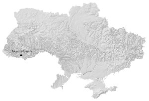
PHYSICAL MAP
Ukraine Elevation Map
The majority of Ukraine consists of fertile plains and plateaus. It doesn’t have any major mountain chains in the country. Instead, it has mountainous regions with the Carpathian Mountains in the west and the Crimean Mountains in the south.

Its highest point is Mount Hoverla located in the southwest, standing 2,061 meters (6,762 ft) in height. This mountain is part of the Ukrainian Carpathians in the southeast of the country.
Capital City
Kiev
Major cities and towns
Cherkasy
Chernivtsi
Dnipropetrovsk
Donetsk
Ivano-Frankivsk
Kharkiv
Kherson
Khmelnytskyy
Kirovohrado
Kryvyy Rih
Luhansko
Lviv
Mykolayiv
Odessa
Poltava
Rivne
Sumy
Ternopil
Vinnytsya
Zaporizhzhya
Zhytomyr
Cities, towns and villages
Bila Tserkva
Brovary
Berdyansk
Chernihiv
Chernobyl
Drohobych
Illichivsk
Izmayil
Kamyanets-Podilskyy
Kirovohrado
Konotop
Korosten
Kovelo
Kramatorsk
Kremenchuk
Kupyansk
Lutsko
Lysychansk
Mariupol
Melitopol
Nikopol
Nizhyn
Shostka
Sumyo
Uman
Uzhgorod
Volyn Hills
Voznesensk
Seas and rivers
Black Sea
Dnieper River
Dniester River
Donets River
Kyiv Reservoir
Sea of Azov
Seym River
Southern Buh River
Landforms and regions
Azov Upland
Dnieper Upland
Volyn Hills


What is the gray filthy layer over Crimea and part of the east of the beautiful country?
Please, re-name the Ukrainian capital, it should by Kyiv.
Hi,
Crimea is missing from the Ukraine silhouette map.