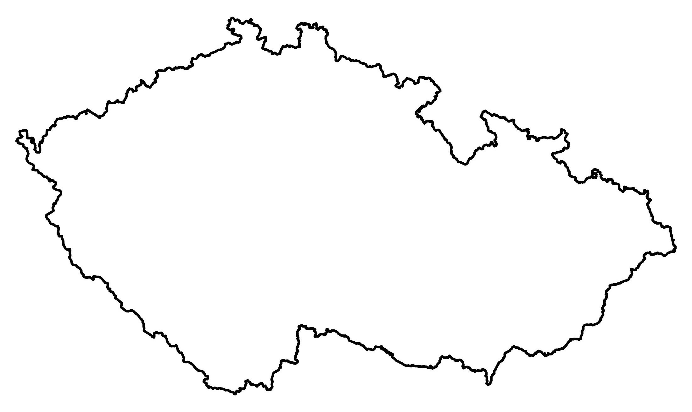
Map of Czech Republic (Czechia)
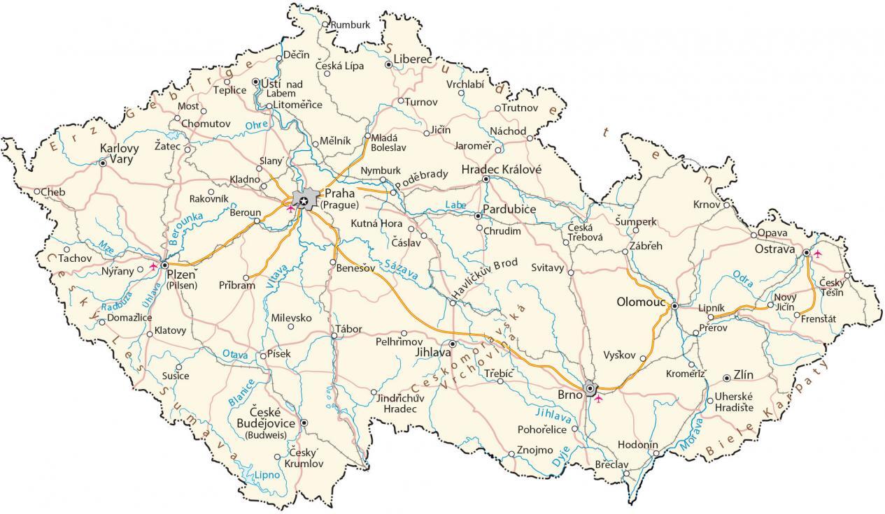
A Czech Republic map (Czechia) with major cities, rivers, and highways. It includes a satellite and elevation map of the Czech Republic for a graphical reference and terrain view.
Czech Republic map collection

You are free to use our Czech Republic map for educational and commercial uses. Attribution is required. How to attribute?
About the map
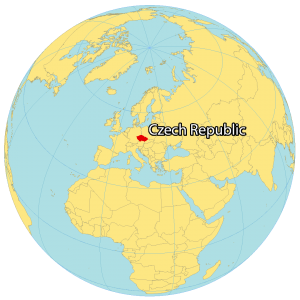
The Czech Republic is a landlocked country located in Central Europe. It borders 4 other European countries including Germany to the west, Poland to the northeast, Slovakia to the southeast, and Austria to the south.
Prague is the capital and largest city of the Czech Republic, situated close to the geographical center of the country. Its location is at the heart of Europe and once was a part of Czechoslovakia since it was dissolved in 1993.
The Czech Republic occupies an area of 78,871 square kilometers (30,452 sq mi) which is similar in size to Austria. The country is divided into three historical regions—Bohemia in the west, Moravia in the east, and Czech Silesia in the northeast—which together comprises the traditional Czech lands.
SATELLITE IMAGERY
Czech Republic Satellite Map
There are two regions in the Czech Republic. First, Bohemia in the west is surrounded by low mountains with plateaus and rolling plains. Second, Moravia in the east is also mostly hills.
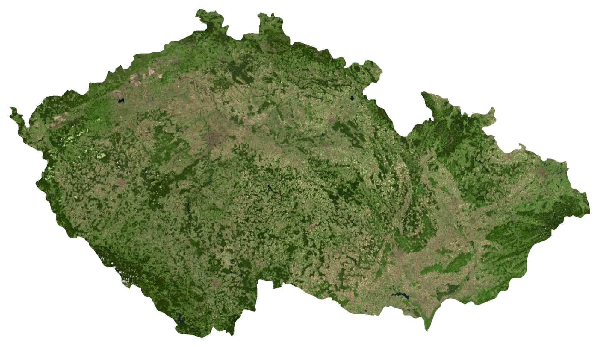
While forests cover approximately 33% of the country, 57% is for agriculture. Vltava, Elbe, Oder, and Morava are the longest rivers in the Czech Republic. Black Lake is the largest and deepest lake in the country.
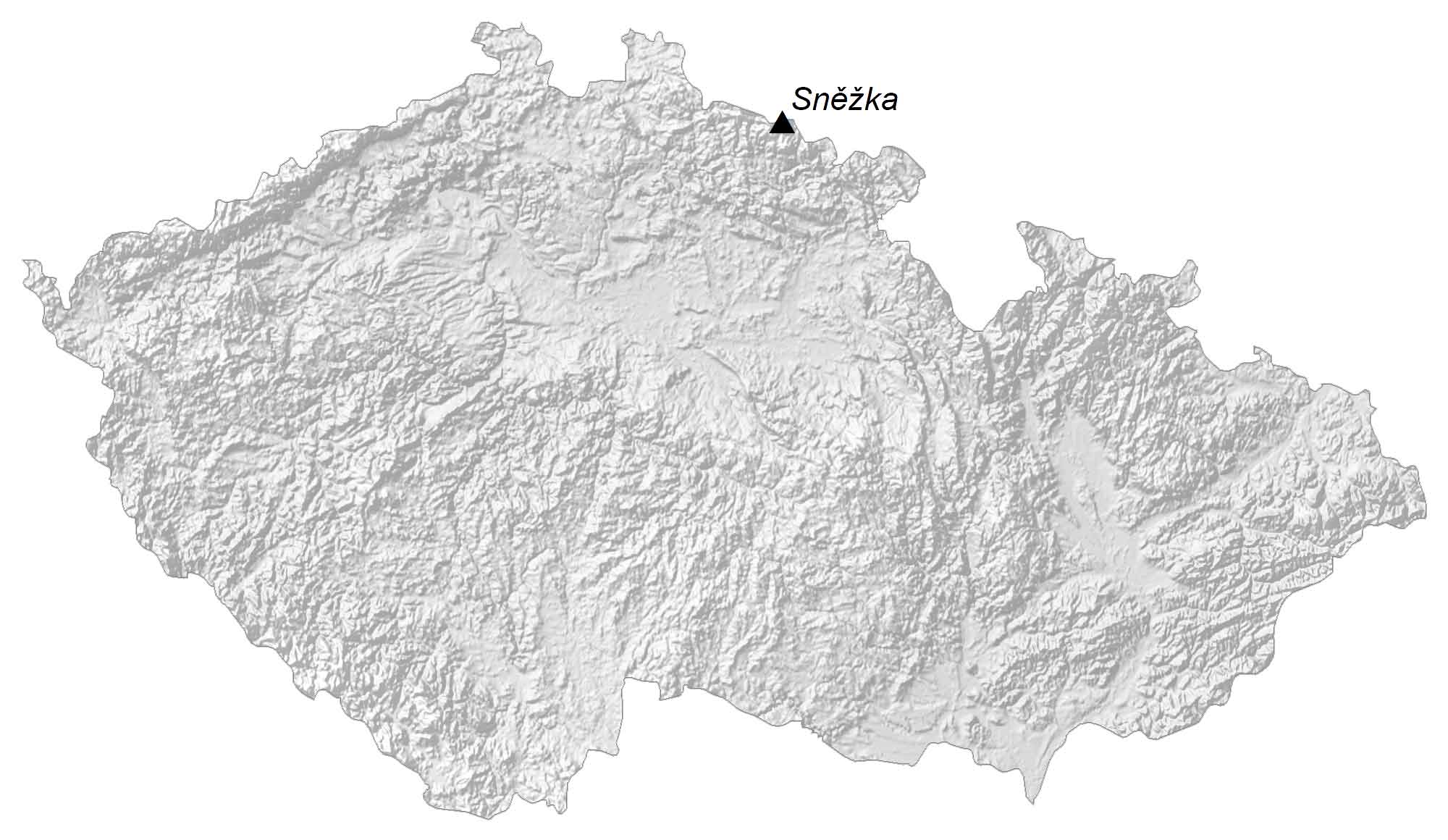
HILLSHADE MAP
Czech Republic Elevation Map
Overall, the Czech Republic has a hilly terrain and is surrounded by low-lying mountains. Sněžka, located at the border between Poland, is the Czech Republic’s highest point at 1,602 meters in height.
Conversely, Hranice Abyss is the world’s deepest, freshwater and underwater cave. Although surveys are not fully completed, the depths of this limestone formation cave can reach down to 473 meters. This also makes it one of the deepest and most surveyed caves that exist in the world today.
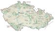
PHYSICAL MAP
Czech Republic Physical Map
The Czech Republic is filled with 4 national parks and various protected landscapes. For example, Krkonoše National Park is the oldest national park in the country because of its position in the center of Europe.
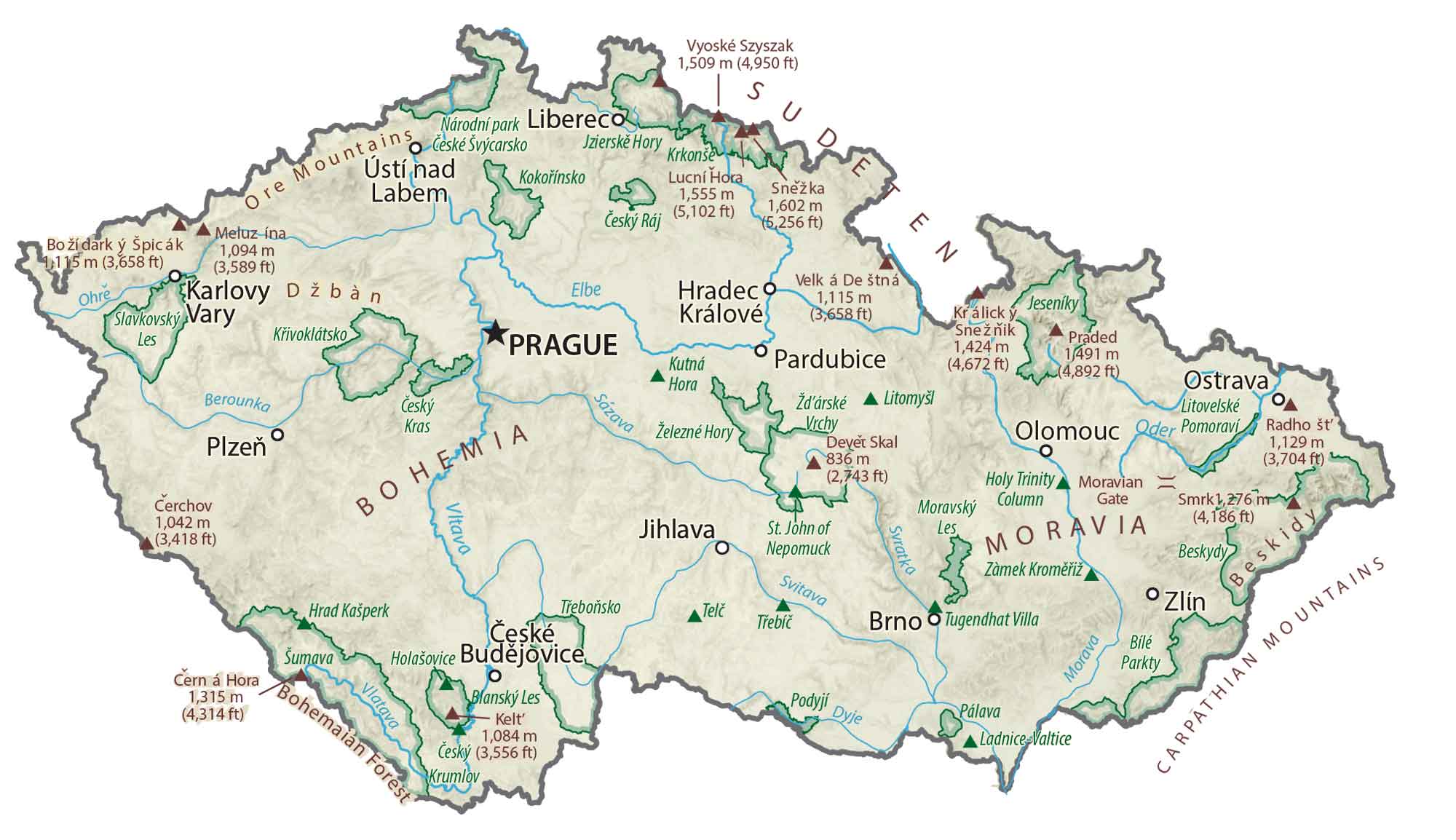
Next, Šumava National Park borders Austria and lets you get up close to the peaks of the Alps or the Novohradské Mountains. Finally, Podyjí National Park and Bohemian Switzerland boast castles and Pravčická Gate, the largest natural bridge in Europe.
Capital City
Praha (Prague)
Major cities and towns
Brno
Ceske Budejovice (Budweis)
Hradec Kralove
Karlovy Vary
Liberec
Olomouc
Ostrava
Pardubice
Plzen (Pilsen)
Zlin
Cities and towns
Benesov
Beroun
Caslav
Ceska Lipa
Cesky Krumlov
Ceska Trebova
Chomutov
Chrudim
Decin
Domazlice
Havlickuv Brod
Hodonin
Jihlava
Jindrichuv Hradec
Kladno
Klatovy
Krnov
Kutna Hora
Litomerice
Mlada Boleslav
Most
Nachod
Nymburk
Pelhrimov
Pisek
Pohorelice
Přerov
Pribram
Rakovnik
Rumburk
Susice
Tabor
Tachov
Teplice
Trutnov
Turnov
Uherske Hradiste
Usti nad Labem
Vrchlabi
Lakes, rivers and creeks
Berounka River
Blanice River
Dyje River
Labe River
Lipno Reservoir
Morava River
Mze River
Odra River
Ohre River
Otava River
Radbuza River
Sazava River
Uhlava River
Vitava River
Geographic features
Ore Mountains (Erzgebirge)
Sudeten Mountains
White Carpathians (Biele Karpaty)
Bohemian-Moravian Highlands
Bohemian Forest (Šumava)


Seems like a nice and interesting place to visit. I like hilly countries with lots of mountains. Also it must be beautiful.
Nice job! Nice breakdown of each region and terrain!
Just checking and would love to travel there and the region one year