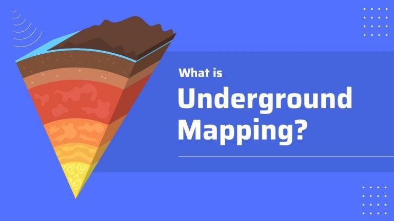
What Is Underground Mapping?
DEFINITION:
Underground mapping is the process of creating maps and models of features below the Earth’s surface, such as utilities, bathymetry, and groundwater.
What Is Underground Mapping?
Underground mapping uses imaging technologies to map underground structures. In general, the purpose of underground mapping is for resource extraction. This includes oil and gas exploration and locating existing infrastructure like underground utilities.
There are many benefits of underground mapping. For instance, it helps urban planners identify danger spots and map utilities. In this article, we will discuss the types of underground mapping technologies that exist today.
Ground Penetrating Radar
Ground penetrating radar (GPR) is a type of radar for imaging the subsurface of the Earth. To use it, a high-frequency electromagnetic wave is sent into the ground and the return waves are measured, like LiDAR. The depth at which the reflections are detected can be used to calculate the structure and content of the subsurface.
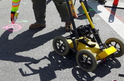
Currently, Ground Penetrating Radar has a variety of applications including but not limited to:
- Detecting buried objects
- Mapping underground infrastructure
- Assessing the thickness of peatland
- Measuring the depth of the water table
- Scanning the grounds for mineral exploration
Seismic Imaging
Seismic imaging is a technique that maps the subsurface using sound waves. This type of technology sends acoustic waves through the ground. It uses either one of the following equipment (1) a vibroseis or (2) an explosive detonation.
As acoustic waves bounce off objects in the ground, they give a recording of how long the reflected sound wave takes to return. Finally, instruments known as geophones record the return wave from the acoustic waves at the survey site.
Geophysicists can use this data to explore the properties of rocks beneath the surface. However, the primary purpose of seismic imaging is generally to locate coal, oil, and gas deposits. But it’s also helpful for geothermal exploration and locating these types of renewable energy sources.
Bathymetric Mapping
Bathymetric mapping is a technique for peering into the depths of the ocean. By using bathymetry, it’s possible to create a detailed map of the ocean floor by taking measurements from a ship using Sonar technology.
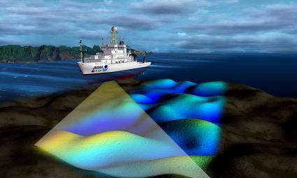
This technique uses echo-sounding data and mapping software for mapping the underwater environment. These bathymetric maps can help with navigation and coastal planning, as well as for studying our marine environment.
By mapping the ocean floor, scientists can learn more about the ocean’s physical features. Plus, they can see how the seafloor changes over time, including its physical characteristics and tectonic plates.
Summary: Underground Mapping
In this article, we discussed the three primary underground mapping technologies. While ground penetrating radar uses high-frequency electromagnetic waves, seismic imaging uses acoustic waves. Both technologies measure the return wave to understand the depths of the subsurface.
For underwater mapping, we mainly use bathymetric mapping. For this technology, sonar emits pings of sounds and listens for an echo. Like LiDAR technology, it calculates the distance to the base by measuring the elapsed time of the echo.


