Mapping the Ocean Floor: Water Bathymetry Data
What is Oceanic Bathymetry?
Have you ever wanted to look deep into the ocean and see its topography?
Turns out, you actually can with ocean bathymetry data.
Bathymetry is the measurement of water depth in oceans, seas, or lakes.
And several bathymetry maps exist today.
Ocean Bathymetry Data: Mapping the Seafloor
GEBCO (General Bathymetric Chart of the Oceans) is the leading organization in the world that maps the world’s oceans.
Based on ship-track soundings and satellite-derived gravity data, GEBCO Grid 2023 is their latest 15 arc-second global grid of elevations. Here’s how to download GEBCO gridded bathymetry data.
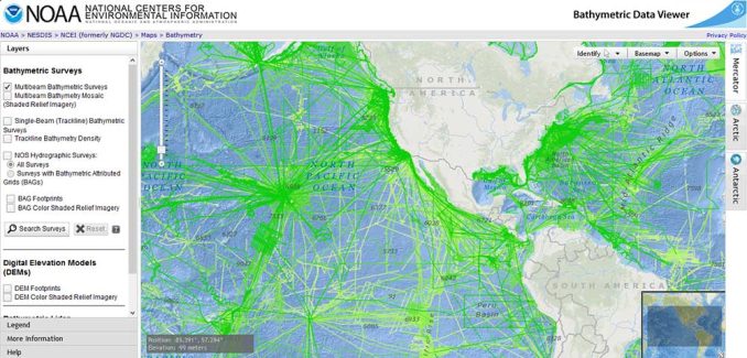
One of the neatest things about NOAA Bathymetry Data Viewer is how you can see where all the Multibeam Bathymetric Surveys take place. In this Bathymetry Data Viewer, you have the option to download raw Sonar data or interpolated ones.
Topobathy is an image service that Esri provides with the best available bathymetry data for specific areas. For example, the coast of California is up to 30 times better than the GEBCO Grid 2023.
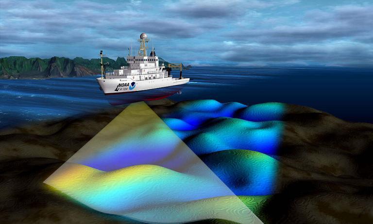
How Do Bathymetry Surveys Work?
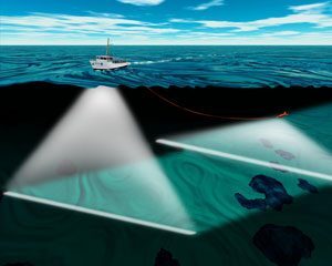
Bathymetry soundings (or sonar) are similar to Light Detection and Ranging (LiDAR). Sonar emits pings of sounds and listens for an echo. It calculates the distance to things by measuring the elapsed time of the echo.
As the ship moves forward, this gives the water depths along the strip of the seafloor. Bathymetry uses sonar because sound waves can travel better in water.
But there’s another source of bathymetry data and this is from satellites. Scientists use gravity mapping to delineate the topography of the ocean floor.
Specifically, CryoSat-2 and Jason-1 satellites found more mass and gravitational pull at tectonic plates. Also, these satellite oceanography missions play an important role in mapping ocean currents and improving global climate models.
Bathymetry Applications
We know more about the moon than we do about the oceans. Less than 1% has been mapped to a high degree of accuracy.
Because bathymetry measures the depth of the seafloor, we use water depth information in various fields. For example, we rely on accurate bathymetry data for understanding global ocean currents along with weather and climate.
The study of plate tectonics has revolutionized our understanding of the Earth. And most underwater trenches are found underwater. Because of bathymetric maps, we know how plate tectonics shape the movement of continents and even the modernization of geodetic datums.
Fishermen use nautical charts with bathymetry for navigation. Other industries that use bathymetry include coastal engineering, oil and gas drilling, and environmental protection such as habitat classification.
Conclusion
Unlike LiDAR which uses light waves and radar which uses radio waves, sonar uses sound.
In other words, multibeam sends out sound waves and measures the two-way travel time between the seabed and the return wave.
We use bathymetry from ocean sounders for construction, weather, climate, and preserving the environment.
GEBCO Grid 2023, Topobathy, and raw sonar data from NOAA are some of the best bathymetry data sources that are available today.
References
Image Credit: National Oceanic and Atmospheric Administration (NOAA)


