Chad Map – Cities and Roads
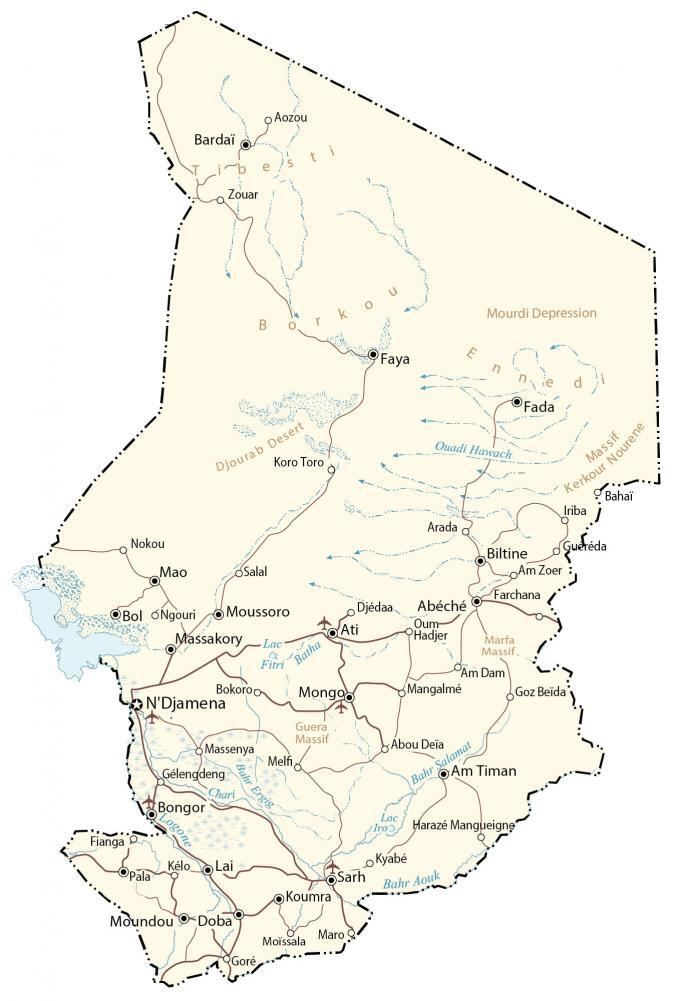
This map of Chad (Republic of Chad) shows major cities, towns, lakes, highways, and roads. Also, it includes an elevation map and satellite imagery to view its desert landscape to the north and more fertile region to the south.
Chad map collection
You are free to use our Chad map for educational and commercial uses. Attribution is required. How to attribute?
About the map
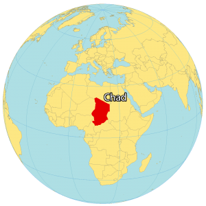
Chad is a landlocked country that borders 6 other countries in Africa. Libya is located to the north, Sudan to the east, the Central African Republic to the south, Cameroon and Nigeria to the southwest, and Niger to the west.
N’djamena is Chad’s capital and largest city, situated near its western border with Cameroon. Approximately 16 million people live in Chad.
Chad is known for its large swaths of desert that cover most of the northern region. Its primary economic activities are mining (like gold and uranium), oil production, and agriculture.
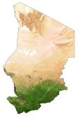
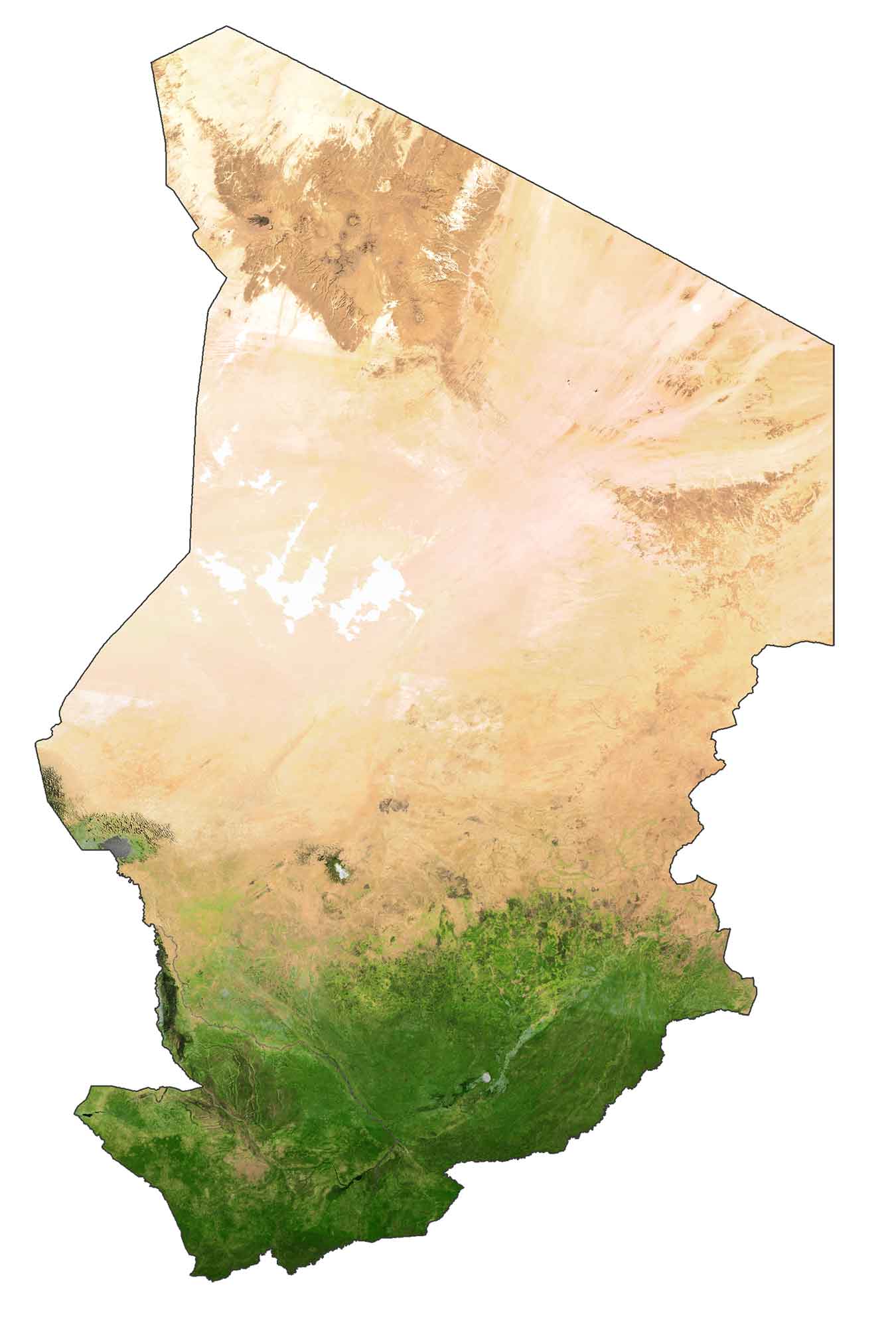
SATELLITE IMAGERY
Chad Satellite Map
Chad is the fifth largest country in Africa at 1,284,000 square kilometers (496,000 sq mi). In comparison, it’s larger than Niger but smaller than Libya. Lake Chad is the seventh-largest lake in the world (and the fourth largest in Africa) and it’s how Chad earned its country name.
The lake serves as an important source of water for not only Chad, but also Cameroon, Niger, and Nigeria. Chad is part of the Sahel, which marks the transition between the Sahara Desert and the Sudanian Savanna. It’s estimated that deserts cover about one-half of Chad.
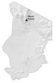
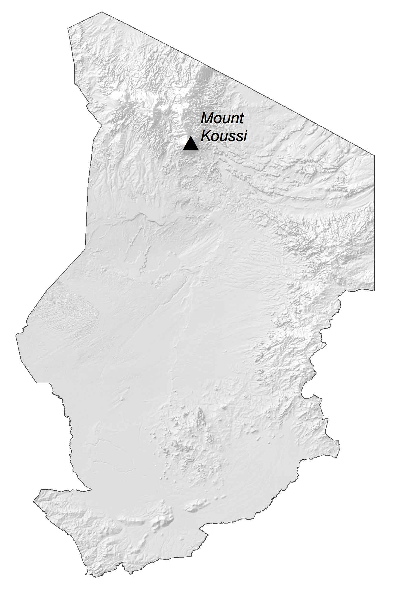
PHYSICAL MAP
Chad Elevation Map
Chad consists of deserts and the Tibesti Mountains in the north. The Sahelian Belt dominates the central and northern regions. In contrast, the more fertile Sudanian Savanna zone is in the south. As part of the greater Sahara desert, the Djurab Desert covers most of the Borkou region in Chad.
Also, the country has several massifs like Kerkour Nourene Massif and Marfa Massif to the east. Whereas the Guera Massif is closer to cities like N’djamena and Mongo. Finally, the Mourdi Depression is a desert depression in northeastern Chad next to the Ennedi Plateau.
Capital City
N’Djamena
Major cities and towns
Moussoro
Massakory
Moundou
Doba
Fada
Faya
Abéché
Sarh
Koumra
Bol
Bardaï
Mao
Cities and towns
Aozou
Zouar
Koro Toro
Nokou
Salal
Am Zoer
Pala
Abou Deïa
Iriba
Bahaï
Maro
Goré
Mangalmé
Arada
Massenya
Harazé Mangueigne
Lakes, rivers and creeks
Quadi Hawach
Batha River
Chari River
Bahr Ergig
Lac Fitri
Lac Iro
Bahr Salamat
Bahr Aouk
Geographic features
Mourdi Depression
Djourab Desert
Marfa Massif
Guera Massif
Tibesti Mountains
Bourkou Mountains
Ennedi Plateau
Massif Kerkour Nourene