Map of Argentina
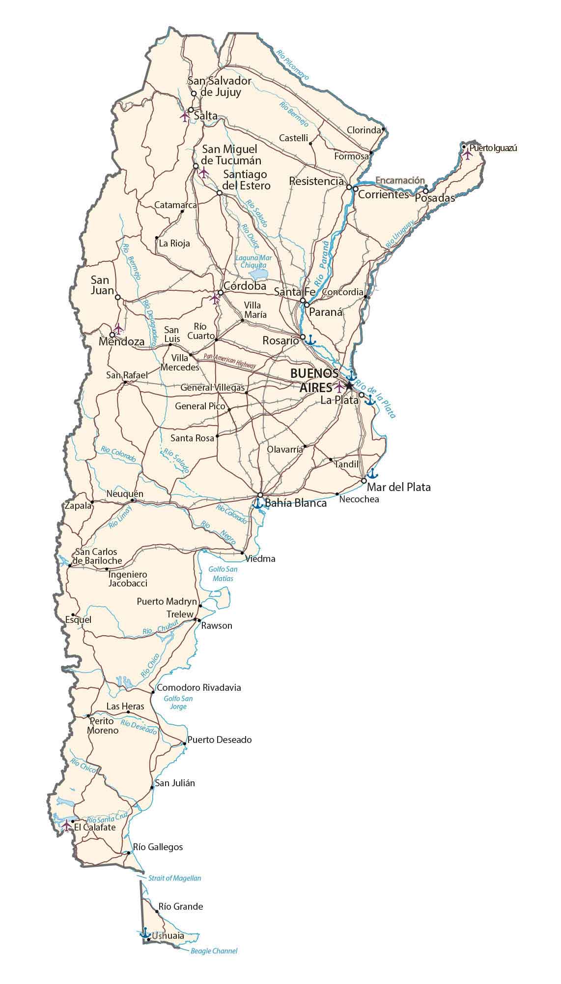
This map of Argentina features major cities, highways, roads, lakes, and rivers. It includes an elevation and satellite map with reference features. For example, the Patagonian Desert, Gran Chaco, and Pampas are major regions in Argentina.

You are free to use our Argentina map for educational and commercial uses. Attribution is required. How to attribute?
About the map
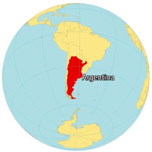
Argentina is located in the continent of South America along the South Atlantic Ocean. It is the second-largest country in South America, after Brazil. The country covers most of the southern portion of South America.
It borders five countries in South America including Paraguay, Brazil, Chile, Uruguay, and Bolivia. The Argentina-Chile border is the longest international border in South America and the third-longest in the world.
Also, Argentina and Brazil’s border is the Iguazu River, which includes the Iguazu Falls. The awe-inspiring Iguazu Falls is a UNESCO World Heritage site that forms a natural boundary and showcases the incredible power of nature.
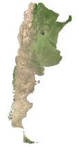
SATELLITE IMAGERY
Argentina Satellite Map
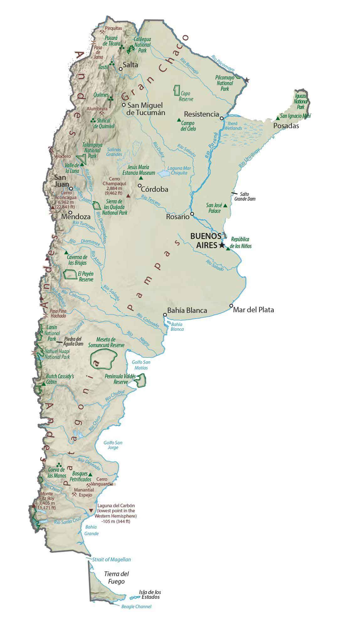
Argentina is a large and versatile country. First, the Patagonian Desert (Patagonian Steppe) stretches from the south of Argentina to the north. Not only is it the largest desert in Argentina, but it’s the 8th largest desert in the world by area.
Second, the Gran Chaco is home to massive forests and unique vegetation in the north. Lastly, the Pampas is a fertile agricultural region known for its agriculture and sparse population.

PHYSICAL MAP
Argentina Elevation Map
Mount Aconcagua is Argentina’s highest point at nearly 7,000 m (23,000 ft). As part of the Andes mountain range, Mount Aconcagua shares a border with Chile. Not only is it the highest peak in Argentina, but it’s also the highest outside of Asia and in the Western Hemisphere.
The Andes is Argentina’s most prominent mountain chain and the highest mountain range outside Asia. These towering peaks shape Argentina’s dramatic landscapes. It’s also great for adventurous trekkers because of its challenging trails.
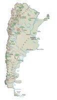
POLITICAL MAP
Argentina Provincial Map
Argentina is divided into 23 provinces and 1 autonomous city. Each province has its own government, laws, and provincial capital. Next, departments are the second level of administrative divisions. Finally, municipalities are the finest level of administrative divisions after departments.
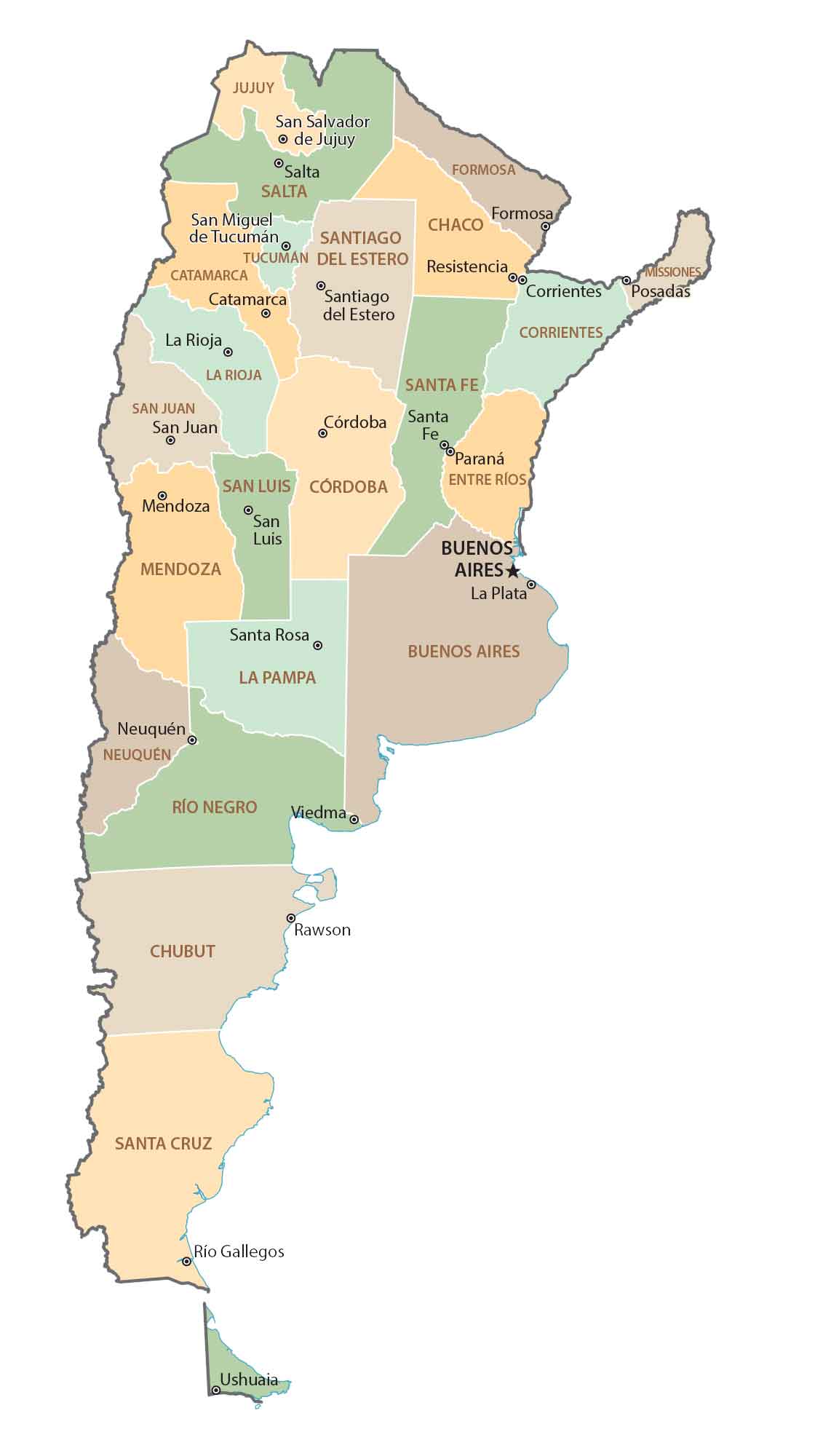
Capital City
Buenos Aires
Major cities and towns
San Salvador de Jujuy
Salta
San Miguel de Tucumán
Santiago del Estero
Formosa
Resistencia
Corrientes
Posadas
Catamarca
La Rioja
San Juan
Córdoba
Santa Fe
Paraná
Mendoza
San Luis
Rosario
Neuquén
Viedma
San Carlos de Bariloche
Puerto Madryn
Trelew
Río Gallegos
Ushuaia
Bahía Blanca
Puerto Iguazú
Cities and towns
Rawson
Castelli
Clorinda
Encarnación
Villa María
Concordia
General Villegas
General Pico
La Plata
Santa Rosa
Olavarría
Tandil
Mar del Plata
Villa Mercedes
San Rafael
San Julián
Ingeniero Jacobacci
Zapala
Río Chico
Las Heras
Perito Rio Deseado
Moreno
Comodoro Rivadavia
Necochea
Puerto Deseado
Lakes, rivers and gulfs
Pilcomayo River
Bermejo River
Sweet River
Salt River
Mar Chiquita Lake
Salt River
Colorado River
Limay River
Negro River
Chubut River
Santa River
Strait of Magellan
Grande River
Beagle Channel
San Matías Gulf
San Jorge Gulf
Other features
Pan American Highway
Parks and reserves
Calilegua National Park
Talampaya National Park
Sierra de las Quijadas National Park
Lanin National Park
Pilcomayo National Park
Nahuel Huapi National Park
Iguazu National Park
Peninsula Valdes Reserve