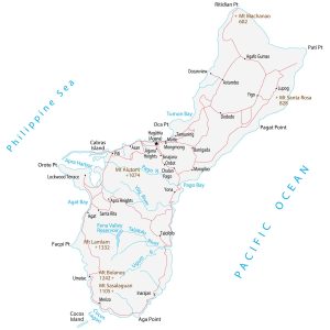
Guam Map – Cities and Roads
This Guam map shows cities, towns, roads, lakes, rivers, and peaks for the island territory of the United States (located in Micronesia).
This Guam map shows cities, towns, roads, lakes, rivers, and peaks for the island territory of the United States (located in Micronesia).
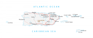
A Puerto Rico map with cities, roads, municipalities, and major landmarks – Puerto Rico is an unincorporated territory of the United States.
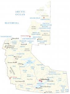
A Northwest Territories map – One of the three territories in Canada located between Nunavut and the Yukon territories in the north.
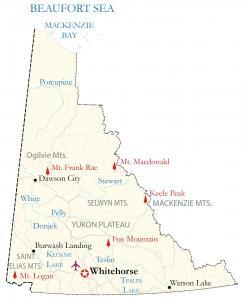
A Yukon Map displaying the territory in Canada known for its high plateaus and rugged mountains like Mount Logan at 5,959 meters.
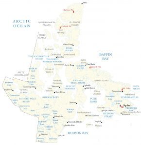
This Nunavut map displays populated places, lakes, and rivers – Nunavut is the newest and largest territory in Canada, occupying the Arctic.
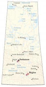
This Saskatchewan map shows cities, roads, rivers, and lakes – Regina, Saskatoon, and Prince Albert are shown in this map of Saskatchewan.
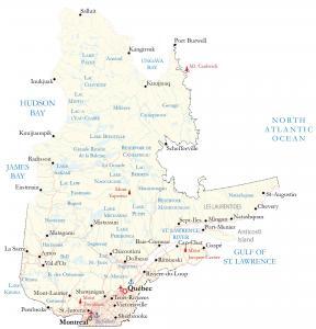
A Quebec map showing major highways, lakes, rivers, satellite imagery, and elevation including major cities like Montreal and Quebec City.
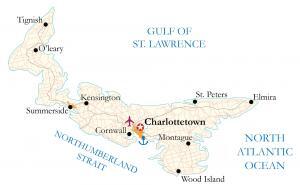
A Prince Edward Island map for the Canadian province located on the east coast – it shows major highways, roads, cities, and populated places.
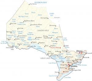
An Ontario map showing major highways, lakes, rivers, satellite imagery, and elevation – with major cities like Toronto, Ottawa, and Hamilton.
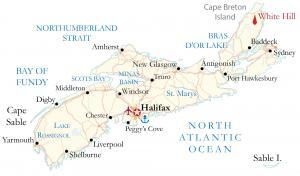
This Nova Scotia map contains major highways, roads, and cities. It includes the capital city of Halifax, as well as other populated places.