Map of Switzerland – Cities and Roads
A map of Switzerland containing major cities, transportation and water – Switzerland is in central Europe, east of France and north of Italy.
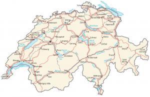
A map of Switzerland containing major cities, transportation and water – Switzerland is in central Europe, east of France and north of Italy.
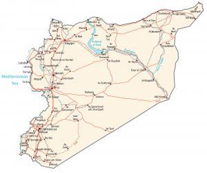
A Syria map featuring cities, transportation and water – Syria is in the Middle East, bordering the Mediterranean Sea, Lebanon and Turkey.
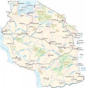
A Tanzania map with major cities, transportation and water – Tanazania is in eastern Africa, bordering the Indian Ocean, Kenya and Mozambique.
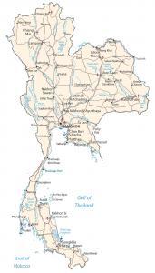
A Thailand map highlighting major cities, roads and water – Thailand is in southeastern Asia, bordering Burma, Laos, Cambodia and Malaysia.
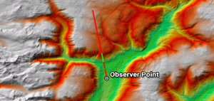
While line of sight determines obstructed and unobstructed on a line, a viewshed dictates surrounding areas as visible or non-visible from an observer POV.
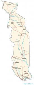
A Togo map featuring major cities, transportation and hydrography – Togo is in western Africa, bordering the Bight of Benin, Benin and Ghana.
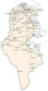
A Tunisia map featuring cities, transportation and water – Tunisia is in northern Africa, next to the Mediterranean Sea, Algeria and Libya.
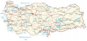
A map of Turkey with cities, roads and water – Turkey is located in southeastern Europe bordering Syria, Iraq, Georgia, Iran and Bulgaria.
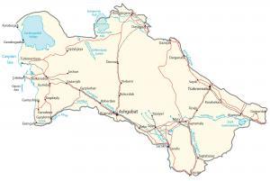
A Turkmenistan map containing cities, roads and water features. Turkmenistan is in central Asia, next to the Caspian Sea, Iran and Kazakhstan.
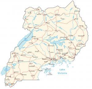
A map of Uganda featuring cities, roads and water – Uganda is in east-central Africa, beside Kenya and the Democratic Republic of the Congo.