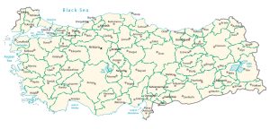
Map of Turkey – Cities and Roads
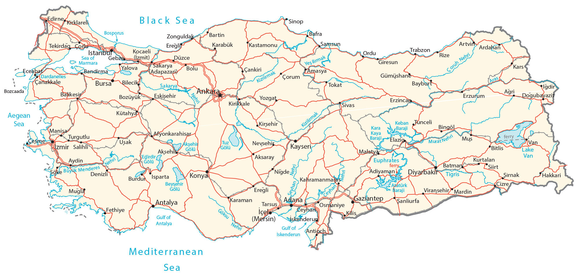
This reference map of Turkey contains cities, towns, highways, roads, lakes, and rivers. It includes a physical map, satellite imagery, and an administrative map of the provinces of Turkey.
Turkey map collection
About the map
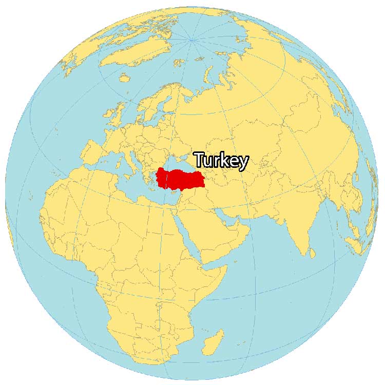
Turkey is located as part of two continents including Southeastern Europe and Western Asia. It has a total of 7,200 kilometers of coastline along the Mediterranean Sea in the south, the Aegean Sea in the west, and the Black Sea in the north. Turkey borders several countries including Georgia, Bulgaria, Syria, Iraq, and Iran.
Turkey is known for its world heritage sites, shipwrecks, the first-ever university, philosophers, and carpets. Turkey’s capital is Ankara but Istanbul is the largest city and financial center, which was formerly known as Constantinople.
Its history extends thousands of years back such as the story of the legendary Trojan War that took place in Troy, Turkey. Other major cities include Izmir, Bursa, and Adana.
You are free to use our Turkey map for educational and commercial uses. Attribution is required. How to attribute?
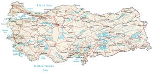
SATELLITE IMAGERY
Turkey Satellite Map
Turkey is a large country in size and occupies 783,356 square kilometers (302,455 sq mi). In comparison, it’s larger than Afghanistan but smaller than Pakistan. Turkey lies between 36°N and 42°N so its climate is mostly hot and dry in the summer. But the temperature, in general, is much milder and wetter in the winter.
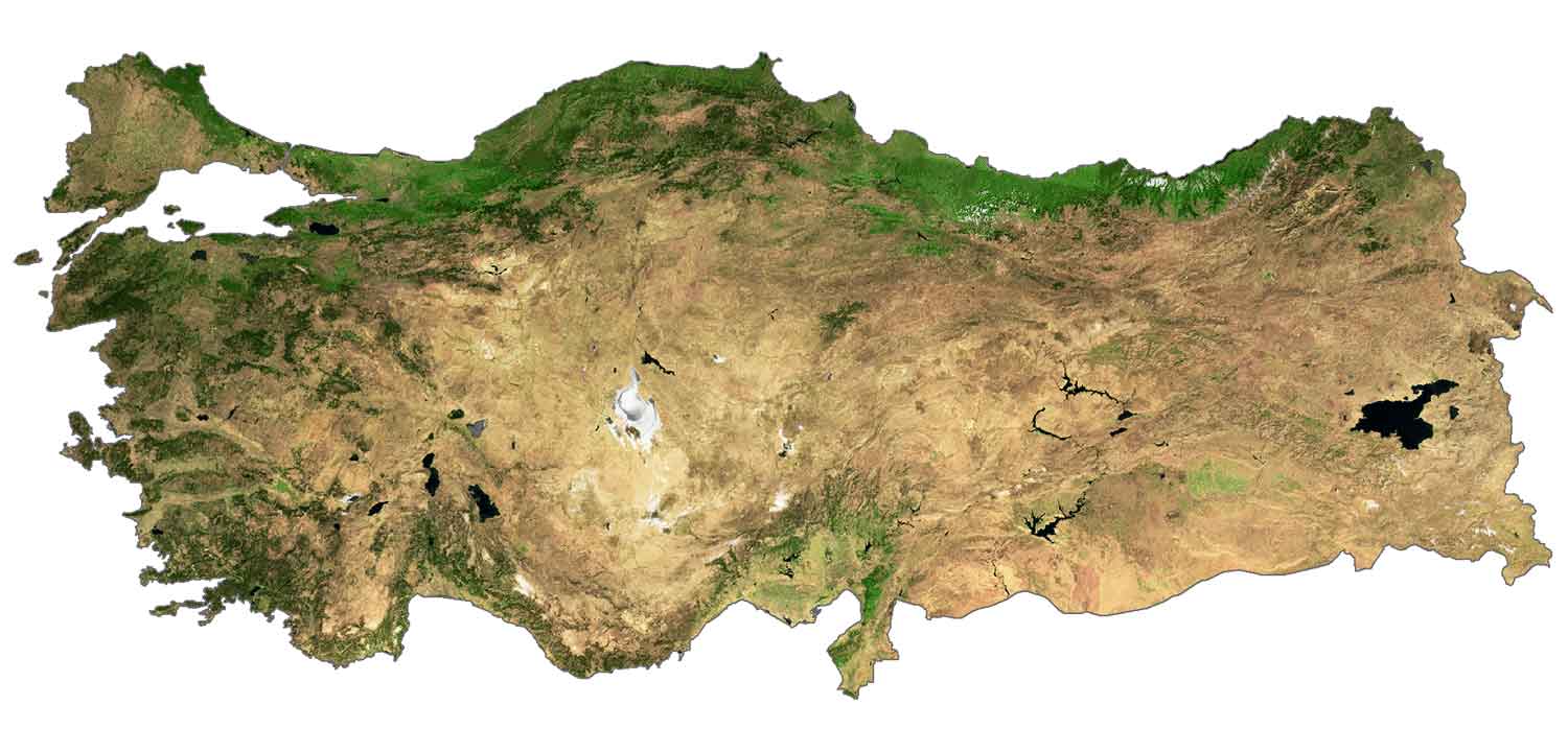
Turkey contains seven geographic regions. Four are coastal regions including the Marmara, Black Sea, Aegean Region, and Mediterranean Regions. Whereas Central Anatolia, Eastern Anatolia, and the Southeastern Anatolia Region are its inner regions.
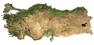
PHYSICAL MAP
Turkey Physical Map
The terrain is a mix of coastal plains, plains in the central region, and several mountain ranges. For example, it includes the Taurus Mountains in the south, the Pontic Mountains in the north, and the Armenian Highlands to the east.
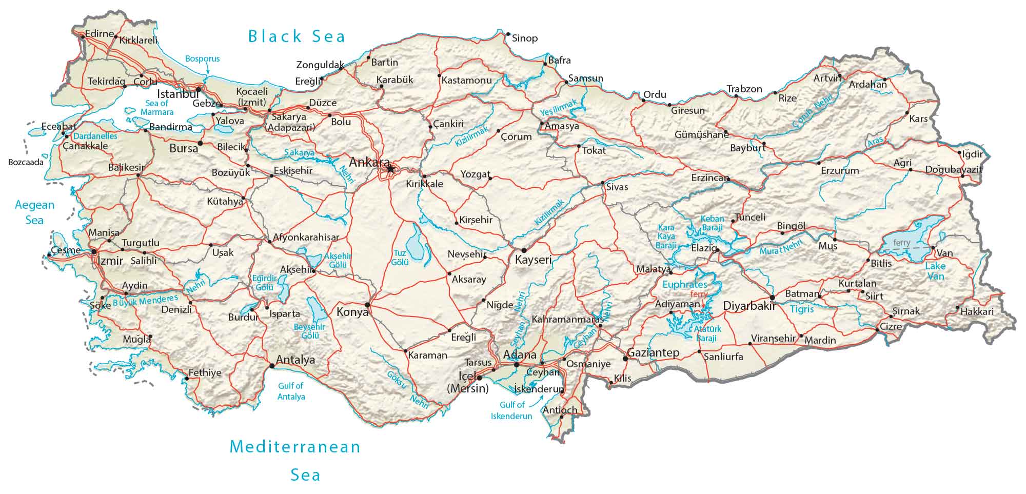
Within the Armenian Highlands, it contains several peaks like Mount Ararat, a snow-capped dormant volcano. At 5,137 meters (16,854 ft), it’s the highest peak in Turkey along its borders with Iran. While Kızılırmak (Halys River) is the longest river at 1,350 kilometers (840 mi), Turkey’s largest lake is Van 3,755 square kilometers (1,450 sq mi).
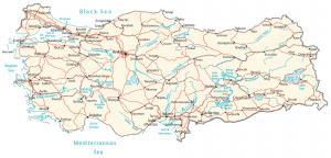
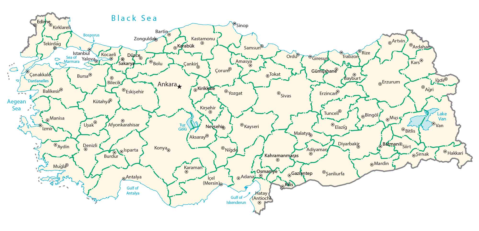
POLITICAL MAP
Turkey Provincial Map
Provinces are the first-level administrative units in Turkey. Currently, there are 81 provinces in Turkey and each one appoints a governor from the Ministry of the Interior. Next, districts are the second-level administrative unit in Turkey. Finally, each province is divided into districts.
Capital City
Ankara
Major cities
Adana
Ankara
Antalya
Bursa
Cankaya
Diyarbakir
Gaziantep
Istanbul
Izmir
Kayseri
Konya
Cities, towns and villages
Adapazari
Adiyaman
Afyonkarahisar
Aksaray
Aksehir
Amasya
Artvin
Ardahan
Balikesir
Bartin
Batman
Bayburt
Bilecik
Bingöl
Bitlis
Bolu
Bozcaada
Bozüyük
Burdur
Çanakkale
Çankiri
Cesme
Cizre
Çorum
Çorlu
Denizli
Doğubayazit
Düzce
Eceabat
Edirne
Elazig
Eregli
Erzincan
Erzurum
Eskişehir
Fethiye
Gebze (Izmit)
Giresun
Gümüshane
Hakkari
Igdir
İçel (Mersin)
Karabük
Karaman
Kars
Kastamonu
Keban
Kirikkale
Kirklareli
Kirsehir
Kilis
Kocaeli
Kütahya
Kurtalan
Malatya
Manisa
Mardin
Mugla
Mus
Nevsehir
Nigde
Ordu
Osmaniye
Rize
Sakarya
Salihli
Samsun
Şanliurfa
Siirt
Sinop
Sirnak
Sivas
Söke
Tekirdag
Tokat
Trabzon
Tunceli
Turgutlu
Uşak
Van
Viransehir
Yalova
Yozgat
Zonguldak
Lakes, rivers and water features
Aegean Sea
Atatürk Dam
Beyşehir Lake
Bosphorus Strait
Black Sea
Büyük Menderes River
Ceyhan River
Çoruh Stream
Dardanelles Strait
Euphrates River
Göksu River
Gulf of Antalya
Gulf of Iskenderun
Keban Dam
Kizilirmak River
Lake Akşehir
Lake Eğirdir
Lake Van
Mediterranean Sea
Murat River
Sea of Marmara
Seyhan River
Tigris River
Tuz Lake
Yeşilirmak River
Islands
Bozcaada Island


Hi all,
Do you have a geological and mineral map of Turkey? I am working on a business project and hope to receive your help. Thank you.
Best
Claire
Hi Claire. Unfortunately, we don’t have that type of map of Turkey.
Can you change the name of Turkey? The name was changed in the year 2022.