Uganda Map – Cities and Roads
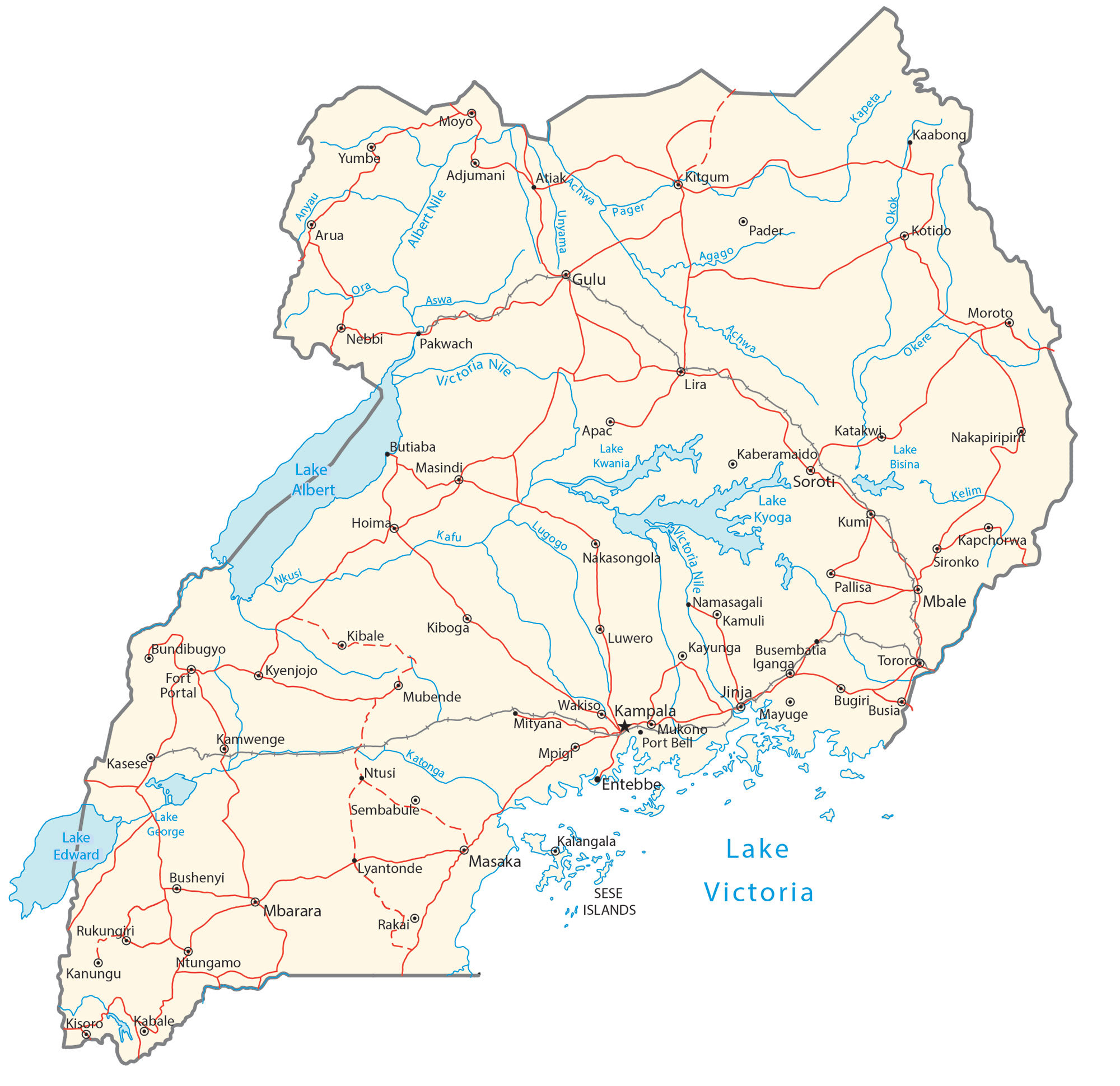
This map collection contains a reference map, satellite imagery, and an elevation map of Uganda. It includes cities, towns, lakes, rivers, highways, roads, and other types of geographic features.
Uganda map collection


You are free to use our Uganda map for educational and commercial uses. Attribution is required. How to attribute?
About the map
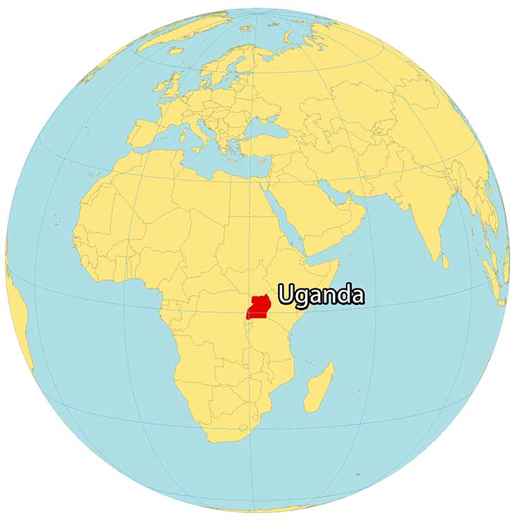
Uganda is a landlocked country located in East Africa. It’s known for its wealth of nature such as the Nile Basin, 60+ protected areas, and Africa’s largest lake, Lake Victoria. Its major cities and the country’s capital, Kampala, are located near this lake.
It borders Kenya to the east and the Democratic Republic of the Congo to the west with two separate mountain chains. Additionally, it’s beside South Sudan to the north as well as Rwanda and Tanzania to the south. Other major cities are Gulu, Lira, and Mbarara.
SATELLITE IMAGERY
Uganda Satellite Map
Uganda occupies a total area of 241,038 square kilometers (93,065 sq mi). In comparison, it’s larger than Ghana but smaller than Guinea. Even though it is a landlocked country, it still has an abundance of lakes and rivers. That’s why it’s recognized as being at the heart of the African Great Lakes region.

For example, not only does it contain Lakes Victoria and Kyoga. But there are Lake Albert, Lake Edward, and Lake George. Within Lake Victoria, it holds several large islands such as Bugala, Lulamba, Bukasa, Kome, Damba, and Buvuma Island. Uganda lies between 1º S and 4º N latitude on the equator so its climate is mostly warm tropical with two distinct rainy seasons.
PHYSICAL MAP
Uganda Physical Map
Uganda has mostly plateaus, volcanic hills, and chains of mountains along its eastern and western borders. For example, Mount Elgon lies along its border eastern border with Kenya. Whereas the Rwenzori Mountains straddle its western border with the Democratic Republic of Congo.

At 5,109 m (16,763 ft), its highest point is the Margherita Peak on Mount Stanley, along the western edge of the country with the Democratic Republic of Congo. It’s also the third highest peak in Africa, after Mount Kilimanjaro and Mount Kenya.
Capital City
Kampala
Major cities
Entebbe
Fort Portal
Gulu
Hoima
Jinja
Kasese
Lira
Masaka
Mbarara
Mbale
Mukono
Nansana
Soroti
Cities, towns and villages
Adjumani
Arua
Bugiri
Bundibugyo
Busia
Busembatia
Bushenyi
Butiaba
Iganga
Jinja
Kalangala
Kamuli
Kamwenge
Kapchorwa
Kaberamaido
Kaabong
Katakwi
Kawempe
Kayunga
Kibale
Kiboga
Kitgum
Kotido
Kumi
Kyankwanzi
Kyenjojo
Luwero
Lyantonde
Mayuge
Masindi
Mityana
Moroto
Mubende
Moyo
Nakasongola
Namayingo
Namasagali
Napak
Nebbi
Ntungamo
Pakwach
Pallisa
Port Bell
Rakai
Rukungiri
Sironko
Tororo
Wakiso
Yumbe
Lakes, rivers and water features
Achwa River
Agago River
Albert Nile River
Anyau River
Aswa River
Katonga River
Kafu River
Kelim River
Lake Albert
Lake Bisina
Lake Edward
Lake George
Lake Kyoga
Lake Kwania
Lake Victoria
Lugogo River
Nile River
Nkusi River
Okere River
Okok River
Pager River
Unyama River
Victoria Nile River
Islands
Sese Islands