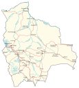
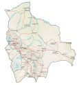
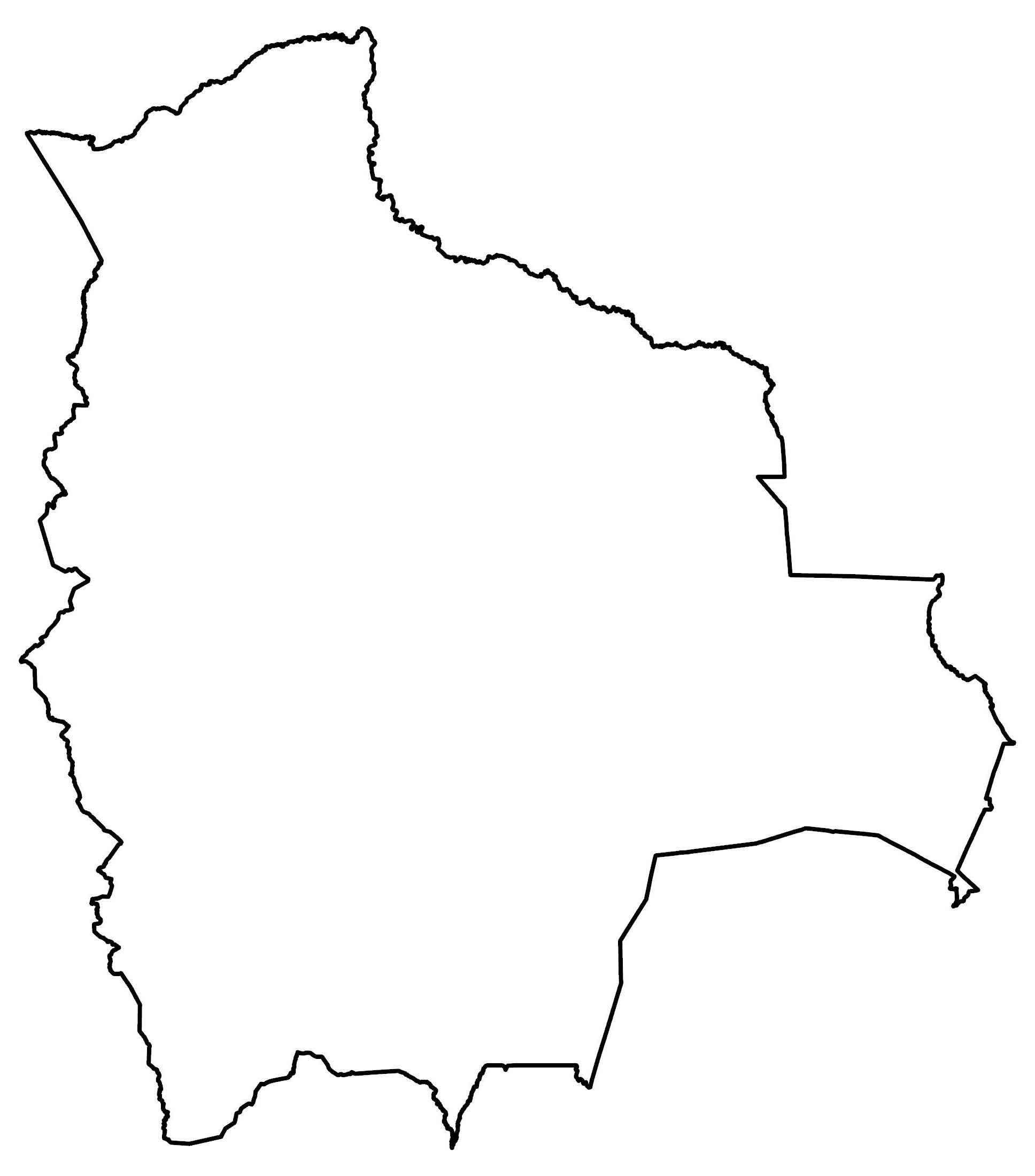
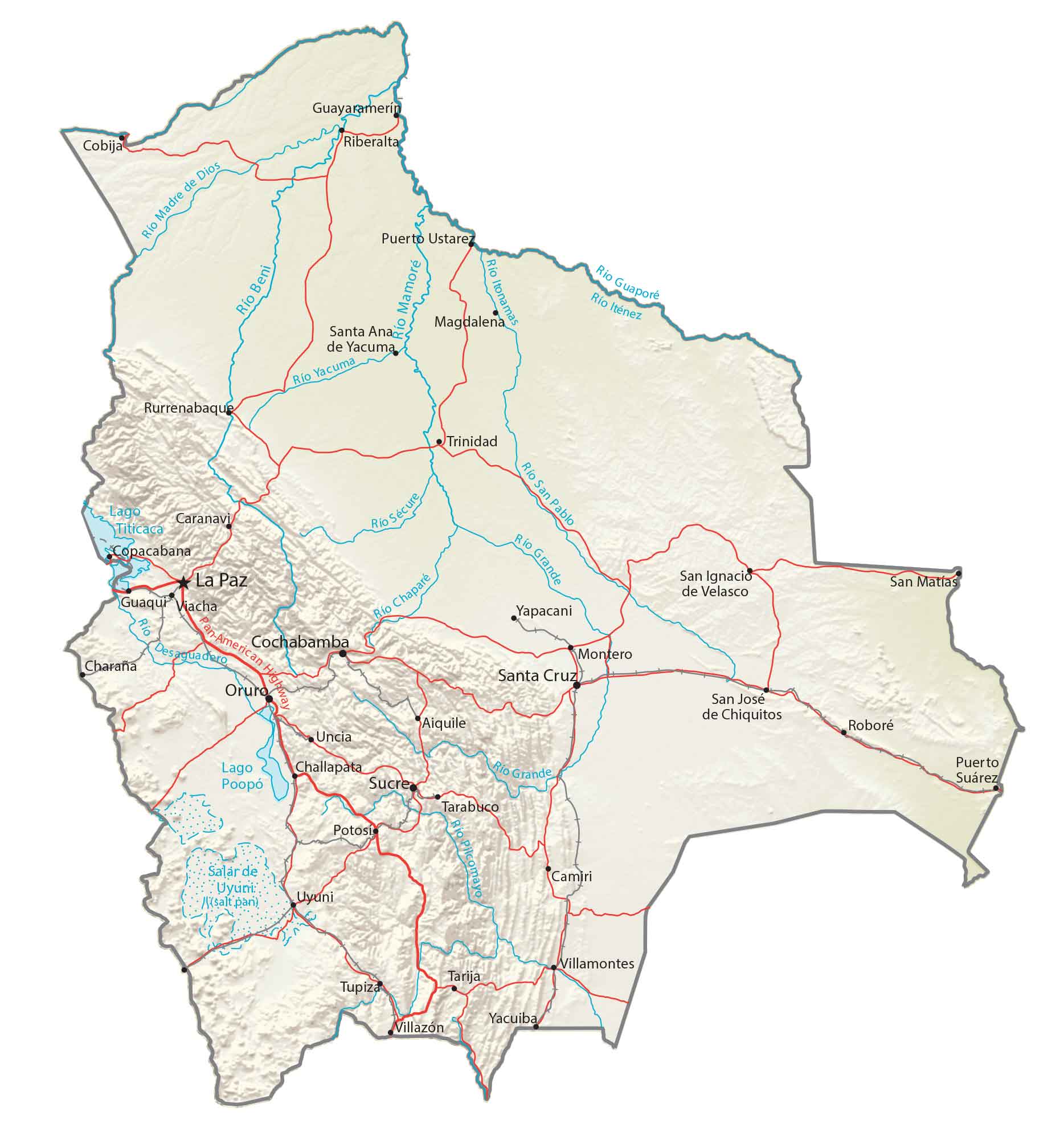
Map of Bolivia – Cities and Roads

This map of Bolivia shows its diverse terrain including the Andes, Altiplano Plateau, Atacama Desert, and Amazon Basin Rainforest. It includes cities, towns, roads, lakes, rivers, and administrative units.
You are free to use our Bolivia map for educational and commercial uses. Attribution is required. How to attribute?
About the map
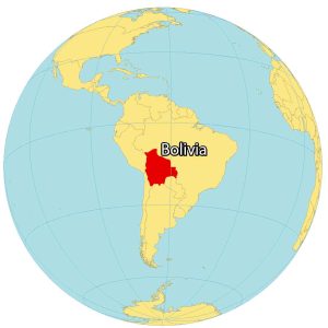
Bolivia is a landlocked country in central South America. It borders 5 other countries including Peru to the northwest, Brazil to the northeast, Paraguay to the southeast, Argentina to the south, and Chile to the southwest.
Sucre is the constitutional capital of Bolivia. Whereas La Paz is the executive capital and the seat of government. The country, itself, is one of the highest and most isolated in South America with the presence of the Andes and Altiplano Plateau.
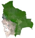
SATELLITE IMAGERY
Bolivia Satellite Map
Bolivia occupies a total area of 1,098,581 square kilometers (424,164 sq mi), which is slightly smaller than Colombia. Its largest lake is Lake Titicaca on the western border of Bolivia, shared with Peru. This is considered the highest navigable lake in the world and is situated 3,800 meters above sea level.
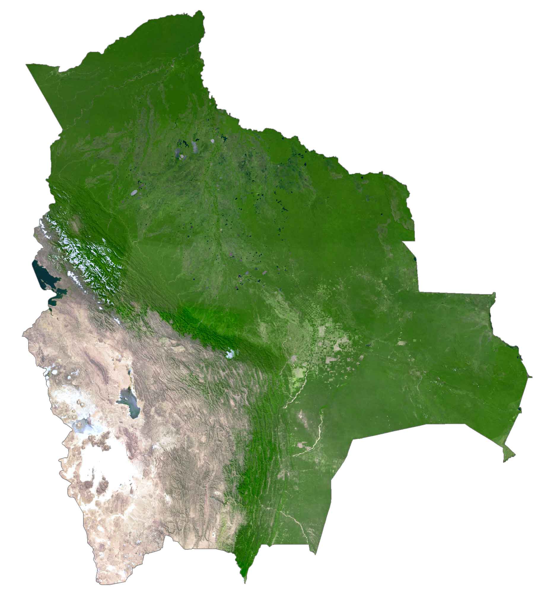
The Bolivian landmass lies on a range of terrain like the Andes Mountains to the west, the Atacama Desert, and the Amazon Basin Rainforest to the east. According to the FAO, forests cover over 50% of Bolivia.
PHYSICAL MAP
Bolivia Physical Map
The country of Bolivia is a mix of different types of terrain. For example, the lowland plains are part of the Amazon Basin in the east. Then, the Andes Mountains occupy the southwest of Bolivia. This is accompanied by the Altiplano Plateau, which is where the Andes are their widest.
Its highest point is an extinct volcano, Nevado Sajama, reaching a height of 6,542 meters (21,463 ft). Nevado Sajama’s majestic peak is not only Bolivia’s highest point but also a symbol of the country’s stunning Andean landscapes and geological history.
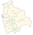
POLITICAL MAP
Bolivia Departments Map
There are 9 departments in Bolivia. From largest to smallest, they include Santa Cruz, Beni, La Paz, Potosí, Pando, Cochabamba, Oruro, Chuquisaca, and Tarija.
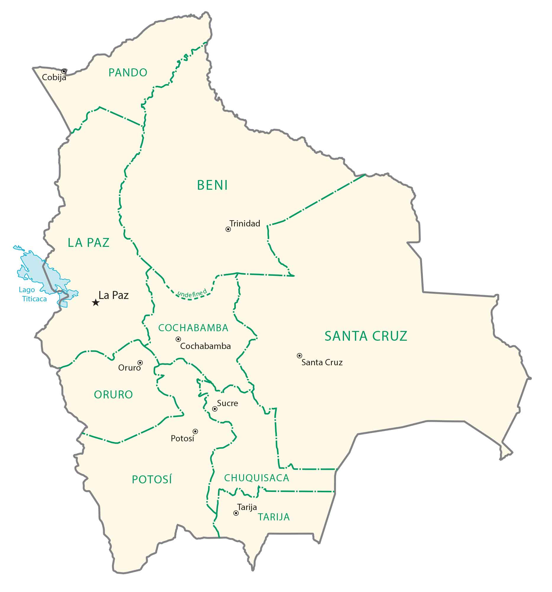
After departments, Bolivia divides its administrative units into provinces, municipalities, and cantons (which are the smallest administrative units in the country).
Capital City
La Paz
Major cities and towns
Santa Cruz de la Sierra
Cochabamba
Sucre
Oruro
Tarija
Potosi
Montero
Trinidad
Yacuiba
Riberalta
Cities and towns
Cobija
Guayaramerín
Puerto Ustarez
Rurrenabaque
Santa Ana de Yacuma
Caranavi
Copacabana
Magdalena
Guaqui
Viacha
Charana
Yapacani
Santa Cruz
Aiquile
Uncia
Challapata
Tarabuco
Camiri
Tupiza
Villazon
Villamontes
San Ignacio de Velasco
San Matías
San Jose de Chiquitos
Robore
Puerto Suarez
Lakes, rivers and creeks
Madre de Dic River
Beni River
Guapore River
Itenez River
San Pablo River
Rio Grande
Yacuma River
Secure River
Itonamas River
Pilcomayo River
Lake Titicaca
Mamore River
Lake Ροορo
Chapare River
Uyuni Salt Flat
Other features
Pan-American Highway