5 Types of Network Analysis in GIS
Geometric networks in GIS enable connectivity between lines on a map, supporting network analysis by establishing a linear flow and routing.

Geometric networks in GIS enable connectivity between lines on a map, supporting network analysis by establishing a linear flow and routing.
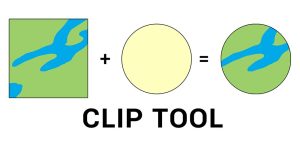
The clip tool cuts out an input layer to a defined feature boundary. Like a cookie-cutter, the output is a new clipped data output and subset.

Spatial analysis solves location problems using math in maps. It blends geography with modern technology to better understand our world.
Full motion video ties your videos with maps. As you play a video, it doesn’t just show a moving point. It shows the whole video footprint on the map.

Indoor mapping specializes in mapping building floor plans. It can incorporate Revit, BIM, and CAD, and build floor plans from buildings.
Everyone’s looking for the “easy button”. If you want to know how to make a map using GIS for free, I have your “easy button”. using QGIS and Natural Earth.
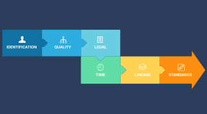
Metadata is like an instruction manual for data. It describes who, what, when, where and why for data. At the same time, it has to be detailed & dependable.
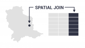
The spatial join tool inserts the columns from one feature table to another based on location or proximity. It can affix one or many fields to the target.
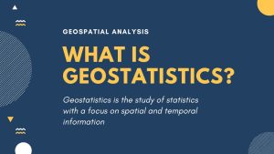
Geostatistics is the study of statistics with a focus on finding patterns of geographic phenomena using variograms, kriging and validation.

The Internet of Things (IoT) connects billions of sensors from around the world, enabling the exchange of information between them.