Map of Barbados
A Barbados map with cities, towns, highways, elevation, and administrative units. Barbados is a single island located in the Caribbean Sea.
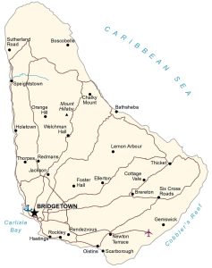
A Barbados map with cities, towns, highways, elevation, and administrative units. Barbados is a single island located in the Caribbean Sea.
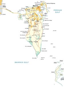
A Bahrain map showing cities, towns, highways, elevation, and administrative units – Bahrain is an island located in the Persian Gulf.
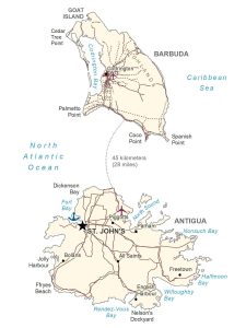
This Antigua and Barbuda map displays towns, populated places, roads, elevation, parishes, and administrative units of its two main islands.
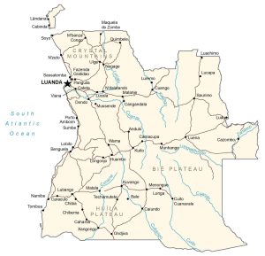
This Angola map contains cities, towns, roads, satellite imagery, and elevation. Angola is located on the west coast in the south of Africa.
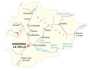
This Andorra map shows towns, villages, hamlets, roads, parks, and peaks – Andorra is an incredibly small state between Spain and France.
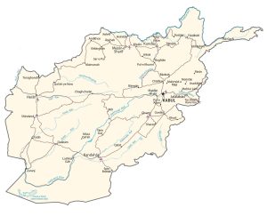
This Afghanistan map displays major cities, towns, roads, rivers, administrative units, physical geography like the Hindu Kush mountain range.
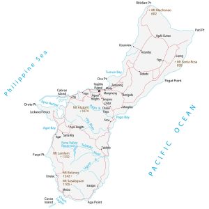
This Guam map shows cities, towns, roads, lakes, rivers, and peaks for the island territory of the United States (located in Micronesia).
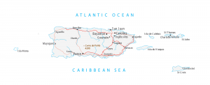
A Puerto Rico map with cities, roads, municipalities, and major landmarks – Puerto Rico is an unincorporated territory of the United States.
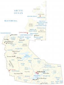
A Northwest Territories map – One of the three territories in Canada located between Nunavut and the Yukon territories in the north.
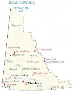
A Yukon Map displaying the territory in Canada known for its high plateaus and rugged mountains like Mount Logan at 5,959 meters.