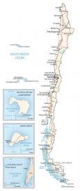
Map of Chile and Satellite Imagery

This Chile map contains major cities, towns, roads, lakes, and rivers. It includes key features such as the Andes Mountains in a physical map, satellite imagery, and region maps.

You are free to use our Chile map for educational and commercial uses. Attribution is required. How to attribute?
About the map
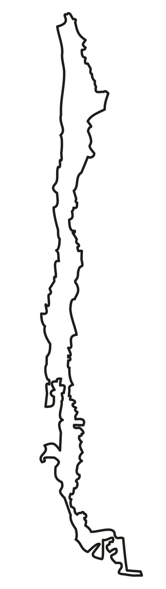
Chile is the longest north-south shaped country in the world, stretching for a total of 39 degrees latitude. If you measure its length from north to south, Chile is 4,620 kilometers long.
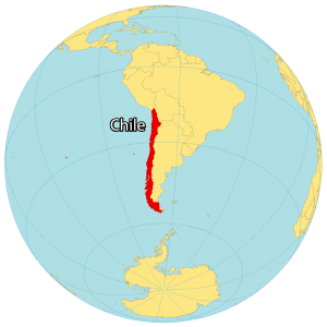
The country includes several islands in the South Pacific Ocean including San Félix, San Ambrosio, Salas y Gómez, Robinson Crusoe, and of course Easter Island. Santiago is Chile’s capital and largest city.
In addition, it’s also the southernmost mainland country in the world. Overall, Chile occupies most of the west coast of South America. It borders just 3 countries in South America including Argentina to the east, Bolivia to the northeast, and Peru to the north.
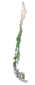
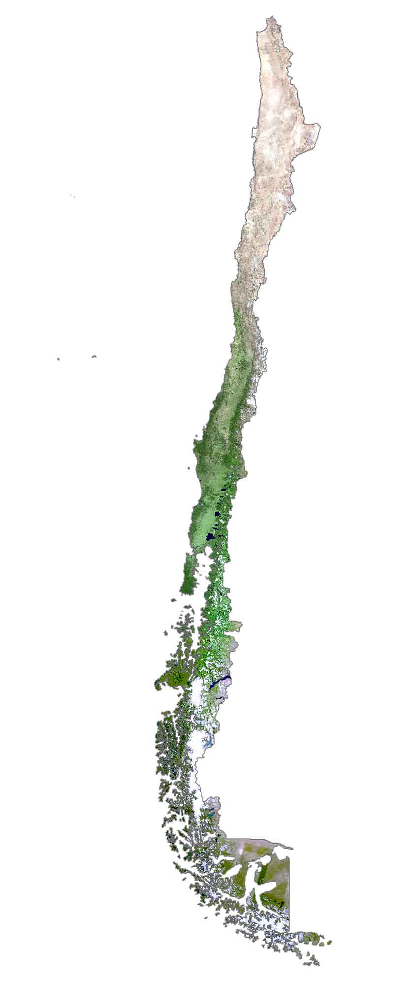
SATELLITE IMAGERY
Chile Satellite Map
Because of the long and narrow shape of Chile, it spans several different climatic zones and landscapes. First, the driest desert in the world, the Atacama Desert, lies in the north of Chile. As it transitions to the south, the climate becomes more Mediterranean and humid subtropical at Easter Island.
Then, the southern region is more characterized by the Chilean Patagonia, an area influenced by the Andes Mountains, lakes, fjords, glaciers, deserts, and steppes. Some of Chile’s longest rivers include the Loa, Bíobío, and Cachapoal. Additionally, it’s the only country where you can find penguins outside of Antarctica on the Seno Otway.
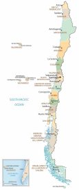
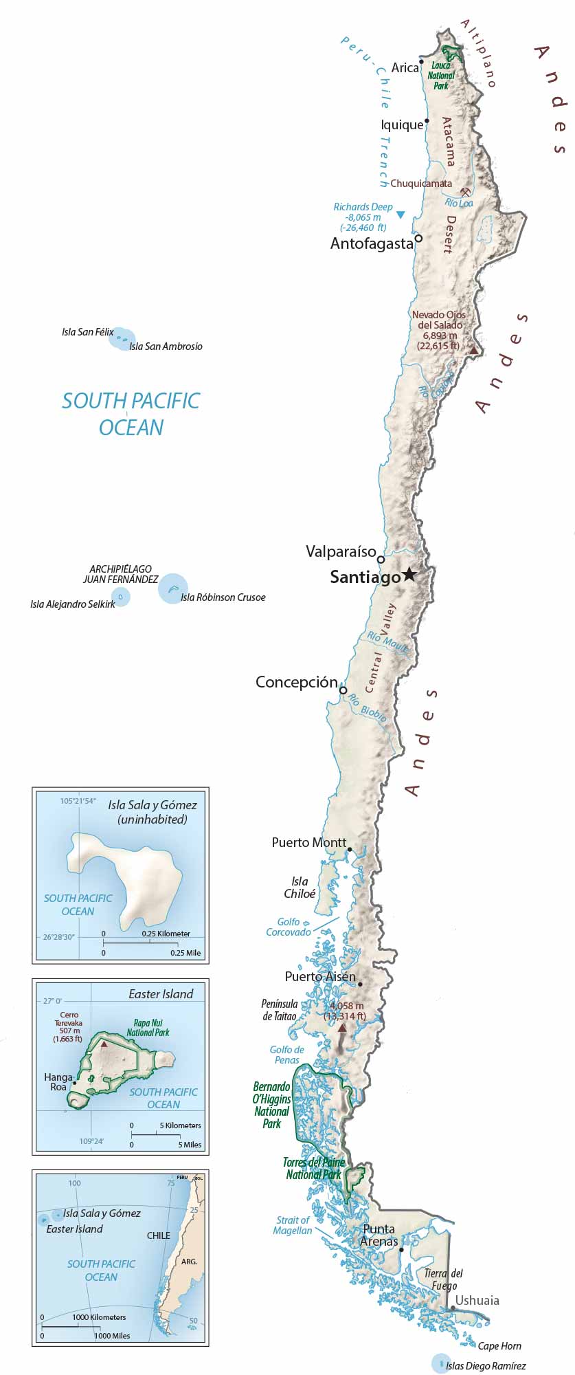
PHYSICAL MAP
Chile Physical Map
The Andes runs along the eastern side of Chile and is among one of the world’s longest mountain ranges. It forms most of its border with Argentina to the east. Because of its active plate tectonics, the country experiences severe earthquakes, volcanoes, and tsunamis.
In fact, the largest recorded earthquake in history, the Valdivia Earthquake, occurred in Chile with a magnitude of 9.5. At 6,893 m (22,615 ft), Nevado Ojos del Salado is the highest peak in Chile. As part of the Andes Mountains, it’s also an active stratovolcano and the second-highest mountain in both the Western Hemisphere and the Southern Hemisphere.
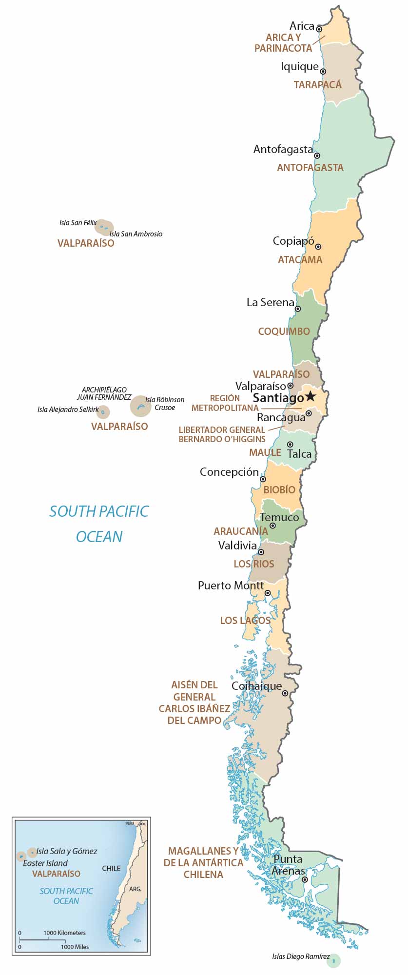
POLITICAL MAP
Chile Regions Map
Chile contains 16 regions, which are distributed north to south in the country. Next, regions are divided into provinces and then communes. While regions are the first level of administrative divisions, communes are the finest level. The metropolitan region of Santiago is the most populous of all regions in Chile.
Capital City
Santiago
Major cities
Antofagasta
Concepción
Iquique
La Serena
Valparaíso
Viña del Mar
Cities and towns
Arica
Calama
Caldera
Coihaique
Colchane
Constitución
Copiapó
Curicó
Huasco
Mejillones
Osorno
Ovalle
Puerto Aisén
Puerto Montt
Punta Arenas
Rancagua
San Antonio
San Vicente
Talca
Temuco
Tocopilla
Valdivia
Hanga Roa
Puerto Natales
Puerto Williams
Puerto Aisén
Lakes, rivers and water
Loa River
Maule River
South Pacific Ocean
Strait of Magellan
Biobío River
Gulf of Penas
Islands and archipelago
Easter Island
Alejandro Selkirk Island
Chiloé Island
Robinson Crusoe Island
Sala y Gómez Island
San Ambrosio Island
San Félix Island
Diego Ramírez Island
Juan Fernandez Archipielago
Tierra del Fuego Archipelago
Geographic regions
Andes Mountains
Atacama Desert
Altiplano Plateau
Central Valley
Cape Horn
National parks
Bernardo O’Higgins National Park
Torres del Paine National Park
Rapa Nui National Park
Administrative regions
Arica y Parinacota
Tarapacá
Antofagasta
Atacama
Coquimbo
Valparaíso
Región Metropolitana de Santiago
O’Higgins
Maule
Ñuble
Biobío
La Araucanía
Los Ríos
Los Lagos
Aysén
Magallanes y la Antártica Chilena