Global Mapper Software by Blue Marble (Review)
Today, we tested out the 64-bit GIS software package Global Mapper by Blue Marble. To say the least, we were pleased with what we saw.
From robust LiDAR processing to its versatility and interoperability, Global Mapper is a refreshing option at a low cost. Here’s exactly what we liked and disliked about it.
Pros/Cons of Global Mapper
Here are some of the advantages and disadvantages of using Global Mapper compared to other GIS software applications.
PROS
CONS
Global Mapper Ratings
Mapping
Analysis
Editing
Data Support
Ranked #7 from 30 GIS Software
Powerful LiDAR Processing and Rendering
First and foremost, LiDAR is a strong point in Blue Marble Global Mapper. Not only does it have a wide range of analysis tools for LiDAR data but its 2D/3D rendering is smooth and fluid.
Even after throwing 54 LAS files (over 5.4 GB of data) at Global Mapper, it handled LiDAR point cloud data with ease. In Global Mapper, you can easily move to a 3D view for a unique oblique perspective.
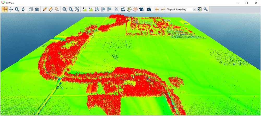
And of course, you can easily go back and forth from 3D to 2D.
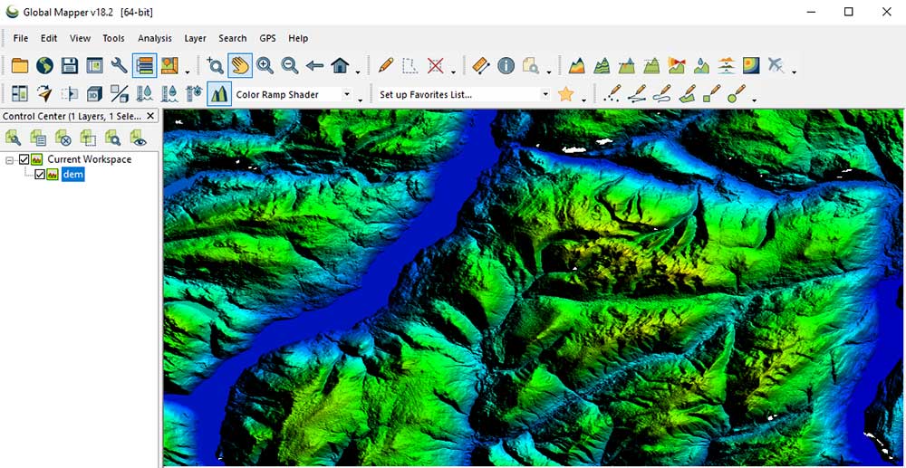
For example, here is Global Mapper in the top-down perspective that everyone is acquainted with:
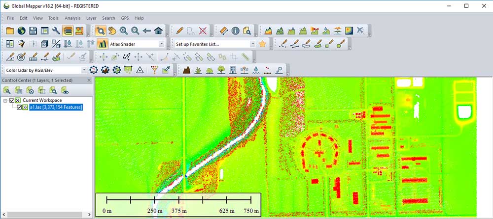
With the LiDAR Module, Global Mapper is everything you need and more. For example, it has advanced tools usually not found in other LiDAR processing software.
- Extracting vector feature automatically from point clouds
- Colorizing points by attribute including Normalized Difference Vegetation Index (NDVI)
- Quick reclassification tools for seven classification types
Robust Terrain Analysis Tools
When you add a Digital Elevation Model (DEM) to Global Mapper, you’ll again notice the raster loads fast polished with shaded relief. But you can also change this type of view type in the raster options if you’d like.
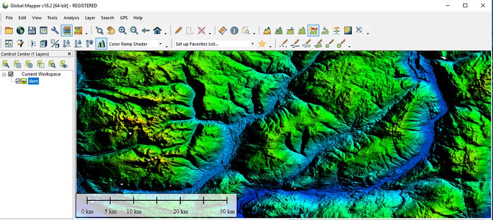
Again, it’s what you can do with elevation data that’s important.
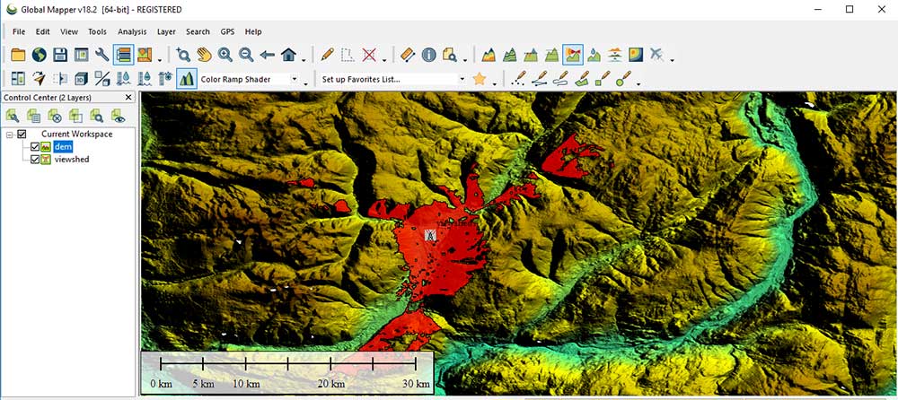
Along with its beautiful display, you have the necessary raster analysis tools you need to work with elevation data. In this example, here is a quick and easy tool that displays the viewshed in a mountainous area.
Further to this, you can perform more complicated volume calculations and terrain modifications. Alternatively, if you need a cross-section of the terrain, it’s a simple process.
Simply, draw a line on your terrain and click the path profile button. Finally, it will create a line of sight graphic that you can save as an image file.
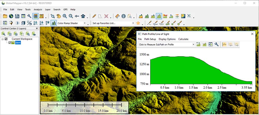
Also, you can export those XY coordinates and elevation values as a CSV if you want to work outside of Global Mapper. In addition, the spreadsheet has slope and distance values which is extremely useful for other GIS applications.
Thumbs Up for Versatility and Uniqueness
We also like Global Mapper for its versatility. Overall, it supports over 250 GIS file formats. Also, it has built-in support for WMS and free online data. This means that you have access to imagery, topography, and elevation for the entire world.
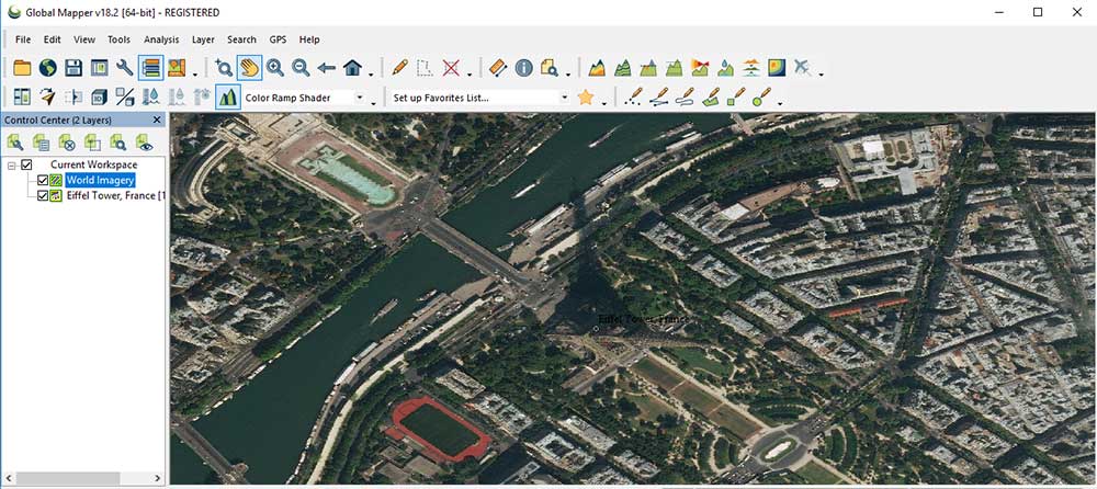
Global Mapper is designed to help you simply digitize features. In particular, we liked how you could enter an address in the geocoder. As part of the GPS tools, it would digitize that specific lat/long coordinate on that address. For example, here is the Eiffel Tower using the geocoder.
It’s integrated with a geographic calculator which is a tool for global coordinate transformations. If you need accurate and consistent coordinates, then this is the one calculator you need in a Global Mapper Workspace (GMW).
However, the use of the Geographic Calculator for coordinate management requires a license and is not included with the standalone installation.
What’s Next?
It’s easy to get started working with Blue Marble Global Mapper.
I felt that the interface is quick to get accustomed to. Overall, it’s very user-friendly with some powerful, intuitive applications.
Have you ever used Blue Marble Global Mapper?
Let us know what you think with a comment below.


I’m a new user of this app. How can I find a tutorial in a pdf file? I want to know more about the other feature of the Global Mapper. Thanks
Hello, I’d like to know your opinion about COAST extension of Global Mapper