Map of Iceland – Cities and Roads
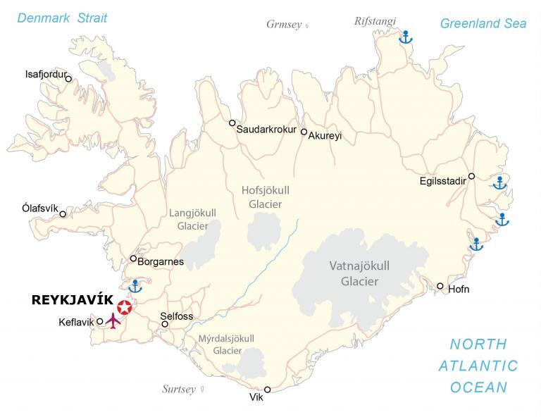
This map of Iceland shows its roads and cities that are mostly situated along its borders. It includes a satellite and topographic map of Iceland that shows its unique geological formations and landscapes.
Iceland map collection

You are free to use our Iceland map for educational and commercial uses. Attribution is required. How to attribute?
About the map
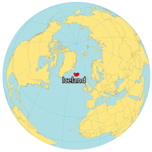
Iceland is a Nordic island country in the North Atlantic, with a population of around 370,000 and an area of 103,000 km2, making it one of Europe’s most sparsely populated countries. It’s situated just below the Arctic Circle and northwest of the United Kingdom.
Greenland is its closest neighboring island, which is a distance of about 300 kilometers away. Iceland is the westernmost European country with Reykjavik being the northernmost capital in the world.
The capital and largest city is Reykjavík, with Reykjavík and the surrounding areas in the southwest of the country being home to over two-thirds of the population. Iceland is volcanically and geologically active. The interior consists of a plateau characterized by lava fields, mountains, and glaciers, while many glacial rivers flow to the sea through the lowlands.
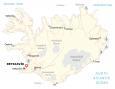
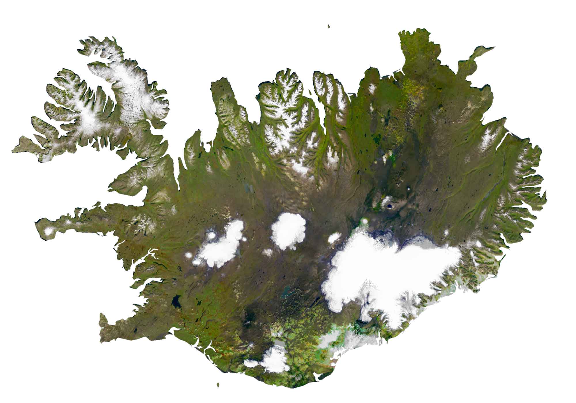
SATELLITE IMAGERY
Iceland Satellite Map
Iceland is known for having more glaciers than all of continental Europe combined. They stand out clearly in white. For example, Vatnajökull, Hofsjökull, Langjökull, and Mýrdalsjökull Glacier are the largest in Iceland.
The country is geologically unique with approximately 130 active and inactive volcanoes in all parts of the country. Despite being located at a high latitude, its climate is temperate because the Gulf Stream brings heat through its ocean currents.
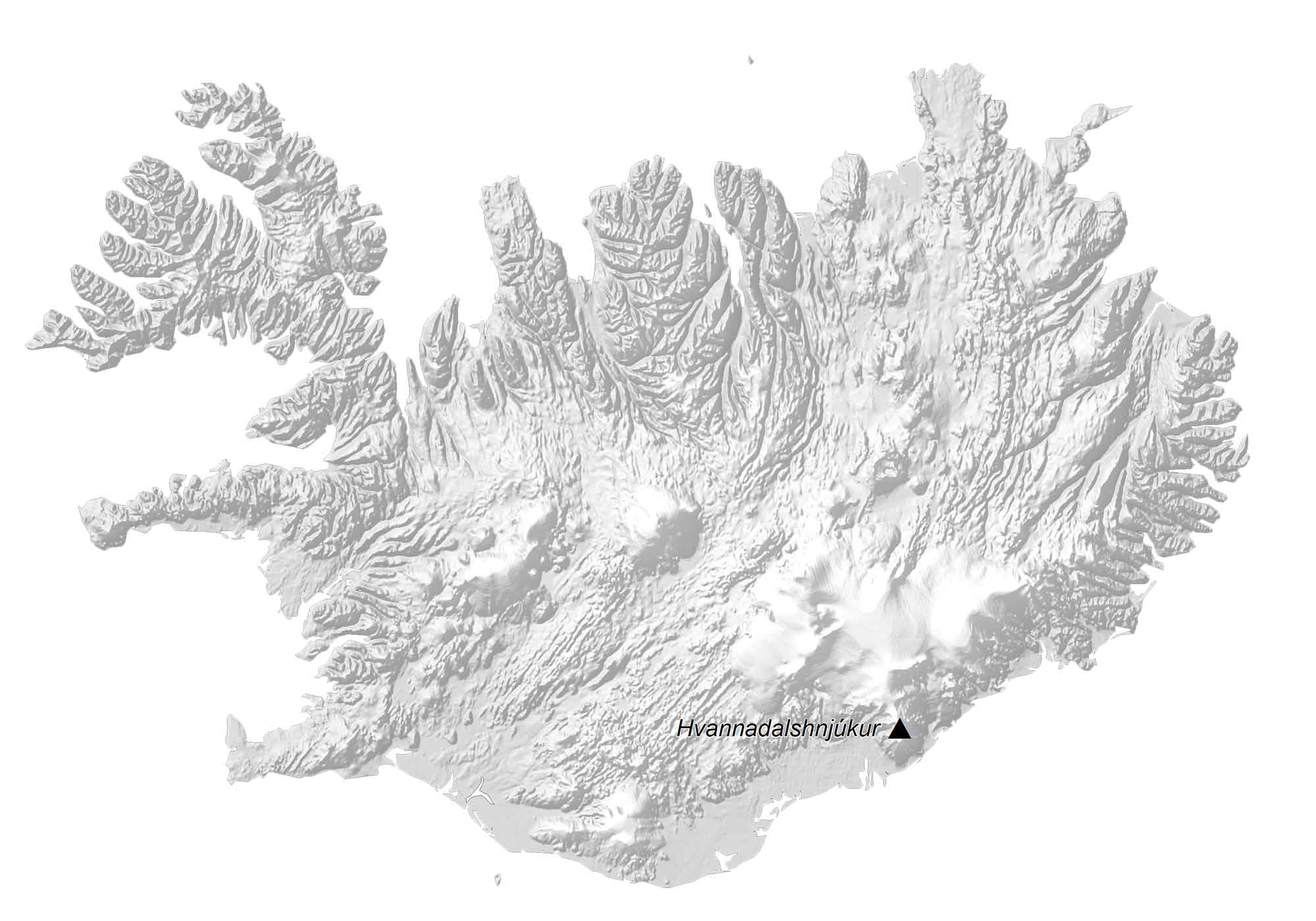
PHYSICAL MAP
Iceland Elevation Map
Iceland’s terrain is mostly plateau with a mix of mountain peaks, coastal bays, fjords, and ice fields. At 2,109.6 meters (6,921 ft) in height, Hvannadalshnjúkur is the highest point in Iceland.
This mountain peak is part of the ice-covered volcano Öræfajökull within Vatnajökull National Park. There are over 4000 named mountains in Iceland. Mount Esja is also a popular mountain for hiking because of its proximity to Reykjavik.
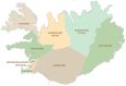
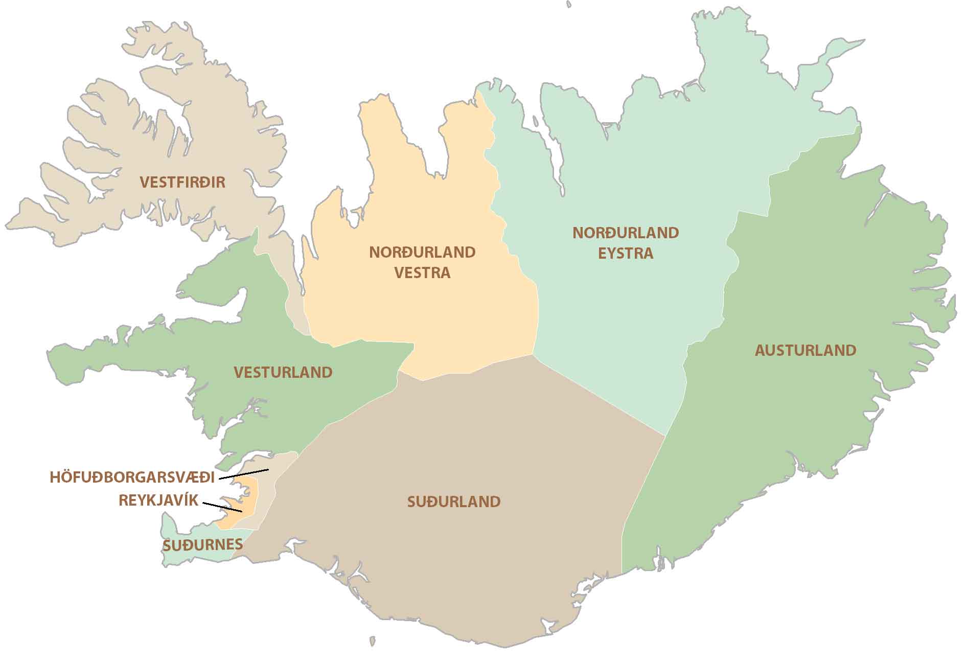
POLITICAL MAP
Iceland Regional Map
There are eight regions in Iceland, which are the first-level administration unit. Next, regions are further broken down into municipalities, the second-level administration unit. Regions are mainly for statistical purposes and health.
But they also roughly follow postal code divisions with the first digit corresponding to a region in Iceland. The right regions in Iceland are the Capital Region, Southern Peninsula, West, Westfjords, Northwest, Northeast, East, and South.
Capital City
Reykjavík
Cities, towns and villages
Akureyi
Borgarnes
Egilsstadir
Hofn
Isafjorduro
Keflavik
Ólafsvík
Saudarkrokur
Selfoss
Vik
Glaciers and water features
Hofsjökull Glacier
Langjökull Glacier
Mýrdalsjökull Glacier
Vatnajökull Glacier
Denmark Strait
Greenland Sea
North Atlantic Ocean
Islands and peninsulas
Grmsey
Rifstangi
Surtsey


Can you make a map of Iceland’s municipalities