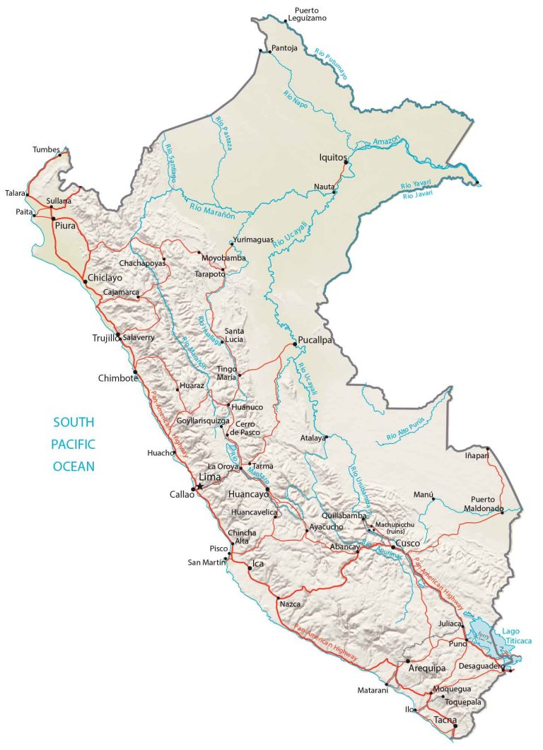
Map of Peru
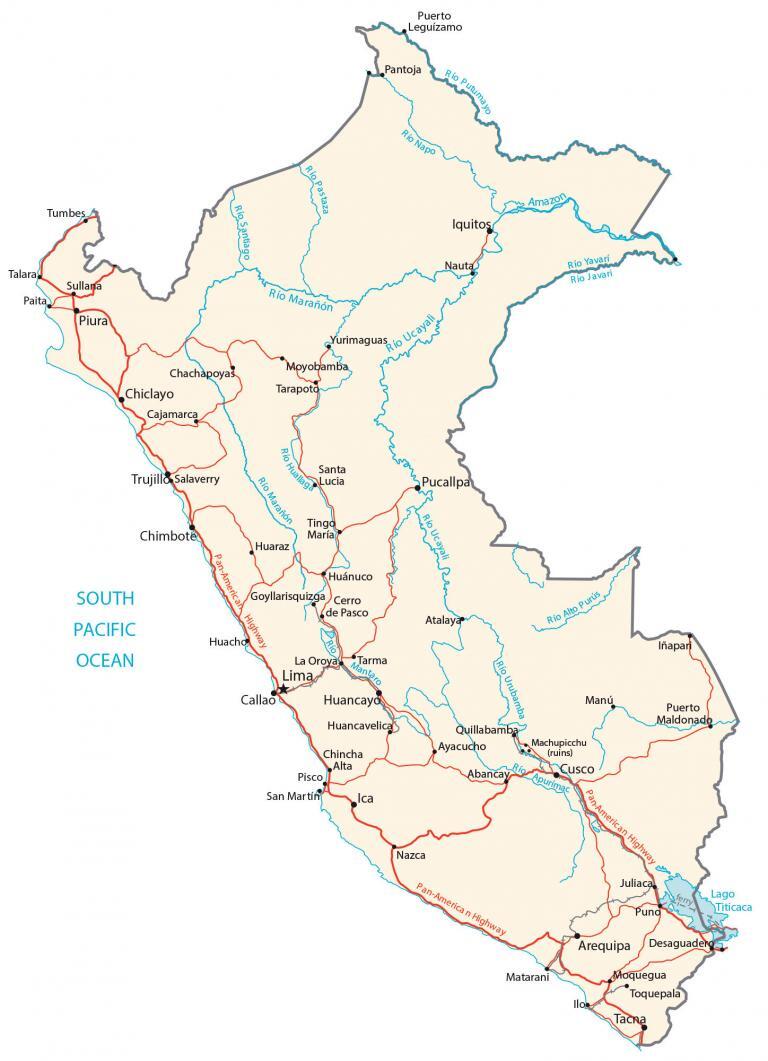
This map of Peru displays major cities, towns, roads, and rivers. It includes everything from the Andes Mountains to the Amazon Rainforest in an elevation map and satellite imagery.
Peru map collection
You are free to use our Peru map for educational and commercial uses. Attribution is required. How to attribute?
About the map
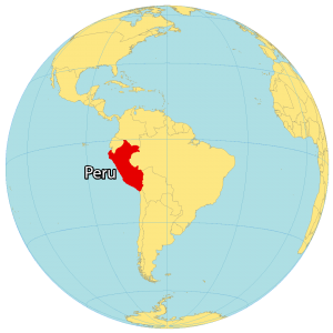
Peru is located in the west of South America. It borders 5 countries including Ecuador to the north, Colombia to the northeast, Brazil to the east, Bolivia to the southeast, and Chile to the south. Additionally, it has a coastline of 2,414 km (1,500 mi) along the South Pacific Ocean.
It’s mostly known for Machu Picchu, the Andes mountains, and the Amazon rainforest. But it was also the administrative, political and military center of the Incan Empire. Lima is the capital and the largest city of Peru. Other major cities are Arequipa, Trujillo, and Chiclayo.
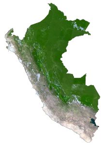
SATELLITE IMAGERY
Peru Satellite Map
There are three types of dominant landscapes in Peru. First, the Sechura Desert is an arid coastal area in northwest Peru. Secondly, the mountainous Sierra and Andes span the center of Peru, which is also home to the UNESCO World Heritage site of Machu Picchu. Finally, the lowland jungle and tropical rainforests of the Amazon Basin lie in the east of Peru.

Another prominent feature is Lake Titicaca along its border with Bolivia. This is the world’s highest navigable lake and is one of South America’s largest lakes. Some of its most important rivers are the Amazon, Purus, Jurua, and Marañón Rivers. But the longest river that is entirely within Peru is the Ucayali River.
PHYSICAL MAP
Peru Physical Map
One of the dominant features in Peru is the highland region along the central-west coast of the country. This mountain chain is the Andes Mountains, which extend along the entire west coast of the South American continent.
At 6,768 meters (22,205 ft), Nevado Huascaran is Peru’s highest peak. Whereas its lowest point is Bayóvar Depression at −34 meters (−112 ft) below sea level. Otherwise, the lowland jungle and tropical rainforests of the Amazon Basin lie to the east of Peru and the low coastal region to the west.
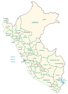
POLITICAL MAP
Peru Regions Map
Regions/departments are the first-level administrative units in Peru, which are divided geographically and administratively. Currently, there are 25 regions in Peru. Additionally, there is one province, which is similar to its regions.

Regions or departments in Peru are divided into provinces, which are the second-level administrative units. Finally, provinces are subdivided into districts, which are the finest level of administration.
Capital City
Lima
Major cities and towns
Arequipa
Ayacucho
Cajamarca
Callao
Chiclayo
Chimbote
Chincha Alta
Cusco
Huancayo
Huánuco
Ica
Iquitos
Juliaca
Piura
Pucallpa
Sullana
Tacna
Trujillo
Cities, towns and villages
Abancay
Atalaya
Cerro de Pasco
Chachapoyas
Desaguadero
Goyllarisquizga
Huacho
Huancavelica
Huaraz
Ilo
Iñapari
La Oroya
Manú
Matarani
Moquegua
Moyobamba
Nauta
Nazca
Paita
Pantoja
Pisco
Puerto Leguizamo
Puerto Maldonado
Puno
Quillabamba
Salaverry
San Martím
Santa Lucia
Talara
Tarapoto
Tarma
Tingo María
Toquepala
Tumbes
Yurimaguas
Lakes, rivers and water features
Alto Purús River
Amazon River
Apurimac River
Huallaga River
Javari River
Lake Titicaca
Mantaro River
Marañón River
Napo River
Pastaza River
Putumayo River
Santiago River
South Pacific Ocean
Ucayali River
Urubamba River
Yavarí River
Other features
Machupicchu
Pan-America Highway