Scandinavia Map Collection
Are you looking for a map of Scandinavia? We offer you 5 free maps of this region. Each highlights different aspects of its geography.
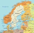
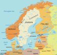
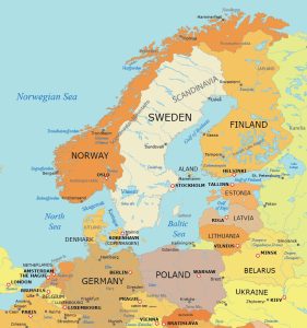
Our Scandinavia map shows this region in Northern Europe. Notably, it comprises Norway, Sweden, and Denmark.
You are free to use our maps of Scandinavia for educational and commercial uses. Attribution is required. How to attribute?
Detailed Map of Scandinavia
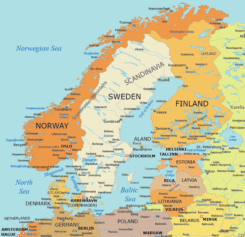
Our detailed map includes the populated places in the Scandinavia region. You can find cities, towns, and villages to give a complete geographical perspective.
In addition to urban areas, you’ll be able to view lakes, rivers, bays, and other water features. This detailed map is a great resource looking to explore the Scandinavian region.
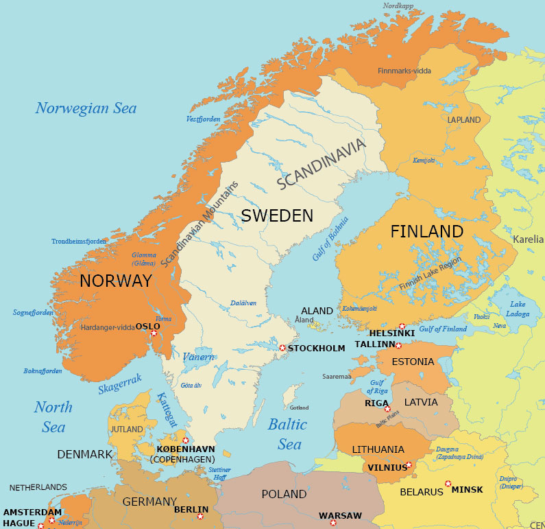
Simple Map of Scandinavia
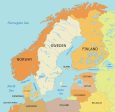
Our simple map of Scandinavia is designed to provide a clear and straightforward overview of this Northern European region. This map is ideal for those seeking a basic understanding of Scandinavia’s geography.
It includes its key countries – Norway, Sweden, and Denmark. You’ll find major cities, significant towns, and important geographical features as a starting point to explore its geopolitical landscapes.

Physical Map of Scandinavia
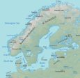
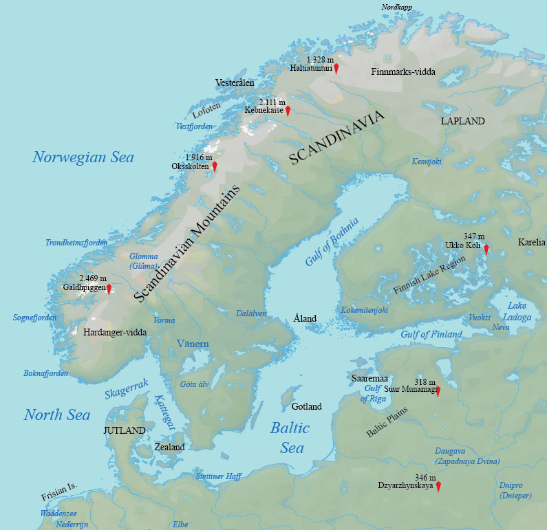
Introducing our physical Map of Scandinavia. This map highlights the physical features of Norway, Sweden, and Denmark. Download for free.
From the majestic fjords and mountains of Norway to the numerous lakes of Sweden, and the gentle rolling hills of Denmark, it is an essential visual for understanding the topographical diversity of Scandinavia.
Administration Map of Scandinavia
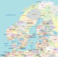
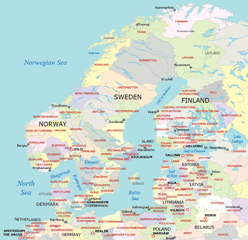
Our administrative map of Scandinavia is an outstanding resource for understanding the political and administrative divisions of this region.
This map details the boundaries of Norway, Sweden, and Denmark. It delineates each country’s counties, municipalities, and major cities.
Scandinavia Map with Capital Cities
This map is designed to showcase the countries of Norway, Sweden, and Denmark, along with their major cities and key urban centers.
It provides a clear depiction of the geographical boundaries and urban layout of each country in this remarkable Northern European region.
Atlas of Scandinavia
Are you looking for political, satellite, and elevation maps of each country in Scandinavia? Our world atlas contains a collection of high-quality, printable maps that cover every aspect of Scandinavia’s geography.
First, the political maps provide clear boundaries and locations of cities and towns, while the satellite maps offer a bird’s-eye view of the landscape. Finally, the elevation maps are particularly useful for understanding the topography of the region, highlighting mountains, valleys, and plains.


Countries in Scandinavia
This table defines the countries that are part of Scandinavia. It also describes the geographic location of each country.
| Country Name | Description of Geography |
|---|---|
| Sweden | Sweden features vast forests, numerous lakes, and a long Baltic Sea coastline. Its terrain includes flat to rolling lowlands and high mountains in the west. |
| Denmark | Denmark consists of a peninsula, Jutland, and an archipelago of 443 named islands. Its terrain is predominantly flat with sandy coasts and arable land. |
| Norway | Norway is characterized by its extensive coastline along the North Atlantic Ocean, fjords, and mountainous terrain. It also hosts part of the Scandinavian Mountains. |
Do you have any maps that you want to see in our Scandinavia map collection? We’d love to hear from you! Drop us a comment below, and we’ll do our best to take action to your request.
Maps of Regions of the World
Explore the regions of the globe with our map collection. It features a selection of detailed maps showcasing diverse geographical terrains, cultural regions, and political borders.