Map Collection of the Middle East
We bring to you five maps in our Middle East map collection. Click on the map below to get more details.

Each map in this collection provides its own perspective. This includes various key features across the diverse region. Download them for free.
You are free to use our Middle East maps for educational and commercial uses. Attribution is required. How to attribute?
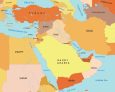
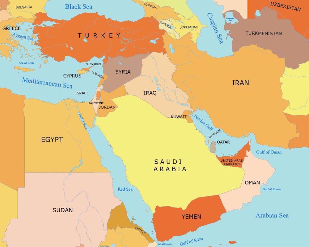
Middle East Map with Countries
The map below shows a simple map of the Middle East with countries labeled. You’ll also find major water bodies like the Mediterranean Sea, Red Sea, and the Persian Gulf. This can be a useful reference for geography.
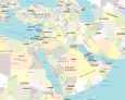
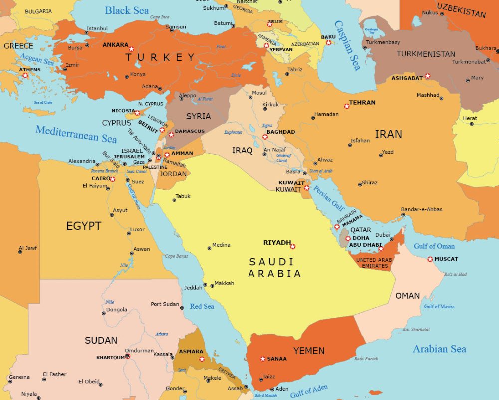
Detailed Middle East Map
Our detailed map of the Middle East gives you a deeper perspective of this geographic region. You’ll find key features across this diverse area such as country borders, seas, gulfs, and populated places.
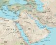
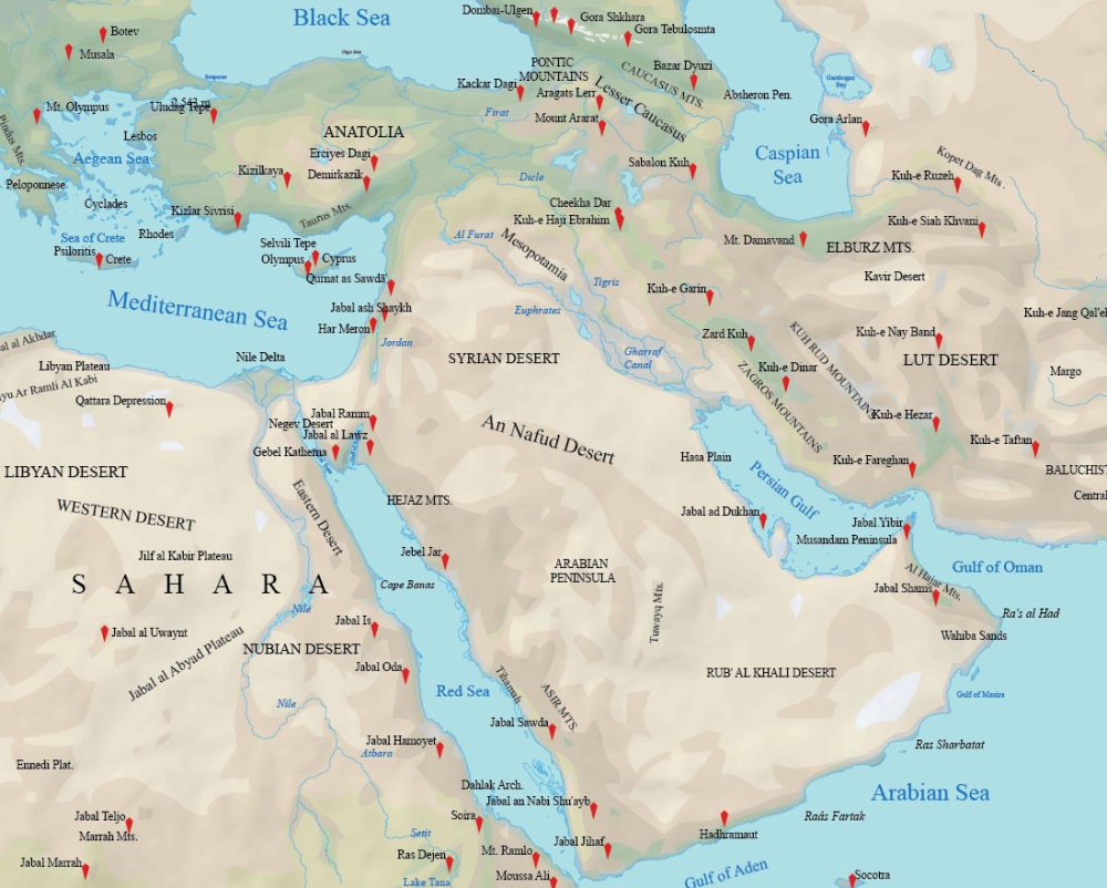
Physical Map of the Middle East
This physical map provides a perspective of the geographical features that shape this dynamic part of the world. From the arid deserts to the rugged mountain ranges, explore the physical area of this land. Step into the Middle East’s unique geography with this map.
Administration Map of the Middle East
Our administration map of the Middle East visually shows the political and administrative boundaries of countries in the region. You’ll find this map as a useful representation for understanding the geopolitical layout of Middle Eastern countries.

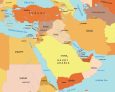
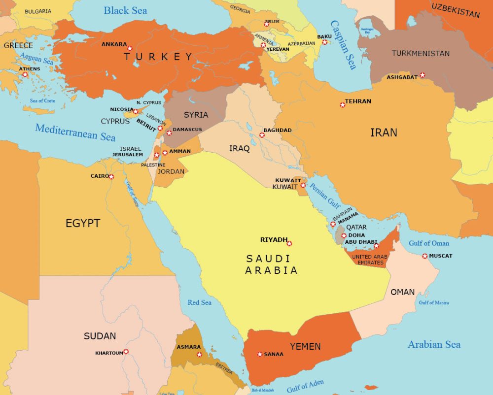
Middle East Map with Capital Cities
This Middle East map highlights the geographic locations of the capital cities within the Middle Eastern countries. It also includes details such as national borders, country names, and major seas/gulfs.
What Are the 17 Middle Eastern Countries?
The Middle East consists of these 17 UN-recognized countries.
| Country | Geographic Location |
|---|---|
| Bahrain | Persian Gulf, near Saudi Arabia |
| Cyprus | Eastern Mediterranean, south of Turkey |
| Egypt | Northeast Africa, Sinai Peninsula |
| Iran | Southwest Asia, between Iraq and Pakistan |
| Iraq | Middle East, bordered by Iran and Turkey |
| Israel | Arabian Peninsula, on the Mediterranean coast |
| Jordan | Middle East, bordering Saudi Arabia |
| Kuwait | Persian Gulf, between Saudi Arabia and Iraq |
| Lebanon | East Mediterranean, north of Israel |
| Oman | Arabian Peninsula, southeast coast |
| Palestine | Arabian Peninsula, between Israel and Jordan |
| Qatar | Persian Gulf, Saudi Arabia to west |
| Saudi Arabia | Arabian Peninsula, largest country |
| Syria | Middle East, north of Jordan |
| Turkey | Southeast Europe, southwest Asia |
| United Arab Emirates | Arabian Peninsula, southeast |
| Yemen | Arabian Peninsula, south of Saudi Arabia |
The Middle East also contains one British Overseas Territory, Akrotiri and Dhekelia.
Atlas of the Middle East
So far, we’ve provided you with reference maps of the entire region of the Middle East. But what about those looking for individual maps for each country?
Look no further. Below, we have detailed maps for all the 17 countries that belong to the Middle East. In alphabetical order, you’ll find political, satellite, terrain, and administration maps for each country.


Any chance of doing a map of the Arab world (22 countries, including more then Egypt in N. Africa)? It would be very useful! Thanks! And many thanks for all the work you’ve already done!
agreed they’re 2 separate rivers.
unless people know something for a FACT
it’s better we don’t say anything than repeat false info
They forgot the Tigris and Euphrates river.
The Tigris and the Euphrates are two separate rivers. Perhaps you should use Google first and then a general physical map of the area.
thanks 😊 from your information ℹ️ .
it’s help us 🙏 our knowledge.
Good map!!!!
I like the quality of the map. It’s high in resolution