Caribbean Map Collection (Printable)
This map of the Caribbean Islands is for anyone wanting a free, downloadable map of this region.

Our Caribbean map collection includes the following:
- Caribbean countries
- Capital cities
- Detailed map
- Physical map
- Administrative map
You are free to use our Caribbean map for educational and commercial uses. Attribution is required. How to attribute?
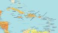
Caribbean Map with Countries
This map of the Caribbean Islands is for anyone wanting a free, downloadable map of this region. We allow you to download this map without any restrictions. Please feel free to use it for any purpose including commercially.
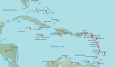
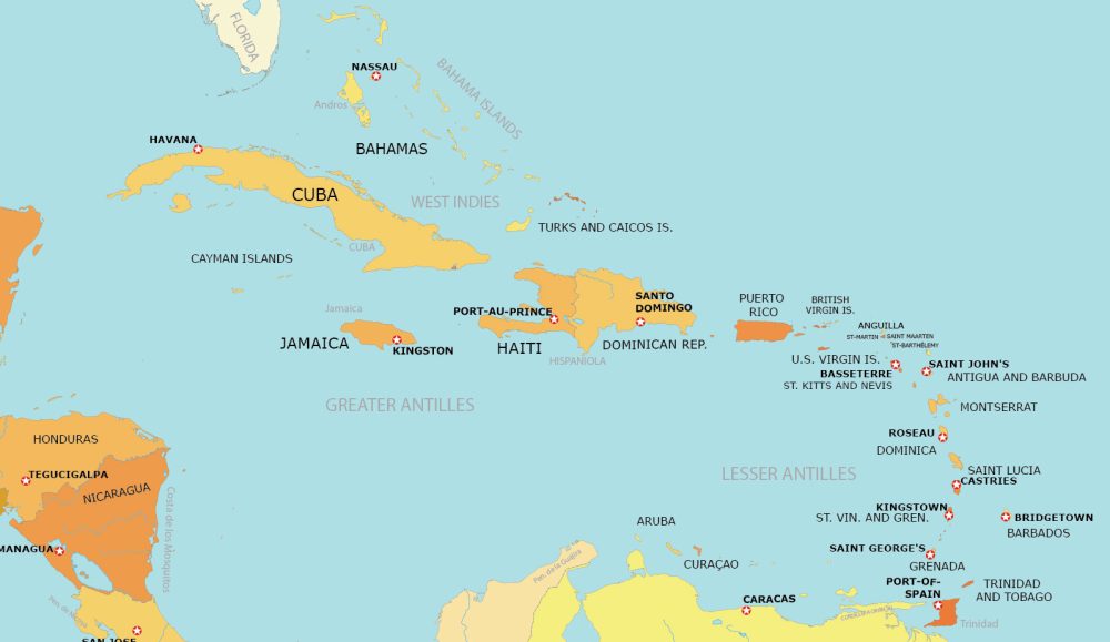
Caribbean Map with Countries and Capitals
The Caribbean Islands are located in the Caribbean Sea, which is a region of the Atlantic Ocean. They are southeast of the mainland of North America.
Use this map of the Caribbean to locate major cities and country outlines. Download the map below for any purpose. If you use this map, we encourage you to add a citation.
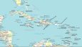
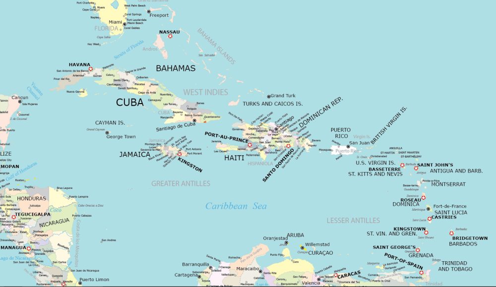
Detailed Map of the Caribbean
This detailed map of the Caribbean highlights its diverse geographical features and network of islands. It delineates the islands, cities, and coastal lines. Additionally, the map emphasizes political boundaries and major water features.

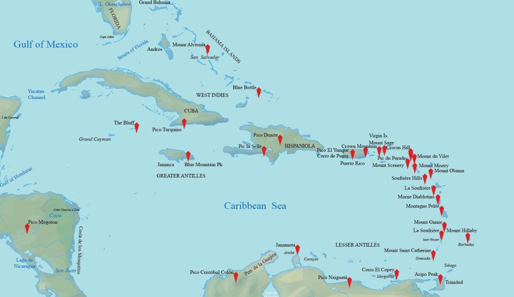
Physical Map of the Caribbean
Our physical map of the Caribbean displays topographic features with a focus on mountain peaks. It labels Pico Duarte, Pic la Selle, Blue Mountain Peak, and other mountain ranges.
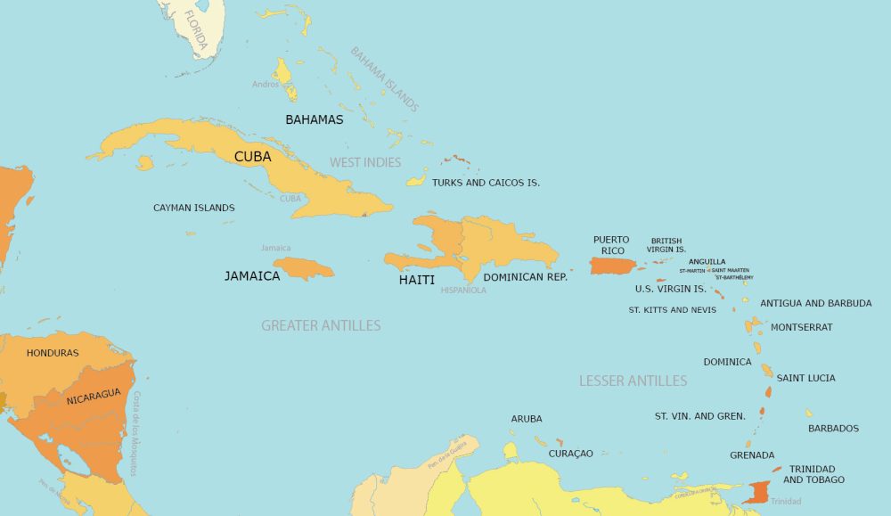
Administration Map of the Caribbean
This is an administration map showing major provinces in the Caribbean. You’ll find populated places and capital cities for all 13 countries. It also delineates regional divisions such as the West Indies, Greater Antilles, and Lesser Antilles.
What are the 13 countries of the Caribbean?
The table below defines the 13 countries that are part of the Caribbean. Each country is listed in alphabetical order.
| Country | Description |
|---|---|
| Antigua and Barbuda | Low-lying islands, coral and limestone, beaches |
| Bahamas | Archipelago of islands and cays, flat coral formations |
| Barbados | Relatively flat, surrounded by coral reefs |
| Cuba | Largest island with diverse landscapes, mountains in southeast |
| Dominican Republic | Varied terrain with mountains, valleys, and beaches |
| Grenada | Hilly, volcanic origin, lush rainforests |
| Haiti | Mountainous, with a tropical climate |
| Jamaica | Mountainous interior, beautiful beaches, tropical |
| Puerto Rico | Mountainous with coastal plains, tropical |
| Saint Kitts and Nevis | Two islands, volcanic with mountainous regions |
| Saint Lucia | Volcanic island, mountainous, famous Pitons |
| Saint Vincent and the Grenadines | Chain of islands, volcanic, lush vegetation |
| Trinidad and Tobago | Two main islands, diverse topography, beaches, hills |
The Caribbean Atlas
As part of our world atlas, we’ve created individual maps for each country. Click on any of the maps below for a more detailed map. Each map allows you to explore the physical and political features of each country.
Caribbean


So there you have it. We hope you enjoyed our Caribbean map collection. We’re always looking for suggestions to improve our atlas. Please let us know in the comment section for your ideas and suggestions.
Thank you much
Please do have a map with the indigenous names. It must high resolution as I want to print it on a long banner.
Hi Angela. Sorry but we don’t have one in that format