Leeward Islands Map Collection
This map presents the Leeward Islands, a chain of islands in the Caribbean Sea. Here, you will find five maps with different views of the Leeward Islands.

As you explore our Leeward Islands map collection, you’ll find key locations, landmarks, and islands that define their geographic extent. Download them for free.
You are free to use our maps of the Leeward Islands for educational and commercial uses. Attribution is required. How to attribute?
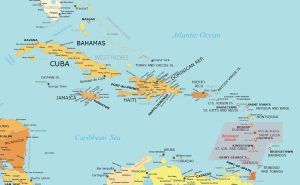
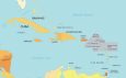
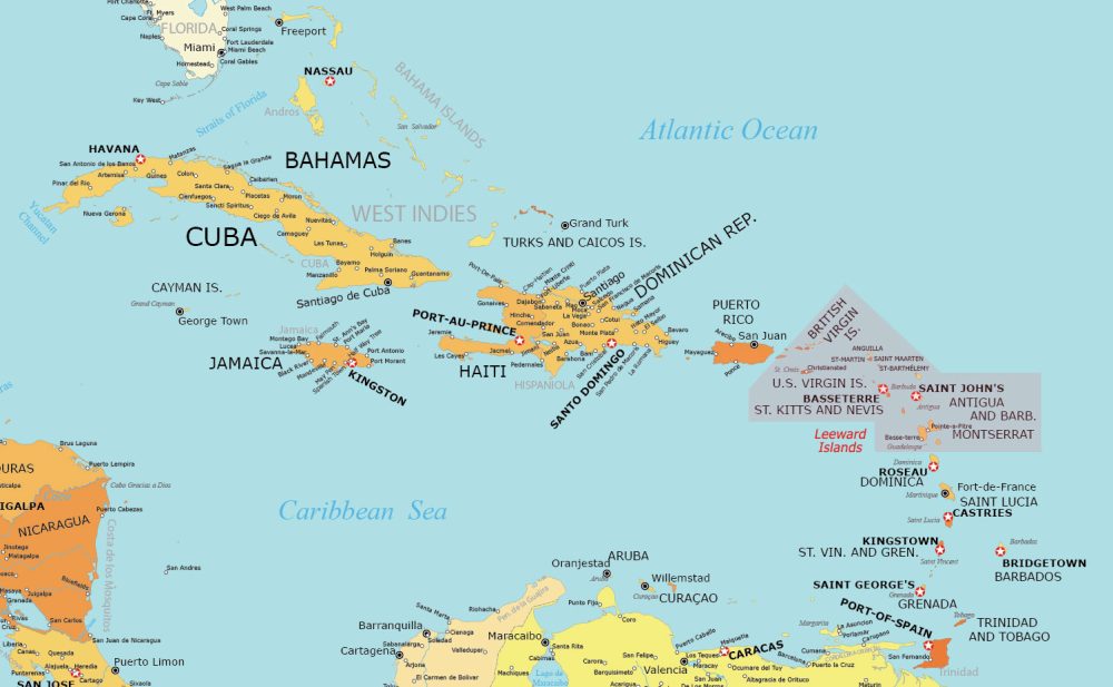
Leeward Islands Detailed Map
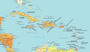
Our first map in this collection gives you the most detail. It clearly labels each island, like Antigua and Barbuda, Saint Kitts and Nevis, and others.
Our detailed map also marks the capital and major cities of each island. It’s perfect for getting the most information from a map.
Leeward Islands Simple Map
While our first map was filled with detail, our simple map is straightforward to the point. You simply get to see countries and islands with labels.
This map is perfect if you want to use it as a blank slate. Mark it up however you want because we allow you to use these maps for any purpose, even commercially.

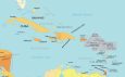
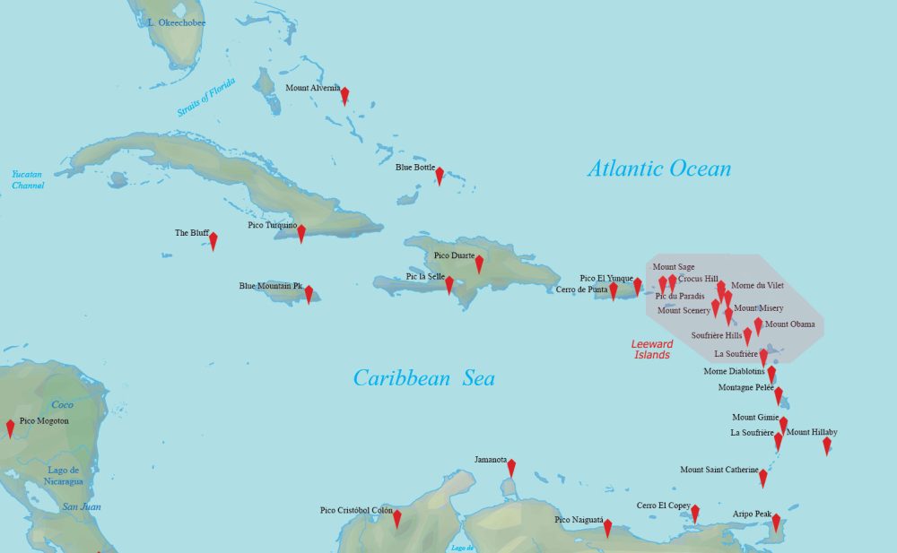
Physical Map of the Leeward Islands
Our physical map highlights the terrain and physical features. Similar to the other maps, the Leeward Islands are highlighted in pink.
Although it’s difficult to see because of the small size of the islands, you can see significant mountain peaks and their labels.
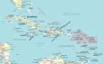
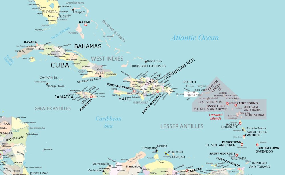
Administration Map of the Leeward Islands
Learn about the administrative units in the Caribbean Sea region. This map is busy with information, from island names to populated places.
You’ll find the capital of each island including Basseterre (St. Kitts and Nevis) and Saint John’s (Antigua and Barbuda).
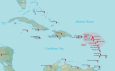
Leeward Islands Capitals Map
Finally, our last map displays the capital cities of all the countries that are part of the Leeward Islands.
This map provides an overview of the political centers. This way, you can better understand the administrative and cultural heart of each nation in the Leeward Islands.

Countries in the Leeward Islands
Why is it called the Leeward Islands anyhow? It all boils down to wind direction. The Leeward Islands are called that because they are located in the direction where the wind usually goes.
If the wind is blowing from east to west, these islands are on the “leeward” side, meaning they are more sheltered from the wind. So, these islands get less wind compared to the Windward Islands, which face the wind more directly.
| Country | Geography Description |
|---|---|
| Antigua and Barbuda | Twin-island nation known for reef-lined beaches, rainforests, and resorts. |
| Saint Kitts and Nevis | Two-island country in the West Indies, known for mountains and beaches. |
| Anguilla | British overseas territory with coral reefs and a rich cultural history. |
| Montserrat | Volcanic island known for its Soufrière Hills eruption and exclusion zone. |
| British Virgin Islands | Group of islands in the Caribbean, known for their reef-lined beaches and yachting. |
| U.S. Virgin Islands | Group of Caribbean islands, known for their white-sand beaches and coral reefs. |
Atlas of the Leeward Islands
Looking for individual maps for all the countries that are part of the Leeward Islands? This world atlas selects those islands that are specific to the Leeward Islands.
Each map often contains political, satellite, and elevation maps. Similar to the maps, most of them are free to use for any purpose.


Maps of Regions of the World
Interested in maps of different world regions? Our global map collection encompasses a range of types. To see these, click on any of the region maps of the world displayed below.