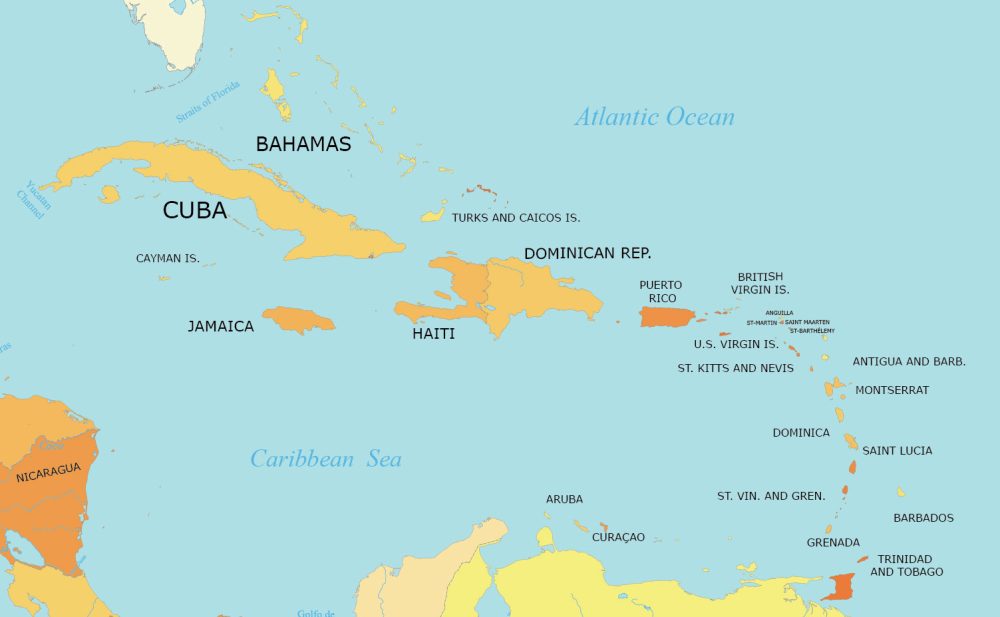
West Indies Map with Countries and Dependencies
Our West Indies map collection highlights the 13 countries and 18 dependencies for this group of islands in the Caribbean Sea.

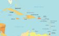

We allow anyone to download our map. You can use it for commercial or educational purposes, granted you provide a citation.
You are free to use our West Indies maps for educational and commercial uses. Attribution is required. How to attribute?
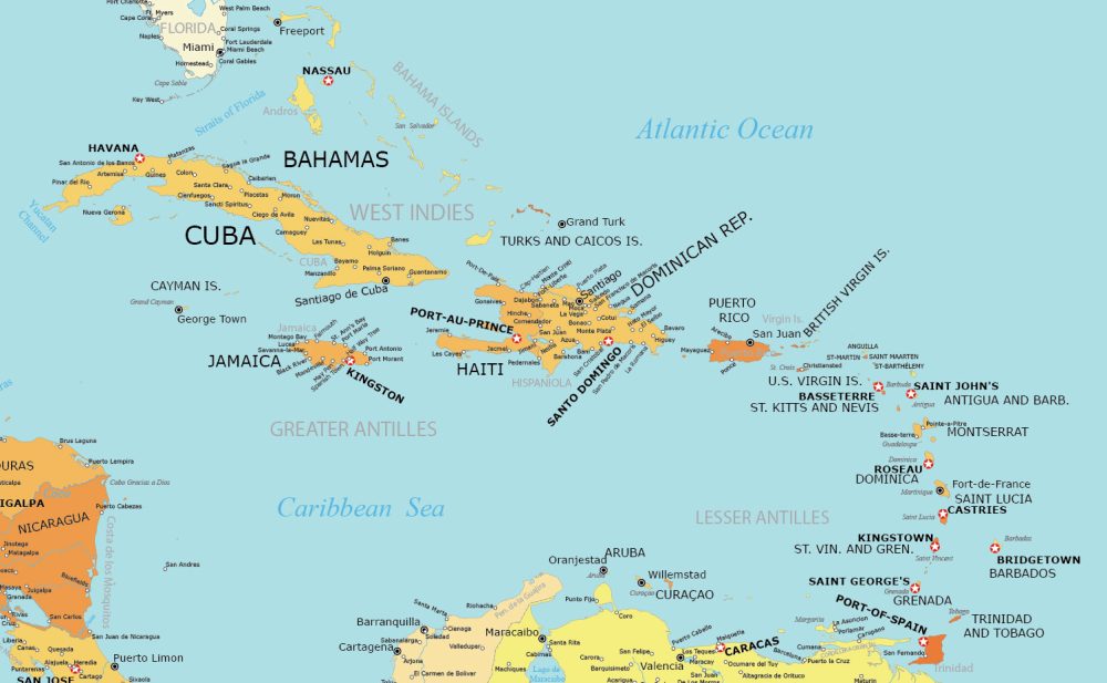
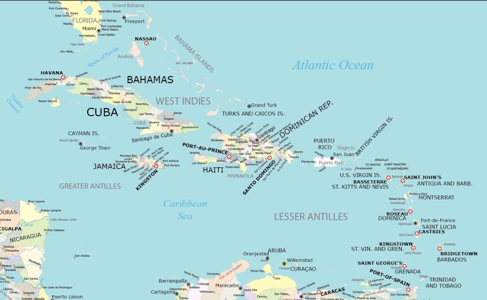
Detailed Map of West Indies with Cities
If you’re looking for a free map of the West Indies with a bit more detail, check out our map below. In this version of the map, we’re labeling major cities, countries, and dependencies.
Similar to our other maps, it’s OK to download and use the map for any purpose. Please add a citation back to the source of the map.
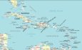
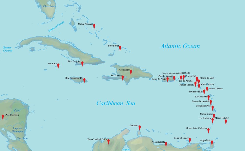
Physical Map of the West Indies
Are you looking for a terrain map of the West Indies? Our physical map highlights mountain peaks in this region dominated by volcanic activity.
Some of the major mountains are Pico Duarte, La Soufrière, and Mount Obama. This map is perfect for topography and elevation.
Administration Map of the West Indies
Explore the government divisions of the West Indies with this administration map of the West Indies.
This map not only highlights the geographical boundaries of each island and territory but also highlights the intricate administrative divisions.
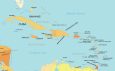
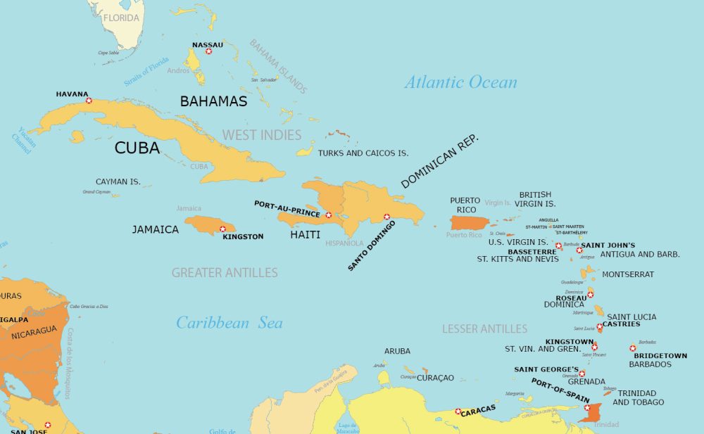
West Indies Capitals Map
Do you want to learn about the capitals of this geographic region? On this map, you’ll find countries and their corresponding capitals.
This map also features major geographic regions and cities. Find out about the capital cities with this map.
Which 13 Countries Belong to the West Indies?
In alphabetical order, here are the 13 independent countries that belong to the West Indies.
| Country | Geographic Location |
|---|---|
| Antigua and Barbuda | Caribbean, islands between the Caribbean Sea and the North Atlantic Ocean |
| Bahamas | North Atlantic Ocean, southeast of Florida, northeast of Cuba |
| Barbados | Eastern Caribbean, islands between the Caribbean Sea and the North Atlantic Ocean |
| Cuba | Caribbean, an island in the North Atlantic Ocean, south of Cuba |
| Dominica | Caribbean, island between the Caribbean Sea and the North Atlantic Ocean |
| Dominican Republic | Caribbean, eastern two-thirds of the island of Hispaniola |
| Grenada | Caribbean, island between the Caribbean Sea and Atlantic Ocean, north of Trinidad and Tobago |
| Haiti | Caribbean, western one-third of the island of Hispaniola |
| Jamaica | Caribbean, island in the North Atlantic Ocean, south of Cuba |
| Saint Kitts and Nevis | Caribbean, islands in the North Atlantic Ocean, southeast of Puerto Rico |
| Saint Lucia | Eastern Caribbean, island between the Caribbean Sea and North Atlantic Ocean |
| Saint Vincent and the Grenadines | Caribbean, islands between the North Atlantic Ocean and the Caribbean Sea, northeast of Venezuela |
| Trinidad and Tobago | Caribbean, islands between the North Atlantic Ocean and Caribbean Sea, northeast of Venezuela |
Which 18 Dependencies Belong to the West Indies?
Here is a table that lists the 18 dependencies that are part of the West Indies.
| Country/Dependency | Geographic Location |
|---|---|
| Anguilla (UK) | Caribbean, an island north of Venezuela |
| Aruba (Netherlands) | Caribbean, a group of islands in the North Atlantic Ocean, east of Puerto Rico |
| Bonaire (Netherlands) | Caribbean, part of the ABC islands near Venezuela |
| British Virgin Islands (UK) | Caribbean, an island in the southern Caribbean Sea, off the Venezuelan coast |
| Cayman Islands (UK) | Caribbean, three islands in the western Caribbean Sea, south of Cuba |
| Curaçao (Netherlands) | Caribbean, island in the southern Caribbean Sea, off the Venezuelan coast |
| Guadeloupe (France) | Caribbean, an island in the North Atlantic Ocean, southeast of Puerto Rico |
| Martinique (France) | Caribbean, island in the eastern Caribbean Sea, north of Trinidad and Tobago |
| Montserrat (UK) | Caribbean, a small island in the Caribbean Sea, claimed by Haiti and the United States |
| Haiti – Navassa Island (United States and Haiti) | Caribbean, an island in the West Indies, east of Saint Martin |
| Puerto Rico (United States) | Caribbean, island between the Caribbean Sea and the North Atlantic Ocean, east of the Dominican Republic |
| Saba (Netherlands) | Caribbean, an island in the North Atlantic Ocean, part of the Leeward Islands |
| Saint Barthélemy (France) | Caribbean, the smallest island of the Netherlands Antilles, north of Venezuela |
| Saint Martin (France) | Caribbean, a group of islands southeast of the Bahamas |
| Sint Eustatius (Netherlands) | Caribbean, island in the northeastern Caribbean Sea, part of the Netherlands Antilles |
| Sint Maarten (Netherlands) | Caribbean, southern part of the island of Saint Martin, north of Saint Barthélemy |
| Turks and Caicos Islands (UK) | Caribbean, a group of islands in the North Atlantic Ocean, east of Puerto Rico |
| US Virgin Islands (United States) | Caribbean, group of islands in the North Atlantic Ocean, east of Puerto Rico |
Looking for more detail?
We’ve built one of the largest map collections of the West Indies. If you’re looking for country maps of the West Indies, we’ve included them below.
Please note that we don’t have detailed maps of all the West Indies dependencies. Below are the only maps that are available within this region.
Caribbean


Where exactly is the West Indies?
The term “West Indies” originated from Christopher Columbus in 1492. This is when he mistakenly believed that he had reached the Indian subcontinent.
When he landed in the Caribbean islands, he thought he had reached the eastern shores of India. That’s why he incorrectly referred to the indigenous people he encountered as “Indians”.
This misperception led to the naming of the region as the “West Indies”. Despite the geographical error, the name West Indies persisted to describe the islands in the Caribbean Sea.
Even today, it still refers to the diverse group of islands and nations in this part of the world. It acknowledges the historical context of Columbus’s exploration and the subsequent European colonization of the Americas.