Polynesia Map – Political and Physical Map
Our map of Polynesia comes in two versions. First, we have a political map with islands, capitals, cities, and countries.
Secondly, we have a physical map. This type of map highlights geographic regions, Pacific groupings, and water bathymetry.
You are free to use our maps of Polynesia for educational and commercial uses. Attribution is required. How to attribute?
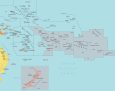
Detailed Map of Polynesia
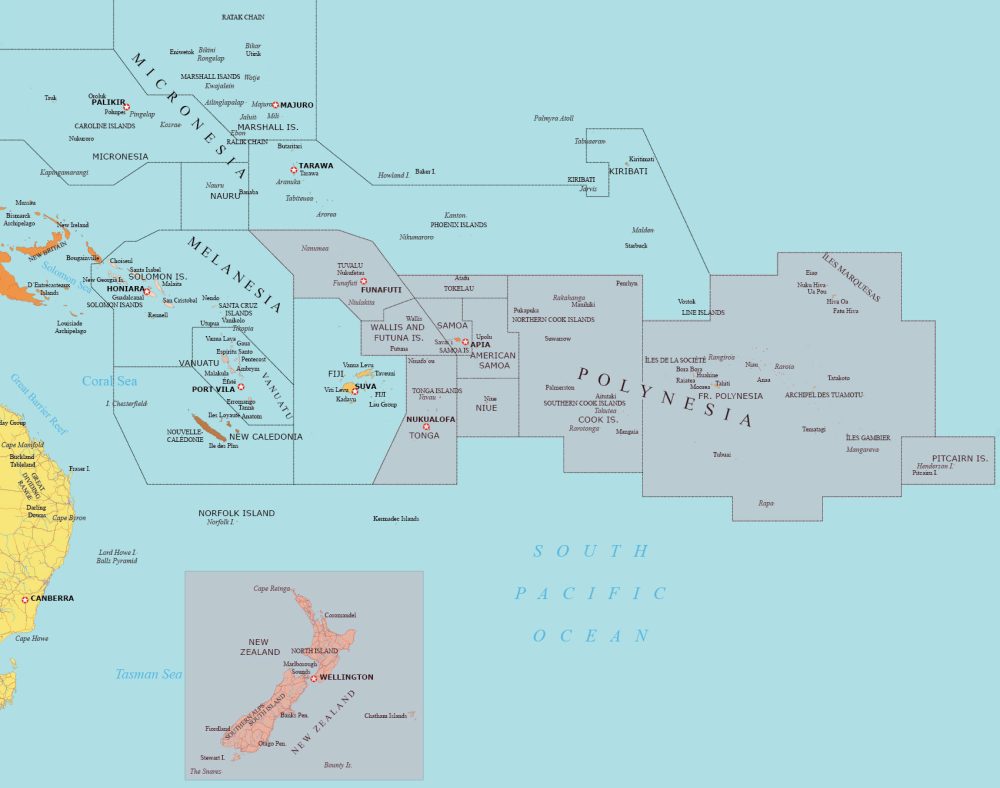
Our detailed map of Polynesia includes the major island groups and archipelagos in the Polynesian Triangle. This map is perfect for exploring capital cities, islands, and water features.
You’ll find countries and territories like New Zealand, Easter Island, Samoa, Tonga, Cook Islands, French Polynesia (including Tahiti), and Tuvalu. We’ve highlighted Polynesia in pink on the map below.
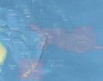
Physical Map of Polynesia
Get to know the physical features and ocean bathymetry of Polynesia. Also, learn about the neighboring regions of Melanesia and Micronesia. This map is free to download and use for whatever reason you want.
It includes water features like the Solomon Sea, the Coral Sea, and the Pacific Ocean. Our physical map serves as both a geographical guide and a terrain representation of the diverse Polynesian region.

Which countries belong to Polynesia?
Below is a table with the various countries and dependencies that belong to the Polynesian region.
| Country/Territory | Description of Geography |
|---|---|
| Samoa | An independent nation comprising the westernmost group of the Samoan Islands. |
| Tonga | A sovereign state and archipelago comprising 169 islands. |
| Tuvalu | An independent island nation within the British Commonwealth. |
| Cook Islands | A self-governing island country in free association with New Zealand. |
| Niue | A small island country, also in free association with New Zealand. |
| French Polynesia | An overseas collectivity of France, including famous islands like Tahiti and Bora Bora. |
| American Samoa | An unincorporated territory of the United States comprising the eastern part of the Samoan Islands. |
| Tokelau | A dependent territory of New Zealand. |
| Pitcairn Islands | A group of four volcanic islands, a British Overseas Territory, and the least populous national jurisdiction in the world. |
| Wallis and Futuna | A French overseas collectivity. |
| Easter Island (Rapa Nui) | A Chilean territory famous for its 887 monumental statues, called moai. |
World Atlas of Oceania
I am sure that you’re already familiar with that Polynesia is part of the continent of Oceania. Our world atlas contains this region. Each set of maps contains a political map, satellite map, physical map, and administration map. Please select any map below to see our world atlas.


