What is Spatial Data Science?
DEFINITION:
Spatial Data Science is the field that combines data science and GIS to analyze and understand location-based data using advanced tools and techniques.
What is Spatial Data Science?
In a world where decision-making is increasingly influenced by data, it is important to understand how spatial data science can help.
Spatial data science is a subset of data science. It’s where data science intersects with GIS with a key focus on geospatial data and new computing techniques. Location matters in data science using statistical computing to access, manipulate, explore, and visualize data.
Having latitude and longitude coordinates in the data does not mean it’s spatial data science. Instead, spatial data science applies their physical locations and understands their spatial relationships.
Today, let’s explore spatial data science. How is it different from spatial analysis? And what are some examples of data science?
What is Data Science? (Without Spatial)
Data science is the study of information and its source, collection, organization, processing, and presentation. It is an interdisciplinary area that incorporates elements of statistics, computer science, operations research, mathematics, and programming.
Data scientists use tools like R and Python to cleanse, aggregate, and manipulate data to create predictive models and analytics. A data scientist’s primary task is to translate raw data using advanced techniques into actionable insights.
Actionable insights can be from any techniques such as machine learning, big data analytics, and data visualization. But the difference between spatial data science is you add the element of spatial analysis and it’s at the focal point of its analysis.
Spatial Analysis vs Spatial Data Science
Before we get into the fine details of spatial data science, how is it any different from spatial analysis? Because you can’t always draw a clear line between the two, let’s explore what spatial data science is.
Remember the focus of data science is extracting meaningful information from data from computation and scientific discovery. Here are some of the buzzwords of both spatial analysis and spatial data science and which category they fall into.
Spatial Analysis
Spatial Data Science
Both spatial analysis and spatial data science start with raw location data, analyze it, and turn it into insights. But the key idea is that spatial data science uses new and specialized techniques and automation. If you want to learn more about spatial analysis, then make sure to check out our Periodic Table for Spatial Analysis.
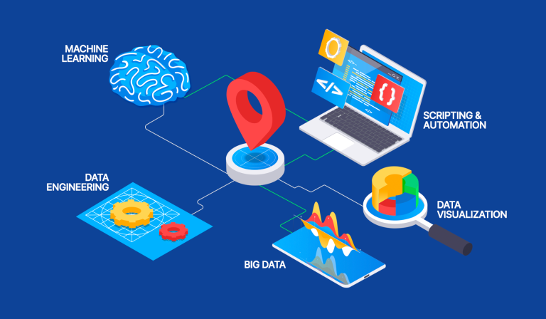
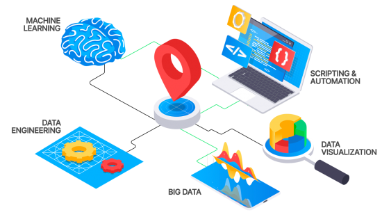
Elements of Spatial Data Science
Data Engineering

Data engineering is a branch of computer science that deals with managing the creation, storage, maintenance, use, and dissemination of data. It uses programming tools such as Python, SQL, and R that aid in the manipulation of big data.
It’s possibly the most time-consuming aspect of data science. But data engineering is also a crucial part of the analysis because it’s only as good as the data we put into it.
Data scientists prepare data for analysis. For example, they fill in missing values, add fields, geoenrich, and cleanse values. Typically, the data science workflow starts with data engineering and the necessary ETL workflow.
Data Exploration and Visualization
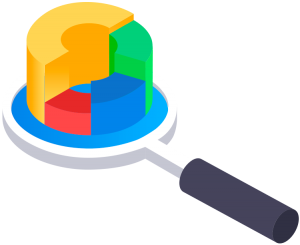
Data exploration and visualization is one of the most important facets of data science. It means first exploring the raw data in a systematic way so you understand it better in order to make better decisions.
Visualization is an essential part of the process of understanding data. It helps us to quickly recognize patterns and relationships, which can help us extract information from big data. You can also use visualization techniques to validate it and ensure it makes sense.
The process of data visualization is one that continues from start to finish. At the start, you can better understand your data. Then in the middle, you can answer what problems you can solve. Finally, in the end, you can tell a story of your data to share with an audience.
Spatial Analysis

Spatial analysis is what GIS is all about. From site selection to space-time or predictive modeling, spatial analysis tells you where things are, how they relate to each other, and how they are connected.
Spatial analysis is a tool used to analyze the distribution of people or any type of feature in a geographic space. You can solve location-based problems by measuring, quantifying, and understanding our world.
It does not only include point locations. But they also include lines, polygons, rasters, and non-spatial information as attributes. Whether you want to show how people move or find patterns like hot spots, then it’s spatial analysis the tool to use.
Machine Learning and AI

Machine learning is the process of teaching a computer to learn without being explicitly programmed. The concept of artificial intelligence and machine learning is just another tool in spatial analysis.
The fundamental idea of machine learning is that it helps speed up any process by analyzing large amounts of data without human input. For instance, you can create an accurate land cover using a machine learning classifier by just training it with samples.
From big data analysis to clustering, machine learning is a way to automate the process of getting insights from your data. With the increasing amount of data that organizations collect, store, and analyze machine learning is becoming an essential part of any workflow.
Big Data Analytics
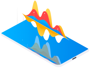
Data analytics is a process where data is analyzed to obtain insights and make decisions about the future state. It can be used in any industry or field of work, such as transportation, marketing, and retail. Big data analytics has been revolutionizing many industries like no other.
The technology world has been using big data analytics for years. But it is starting to become more important as the world becomes more digitized. Big data analytics refers to the analysis of large volumes of data.
Although big data falls within the category of spatial analysis, the main idea is that you analyze it at scale. No matter what your spatial data consists of (points, lines, polygons, or raster), it can be a very helpful tool in data science.
Modeling and Scripting

Automation has been around for a long time as a way to reduce manual labor. It allows us to focus on more important tasks with less effort, saving us time and producing a repeatable workflow.
In a typical data science workflow, you take everything from data engineering to analytics and string them together in an automated way. This allows you to reproduce and develop a self-functioning system.
When you operationalize analytics capabilities, this is a big part of ETL, which stands for Extract, Load, and Transform. But it doesn’t necessarily mean you run it daily, because it could be a weekly, monthly, or yearly business process.
The Pieces of Spatial Data Science Puzzle
Spatial data science helps companies make better decisions with location-enabled data as the focal point to drive business strategies.
In addition, it can also allow for more accurate predictions in different fields such as economics, social sciences, engineering, and the environment.
The power of data science is starting to reach every aspect of our daily lives.
Spatial data science can reveal patterns through advanced computing techniques like machine learning and big data analytics that may have otherwise been hidden.


Hello,
Spatial Data Science seems like an up-and-coming field, and I would like to know if any colleges have a major in this field, as well as learn about careers in this area?
Hi! Thank you for the great content! There’s a glitch in the comparison between Spatial Analysis and Spatial Data Science, it seems that the Spatial Analysis list was repeated instead of the Spatial Data Science part. Again, thanks for all the content, this post especially really helps to put Spatial data science in perspective.