US County Map of the United States
A US county map that displays the 3,142 counties and equivalents including parishes, boroughs, census areas, independent cities and the District of Columbia.
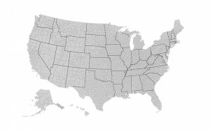
A US county map that displays the 3,142 counties and equivalents including parishes, boroughs, census areas, independent cities and the District of Columbia.
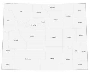
This Wyoming county map displays its 23 counties. Laramie, Natrona and Sweetwater County are the most populated counties in Wyoming.
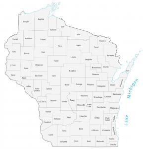
This Wisconsin county map displays 72 its counties. Milwaukee County, Dane County and Waukesha County have the highest population in the state of Wisconsin.
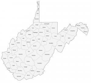
This West Virginia county map displays its 55 counties. Kanawha, Monongalia and Cabell counties are some of the most populated counties in West Virginia.
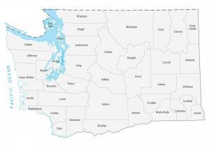
This Washington county map displays its 39 counties. King County, Pierce County and Snohomish County have the highest population.

This Virginia county map displays its 95 counties and independent cities. Fairfax Count, Prince William County and Virginia Beach County are most populated.
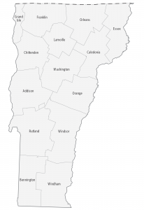
This Vermont county map displays its 14 counties. Chittenden County, Rutland County and Washington County have the highest population in Vermont.
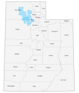
This Utah county map displays its 29 counties. Salt Lake County, Utah County and Davis County have the highest population.
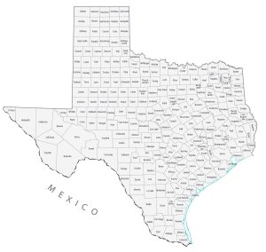
A Texas county map that displays its 254 counties. Harris County, Dallas County and Tarrant County are the most populated counties in Texas.
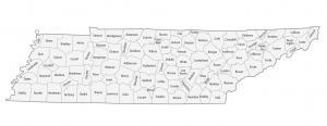
This Tennessee county map displays its 95 counties. Shelby County, Davidson County and Knox County are the most populated counties in Tennessee.