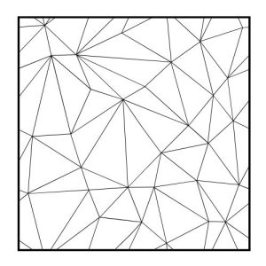
Triangular Irregular Network (TIN)

DEFINITION:
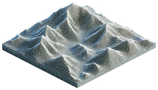
A Triangular Irregular Network (TIN) is a way to represent the shape of a 3D terrain using connected triangles.
What Is a Triangular Irregular Network in GIS?
A Triangular Irregular Network (TIN) is a way to represent a 3D surface. But it uses triangles, instead. For example, they can show complex surfaces such as slopes and elevation.
These types of models use triangles, which we form by connecting points called nodes. The nodes have X, Y, and Z coordinates. Each triangle is a facet in a TIN model.
Today, let’s take a look at TIN models in GIS.
How is TIN different from DEM?
DEM stands for Digital Elevation Model. We use it to represent elevation in GIS. But it’s very different from TIN in several ways.
First, TIN is more flexible and captures more detailed landscapes better. It’s able to adapt to changes in terrain better because the spacing is irregular. This is why we use TIN for detailed projects in engineering and construction.
On the other hand, DEM has evenly-spaced grid cells. This makes it suitable for broader, uniform areas. It’s possible to shrink the pixel size for DEM. But this affects the cell size of the entire grid.
Finally, another big difference is how each format displays elevation. TIN uses triangles to represent terrain in vector format (such as .ADF). Whereas DEM uses a grid of squares in raster format (such as .TIF).
Why use a Triangulated Irregular Network?
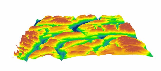
The main reason you should consider using TIN is its ability to show features like ridges and valleys. TIN models adapt to the terrain’s natural shape, where it’s needed most. They capture the ups and downs of the land accurately.
So, this makes TIN ideal for engineering projects and construction planning. For any project that needs precise details, you should consider using a TIN model, rather than a raster-based DEM.
For example, hydrologists often use TIN models to better understand flood risk management. Even though DEMs are a more common input, TIN models can help simulate how water flows in a landscape.
TIN Models in GIS
Think about all the GIS uses and applications of Triangular Irregular Networks.
Infrastructure – We use TIN models to design roads, bridges, and buildings. From laying pipelines to planning drainage, TINs can help engineers better interpret the terrain.
Telecommunications – TIN uses Delaunay triangulation, which can determine signal paths and tower locations. We can use Voronoi Diagrams to find the nearest cell tower.
Video Game Design – Even some video games use TIN models for realistic landscapes. This brings a more immersive and true-to-life gaming experience.
As you can see, TIN models bring precision and realism. This makes them useful for representing complex terrains.
Do you use Triangular Irregular Networks in your job? We’d love to hear from you in the comment section below.


