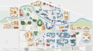
Fulcrum App: Is It the #1 Field Collection App?
Because data collection is one of the most time-consuming and crucial aspects of any field project, the Fulcrum App can simplify this process.
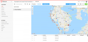
Because data collection is one of the most time-consuming and crucial aspects of any field project, the Fulcrum App can simplify this process.
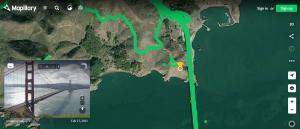
Mapillary is a crowdsourced platform where users can upload geotagged photos in the world and explore 1.5+ billion street-level images.

Google Street View is like a virtual tour of the entire world, right at your fingertips. But there’s more to explore with these 5 features.

ArcGIS Velocity is a cloud platform for scalable, real-time, and big data analytics using sensor information, enabled through ArcGIS Online.

The ArcGIS API for Python is an access point to accessing a rich set of tools including mapping, spatial analysis, and data science.
ArcGIS Experience Builder is a powerful tool that allows you to build a website from scratch without requiring any programming knowledge.
ArcGIS Arcade is a simple and lightweight expression language you can use in the ArcGIS platform including ArcGIS Online, ArcGIS Pro, and more.

This beginner’s guide to ArcGIS Earth will help you navigate through the program and get started on your path to exploring the globe.
ArcGIS Indoors is a complete indoor mapping solution for smart building management, planning indoor space, and monitoring facility operations.
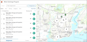
ArcGIS Workforce is designed to simplify fieldwork by allowing users to dispatch work to mobile field workers and then assign them tasks.