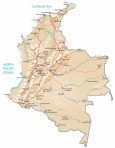
Map of Colombia – Cities and Roads
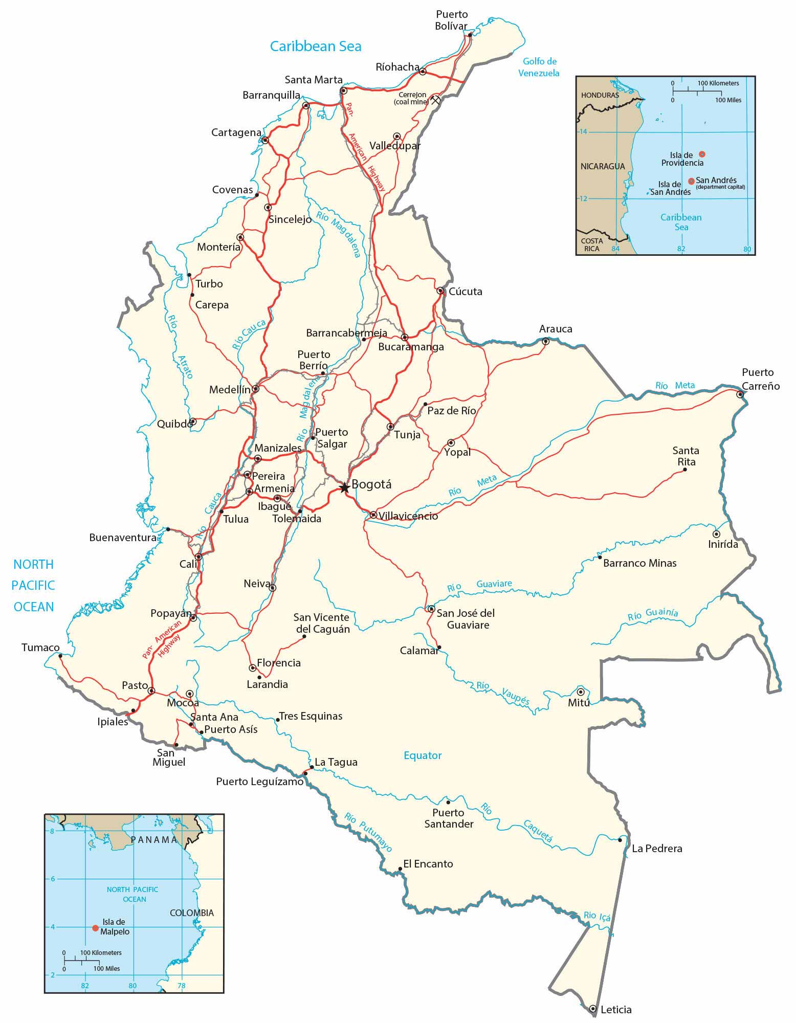
Our map of Colombia shows major cities, towns, roads, and rivers. It includes a satellite and physical map to see its diverse landscape – from the Andes Mountains to the eastern lowland plains (Llanos).
Colombia map collection
You are free to use our Colombia map for educational and commercial uses. Attribution is required. How to attribute?
About the map
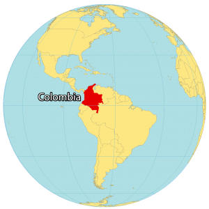
Colombia is located in the northern region of South America and is the only country in South America to border both sides of the ocean. It borders 5 other countries including Panama to the north, Venezuela to the east, Brazil to the south, as well as Ecuador and Peru to the southwest.
Bogotá is its capital and largest city. Colombia doesn’t experience any significant changes in temperature throughout the year. This is why there aren’t any seasons like winter or summer. Colombia has 18 UNESCO world heritage sites with a range of festivals and carnivals, during the year.
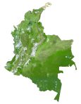
SATELLITE IMAGERY
Colombia Satellite Map
Colombia occupies an area of 1,141,748 square kilometers (440,831 sq mi). In comparison, this makes it larger than Bolivia but about 7 times smaller than Brazil. Because Colombia is located in every climate zone, it has the greatest diversity of flowers in the world. Not only flowers and orchids, but also it’s diverse in mammals, insects, and birds.

While the Andean region is characterized by high altitudes, the Amazon Rainforest consists of dense jungles. It’s also known for its valleys, caves, jungles, deserts, canyons, and colorful rivers. Also, the Coffee Triangle is where Colombia grows the majority of its coffee beans in rural Colombia.
PHYSICAL MAP
Colombia Physical Map
Colombia’s terrain is mostly high altitude, especially the Andes Mountains in the west. But Pico Cristobal Colon is Colombia’s highest peak and is part of the Sierra Nevada de Santa Marta mountain range. At 5,730 m (18,800 ft), it is also the fifth most prominent in the world.
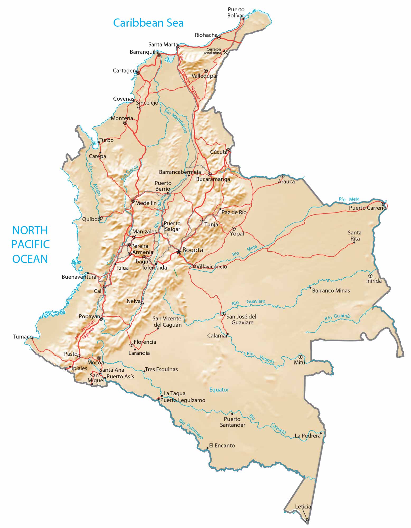
While the northwest of Colombia is mostly mountainous, the eastern region consists of lowland plains, known as the Llanos. This vast tropical grassland plain is shared with Venezuela and the Amazon Rainforest region.
Capital City
Bogotá
Major cities
Barranquilla
Bucaramanga
Cali
Cartagena
Medellín
Cities and towns
Armenia
Barrancabermeja
Barranco Minas
Buenaventura
Carepa
Cúcuta
Florencia
Ibagué
Ipiales
Leticia
Manizales
Montería
Neiva
Pasto
Pereira
Popayán
Puerto Asís
Puerto Bolívar
Puerto Carreño
Puerto Leguizamo
Puerto Santander
Quibdó
Ríohacha
Salgar
San José del Guaviare
San Vicente del Caguán
Santa Marta
Sincelejo
Tres Esquinas
Tuluá
Tunja
Turbo
Valledupar
Villavicencio
Yopal
Rivers and water
Atrato River
Cauca River
Guaviare River
Içá River
Magdalena River
Meta River
Putumayo River
North Pacific Ocean
Caribbean Sea
Islands and other features
Malpelo Island
Providencia Island
San Andrés Island
Pan-American Highway