How To Use Esri Collector and Survey123 as Field Work Apps

What are Esri Collector and Survey123?
Esri Collector and Survey123 are the one-two punch for data collection in the field.
Esri Collector is the backbone of all Esri’s field apps. It enables you to use maps anywhere for inspections, field surveys, and asset management.
By connecting to Survey123 from Collector, users can fill out survey forms through its interface.
Both apps are available to download on Android or Apple for free through the app store. So let’s get an overview of both apps and some of their uses and applications.
Esri Collector is for mobile maps
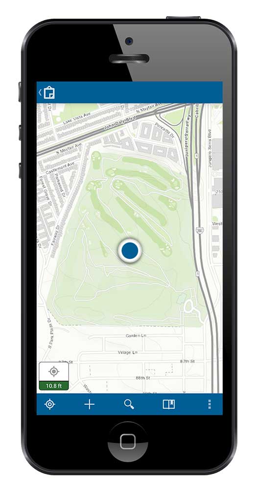
Esri Collector equips you with online and offline maps for field use. So that means if you’re away from cell phone coverage, you still have its functionality.
Web maps are at the core of Collector. It’s through ArcGIS Online web maps that you decide what workers collect in the field. It’s also how you set permissions for who can view the app.
Through Esri Collector, you can collect and update points, lines, and polygons. Also, you can attach photos and search for locations and features.
If you want to improve positional accuracy, Esri Collector can pair with external GNSS receivers. By default, your phone’s GPS receiver has about 5-meter accuracy. But external GNSS receivers can improve it to less than 1-meter accuracy.
Survey 123 is for pop-up forms
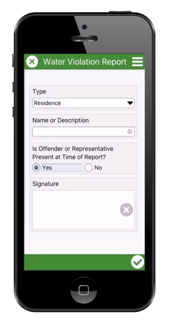
For data entry, you can call Survey123 from Collector. Survey123 displays as a pop-up where you can fill a set of predefined fields.
The Survey123 Hub is where you store data from surveys and design entry forms. You can include anything from drop-downs, geopoints, and even barcodes in your surveys.
For form design, the first option is to customize surveys through the Survey123 Web Designer. And the second option is through an Excel spreadsheet. Both are easy to tweak and intuitive to work with.
Once the survey is completed in the fields, this gets pushed to the cloud from ArcGIS Online. But it also works offline as a local file. Eventually, when you connect back to the internet, you can submit it to the cloud.
Esri Collector and Survey123 Examples
Organizations are collecting piles of data using Esri Collector and Survey123. But the best part is that it gives them the power to solve a field collection problem.
Whether it’s crisis response, environmental impacts, or people in the community… The data powers them with meaningful answers to real-world problems.
We found the majority of Esri Collector and Survey123 apps involve this broad range of applications:
- Environmental observations
- Inventory damage or unplanned events
- Census surveys
- Asset management
- Field inspections
How do you use these field apps?
So this wraps up our overview of these field apps.
Now, it’s time to hear what you have to say about Esri Collector and Survey123
- How are you using it? Is it easy to use?
- What do you like about it?
- And what don’t you like?
Please let us know in the comment section below. We’d love to hear from you.


Any alternative for QGIS users…? Thanks !
QField and Mergin Maps are good options for QGIS users. Here’s more info – https://gisgeography.com/field-apps-data-collection-tools/
Wonderful support for anything about ArcGIS
Can this be used for land surveys?
How would this applications differ from the app Quick Capture; could they all be incorporated?
Hi Paola. I haven’t used Quick Capture below. Sorry, I can’t compare the two.
Collector is better for describing or inventorying fixed assets such as fire hydrants, clinics, damaged houses (after disaster). Survey123 is better for questions or when there is a need for branching (the answer leads to another related question).
Which one is best suitable for Urban planner’s field work
Depends on what you’re doing