Micronesia Map – Islands and Cities
We’ve created two maps of Micronesia so you can use them for free and for any purpose. Our maps include a detailed map with islands and a physical map with ocean bathymetry.

So if you need a map of the Micronesia region in Oceania, then this is yours to keep. Each map shows various levels of detail and different types of geographic features.
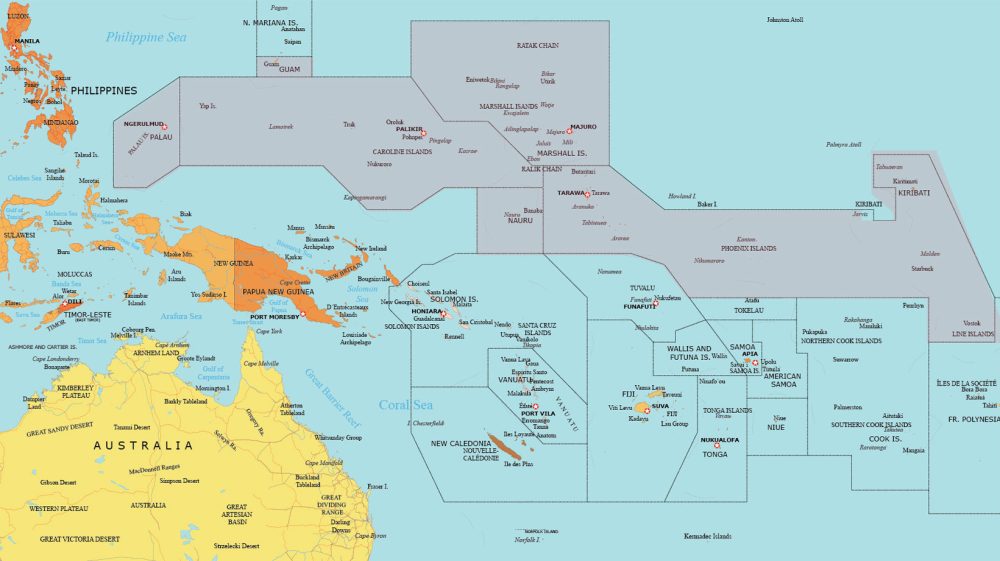
Detailed Map of Micronesia
Our detailed map labels the names of key locations like major islands, cities, and towns. For example, it includes the Federated States of Micronesia, Marshall Islands, Kiribati, Nauru, and Palau.
This map of Micronesia is ideal for those who want a high-level overview of this subregion in Oceania. It highlights the countries that belong to Micronesia in pink.
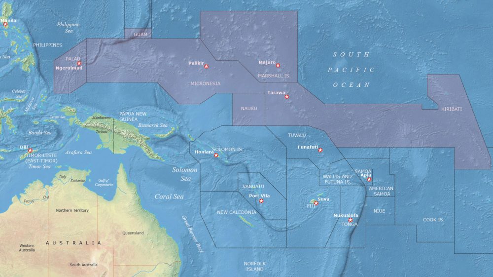
Physical Map of Micronesia
Our physical map shows topographic features. But it’s best for viewing ocean bathymetry. This includes the Mariana Trench (the deepest part of the ocean). It’s found close to Guam in Micronesia.
Other key features of this physical map include the neighboring regions of Polynesia and Melanesia. You can also find capital cities, seas, gulfs, and of course the South Pacific Ocean.
Which countries are part of the Micronesia region?
Here’s a table featuring the countries and territories in the Micronesia region. You’ll also find a description of each country in the second column of the table.
| Country/Territory | Description |
|---|---|
| Federated States of Micronesia (FSM) | Independent nation with over 600 islands, known for coral reefs and traditional cultures. |
| Palau | Island country with rich marine life, famous for its rock islands and diving spots. |
| Marshall Islands | A country of atolls and islands, known for its lagoons and WWII relics. |
| Nauru | Smallest island country, known for its phosphate mining history and bird life. |
| Kiribati | Nation of 33 atolls, straddling the equator, known for its significant maritime area. |
| Guam (USA) | US territory with diverse culture, historical sites, and tropical beaches. |
| Northern Mariana Islands (USA) | US commonwealth with significant Spanish and Japanese heritage, and beautiful beaches. |
| Wake Island (USA) | Uninhabited atoll used as a US military base, known for its strategic location. |
World Atlas of Oceania
Don’t stop here. Get to know the rest of Oceania with our world atlas. You’ll be able to find all the countries that belong to the Micronesia region. Plus, you can find Oceania and all the countries of the world. Most maps include a political map, elevation map, and satellite map.


