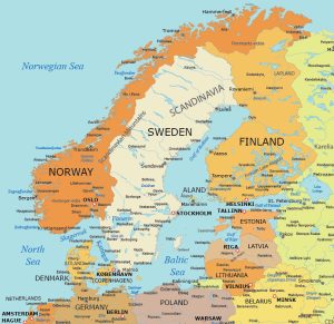
Baltic Peninsula Map
Our Baltic Peninsula map includes the surrounding countries around the Baltic Sea. We’ve built five maps including 3 political, 1 physical, and 1 administrative map.

Download our Baltic Peninsula maps for free today. Use them to explore the diverse landscapes and cultural landmarks of this unique and strategically important region in Northern Europe.
You are free to use our maps of the Baltic Peninsula for educational and commercial uses. Attribution is required. How to attribute?
Detailed Baltic Peninsula Map
The Baltic States primarily include Estonia, Latvia, and Lithuania. Each of these countries borders the Baltic Sea on the west side. They also share a similar history and cultural aspects. Plus, all three are members of the European Union and NATO.
If you include all countries with coastlines along the Baltic Sea, they would also include Sweden, Finland, Poland, Germany, and Denmark. Russia also has the Kaliningrad Oblast exclave and the Saint Petersburg region.
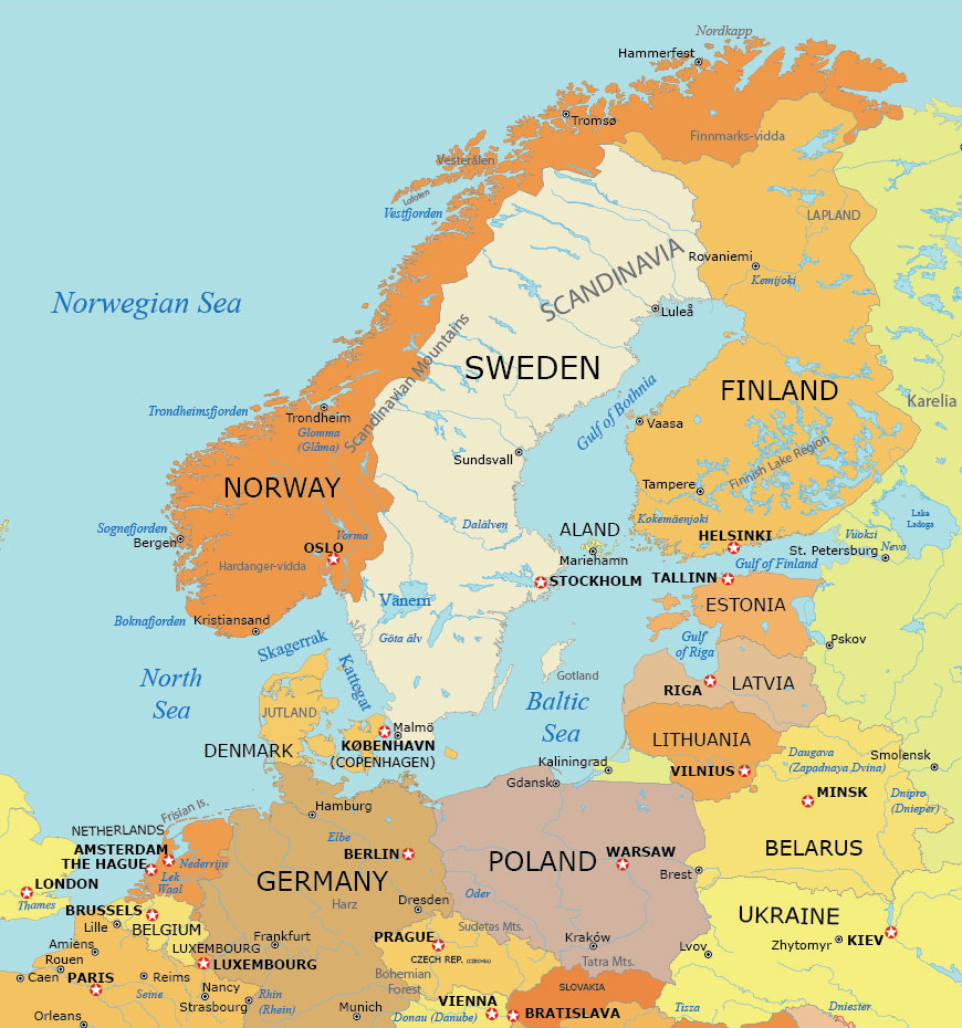
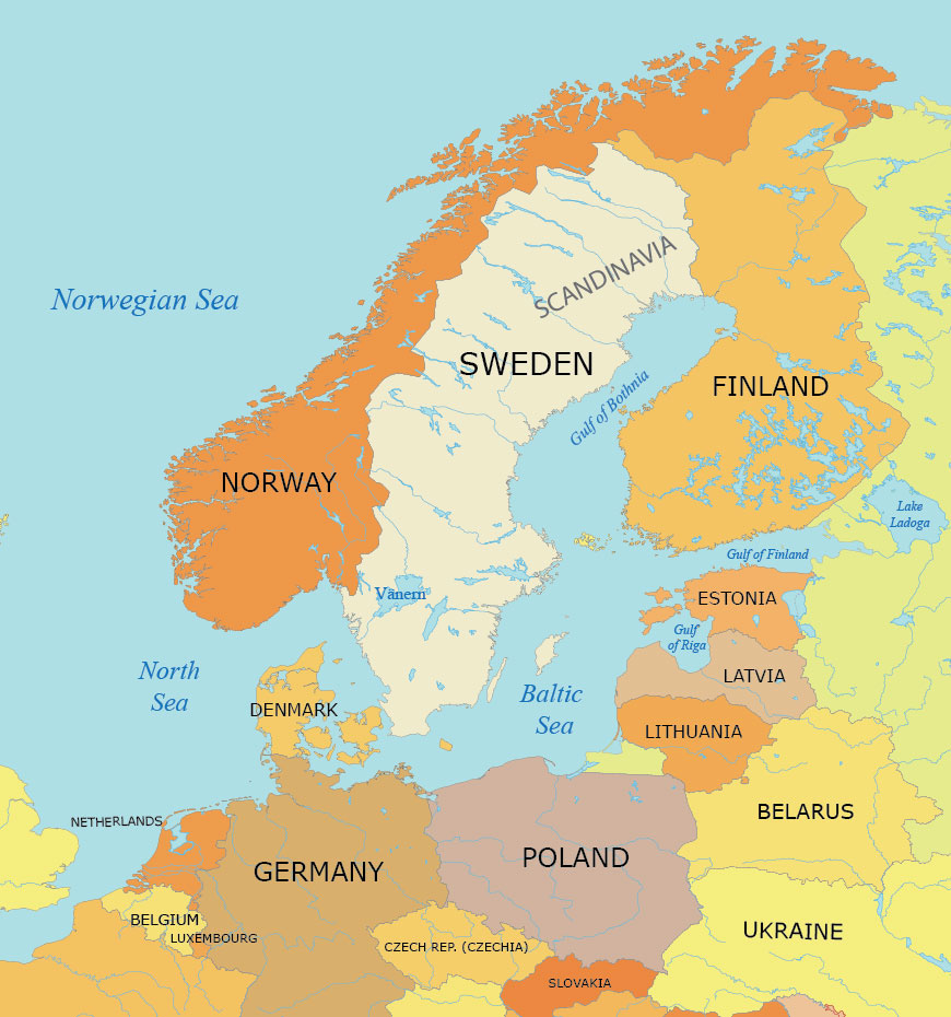
Simple Baltic Peninsula Map
This map of the Baltic Peninsula simply shows the countries that have coastlines along the Baltic Sea. You’ll find detailed outlines of the coastlines and countries providing a clear visual of this geopolitically significant region.
In addition to political boundaries, we display the major water features of this region. At the center of this map is the Baltic Sea, surrounded by its diverse coastal nations. It also highlights important rivers, lakes, and other water bodies that define and influence the area’s geography.
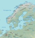
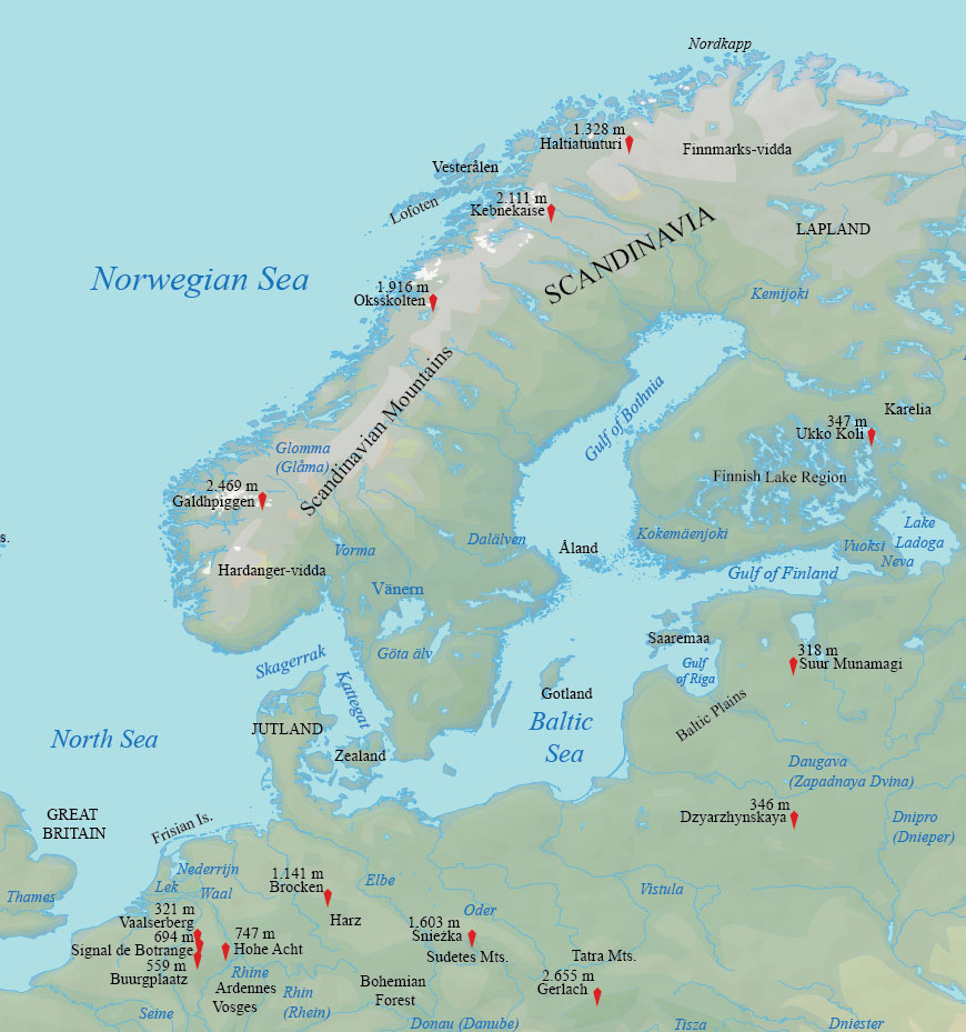
Physical Map of the Baltic Peninsula
Explore the distinct physical features of the Baltic Peninsula. Our physical map offers a clear view of the region’s varied landscapes such as the expansive coastline of the Baltic Sea to the intricate network of rivers and lakes.
Get familiar with the terrain and gain a deeper understanding of Northern Europe’s physical geography. You’ll learn about mountain chains and their corresponding peaks. This map is perfect for an overview of the major landscape features in the Baltic Peninsula.
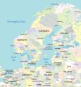
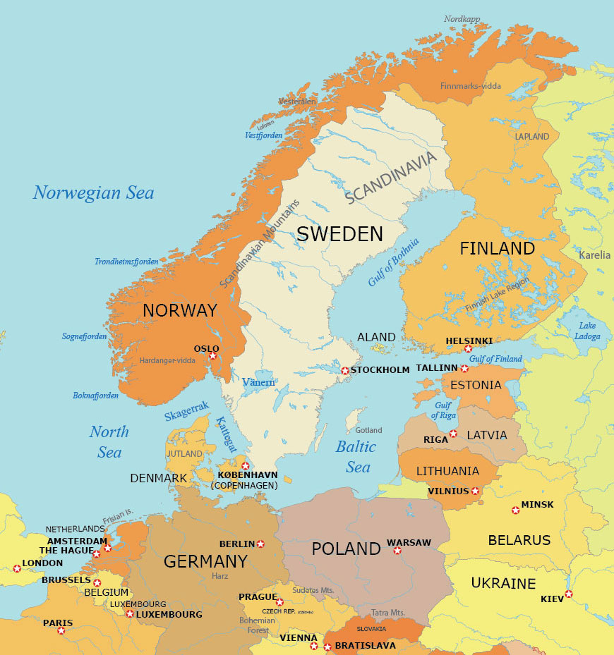
Administration Map of the Baltic Peninsula
Dive into the political and administrative landscape of the Baltic Peninsula with our administration map. This map outlines the administrative divisions, including provinces, regions, and municipalities, of the countries bordering the Baltic Sea.
This map serves as a resource for understanding the governmental structure and regional boundaries. Learn about the administrative units of Northern Europe, perfect for anyone with an interest in the political geography of the Baltic region.
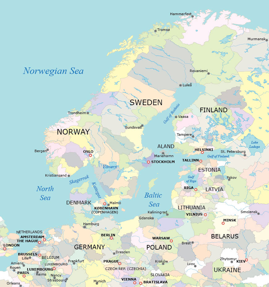
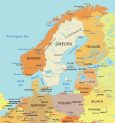
Baltic Sea Map with Countries and Capitals
Discover the nations bordering the Baltic Sea with our countries and capital cities map. This map presents a clear and detailed view of the countries surrounding the Baltic Sea, pinpointing their capital cities for geographic reference.
It’s great for those looking to explore the political geography of Northern Europe. You’ll find an overview of the region’s key urban centers and national boundaries. Download our Baltic Sea map for free and use it today for any purpose.
World Atlas of the Baltic States
Navigate the Baltic States with the World Atlas. This atlas offers detailed maps of Estonia, Latvia, and Lithuania. It covers a range of aspects from political borders to satellite imagery and physical terrain.
Baltic States Maps
Here are the three Baltic States that are located in Northern Europe along the eastern coast of the Baltic Sea.


Baltic Peninsula Maps
Other than the 3 Baltic States that are listed above, the Baltic Sea is bordered by the following countries:


Baltic Peninsula Countries
The table below describes the countries that surround the Baltic Sea. It also describes the geographic location in relation to the Baltic Sea.
| Country | Geographic Location |
|---|---|
| Estonia | Northern Europe, the eastern coast of the Baltic Sea, across from Finland. |
| Latvia | Northern Europe, the central-eastern coast of the Baltic Sea, south of Estonia. |
| Lithuania | Northern Europe, southernmost of the Baltic states, coastline on the southeastern Baltic Sea. |
| Sweden | Northern Europe, western and southern coastlines along the Baltic Sea, opposite Finland and the Baltic states. |
| Finland | Northern Europe, southern coast on the Gulf of Finland, part of the Baltic Sea, opposite Estonia. |
| Poland | Central Europe, northern coast along the Baltic Sea, east of Germany. |
| Germany | Central Europe, northeastern coast along the Baltic Sea, west of Poland. |
| Denmark | Northern Europe, borders both the North and Baltic Seas, southwest of Sweden. |
Maps of Regions of the World
Get a view of the different regions of the world. Our map collection offers a range of detailed maps with diverse geographical landscapes, cultural areas, and political boundaries.